PPT-Southern Asia: Pakistan
Author : giovanna-bartolotta | Published Date : 2019-02-13
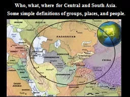
Unit 3 Climate Terrain Highest mountain ranges in the world The H imalayas and Hindukush Gwadar port is the largest sea port in the world T har Desert is the
Presentation Embed Code
Download Presentation
Download Presentation The PPT/PDF document "Southern Asia: Pakistan" is the property of its rightful owner. Permission is granted to download and print the materials on this website for personal, non-commercial use only, and to display it on your personal computer provided you do not modify the materials and that you retain all copyright notices contained in the materials. By downloading content from our website, you accept the terms of this agreement.
Southern Asia: Pakistan: Transcript
Download Rules Of Document
"Southern Asia: Pakistan"The content belongs to its owner. You may download and print it for personal use, without modification, and keep all copyright notices. By downloading, you agree to these terms.
Related Documents