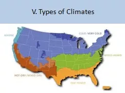
Climate prediction is coming of age El Nino Southern Oscillation ENSO Man induced climate change Impacts on Water Resources may be significant Changed Climate Advanced Warning Goal A basic quantitative understanding of how the global climate system works to allow informed assessment ID: 1022728
Download Presentation The PPT/PDF document "Why Study Climate? Hydrology as we know ..." is the property of its rightful owner. Permission is granted to download and print the materials on this web site for personal, non-commercial use only, and to display it on your personal computer provided you do not modify the materials and that you retain all copyright notices contained in the materials. By downloading content from our website, you accept the terms of this agreement.
1. Why Study Climate?Hydrology as we know it is driven by the climate, primarily precipitation, but also temperature and radiation. To understand the variability in hydrology we need to understand climate.
2. Climate prediction is coming of age?El Nino+ Southern Oscillation= ENSOMan induced climate changeImpacts on Water Resources may be significantChanged ClimateAdvanced Warning
3. Goal?A basic quantitative understanding of how the global climate system works, to allow informed assessment of climate based forecasts and their role in hydrology and water resources systems.
4. Learning ObjectivesYou should be able to quantify the energy balance of the earth and the greenhouse effectYou should be able to quantify the latitudinal distribution of energy fluxes at the earth surfaceYou should be able to describe the general circulation of the atmosphere and how this relates to the hydrologic cycle and the distribution of hydrologic processes on the earthYou should be able to describe El Nino Southern Oscillation (ENSO) and how it relates to hydrologyYou should be able to quantify the broad hydro climatological water balance at a location of interestYou should be able to apply holistic energy and mass balance analysis to examine the sensitivity of climate and hydrologic processes to changes in inputs
5. OverviewSolar RadiationAtmospheric effect on radiation (Greenhouse effect)Latitude and SeasonsGlobal Circulation patternsWeather and ClimateTeleconnections (ENSO)The distribution of hydrologic variables
6. Incoming and Outgoing Energy SpectraFrom Dingman, 2002log-scalelinear-scale
7. W/m2Year ADTotal Solar Irradiance (W/m2) reconstructed dataSlide from Simon WangSource: Delaygue and Bard (2010)
8. Global Energy BalanceSlide from Simon Wang
9. World Water BalanceFrom Brutsaert, 2005
10. Two layer atmosphere energy balance WRefer to Box 3-2 for definitions of quantities and numerical estimates of parameters
11. From Dingman, 1994
12. AtmosphereEnergy flux(transport)Energy flux(transport)Slide from Simon Wang
13. Slide from Simon Wang
14. From Dingman, 1994
15. From Dingman, 1994
16. From Dingman, 1994
17. A rotating Earth would introduce [ what ] force?Single-Cell Model Slide from Simon Wang
18. Coriolis Effecthttp://www.youtube.com/watch?v=_36MiCUS1ro&feature=related
19. Single-Cell Model:Explains why there are tropical easterlies (trade winds) “Ideal Hadley Cell (Model)”Slide from Simon Wang
20. Upper-level windsSingle-Cell Model:But there is a problem…“Ideal Hadley Cell (Model)”Slide from Simon Wang
21. Single-Cell Model:The problem is… Speed of sound: ~ 330 m/secSlide from Simon Wang
22. Single-Cell Model Three-Cell Model Upper-level winds~100 km/hr(or 60 mph)Taking Coriolisforce into accountSlide from Simon Wang
23. Single-Cell Model Three-Cell Model Continent-Ocean(topographical) influencesSlide from Simon Wang
24. Three-Cell Model Slide from Simon Wang
25. Three-Cell Model: Scientific evolutionThermally directcirculation forcingair towards equatorEarth’s rotation andthe conservation oflinear momentumcause the Trade WindsHadleyCoriolis force deflectswinds toward the eastand pulls air from south+ Conservation ofangular momentumFerrel170 years!Halley Slide from Simon Wang
26. From Dingman, 1994
27. From Dingman, 1994
28. From Dingman, 1994
29. Streamflow datahttp://waterwatch.usgs.gov/http://waterdata.usgs.gov/nwis
30. Precipitation Datahttp://www.climate.gov/maps-datahttp://gis.ncdc.noaa.gov/map/viewer/#app=clim&cfg=cdo&theme=hourly&layers=001&node=gis
31. PRISM Precipitation datahttp://www.prism.oregonstate.edu/
32. Water Balance Equation ∆S=P-Q-EPEQ∆SP=Q+EQ=P-E
33. From Dingman, 1994
34. PP=Q+EEE=PE=EpEQ
35. PP=Q+EEE=PE=EpEQW=Q/P 0W=Q/P 1
36. HumidAridEnergy LimitedWater LimitedEp/PRearranged with Aridity Index axesE/PEvaporative FractionDryness (Available Energy /Precip)1E=Ep Energy limited upper boundE=P Water limited upper boundQ/PBudyko, 1974
37. E/P=(R/P) Budyko, 1974E/PEvaporative FractionDryness (Available Energy/Precip)R/P1 2
38. Some examples from UtahIDWatershed1302West Canyon Creek near Cedar Fort 1402White River Below Tabbyune Creek2102Yellowstone River near Altonah2104Duchesne River near Tabiona
39. What else controls the water balance partition function (Budyko curve)? Evapotranspiration fractionDryness (available energy /precip)1humidaridenergy limitedwater limitedR/PE/PE = R : energy limited upper boundlargesmallSoil Storage/ Retention or Residence timemediumE = P : water limited upper boundTheoretical functional formf(R/P, S/(P))
40. Explains 88% of geographic varianceRemaining 12% difference is consistent with uncertainty in model input and observed runoffUncalibrated Runoff RatioLowHighMilly, P. C. D., (1994), "Climate, Soil Water Storage, and the Average Annual Water Balance," Water Resources Research, 30(7): 2143-2156.
41. Milly/Budyko Model – Framework for predictions hypothesis testingMilly, P.C.D. and K.A. Dunne, 2002, Macroscale water fluxes 2: water and energysupply control of their interannual variability, Water Resour. Res., 38(10).Increasing Retention or Soil capacityQ/PIncreasing variability in P – both seasonally and with storm eventsIncreasing variability in soil capacity or areas of imperviousness
42. From Dingman, 1994
43. El Niñowhat used to be a local feature has turned into a global phenomenon Slide from Simon WangTeleconnections
44. Ekman spiralCostal upwellingSea surface temperaturewarmsurface chlorophyll content high productivityNimbus 7 satelliteSlide from Simon Wang
45. affects air pressureSlide from Simon Wang
46. El Niño: local phenomenon regional global !! “coupled” modeSlide from Simon Wang
47. From Dingman, 1994
48. 2-D structureENSO ModelSlide from Simon Wang
49. 3-D structureENSO ModelSlide from Simon Wang
50. Coupled System: NormalA thermocline is a thin layer in the ocean in which temperature changes more rapidly with depth than above or below. The thermocline appears to be an invisible blanket which separates the upper mixed layer from the calm deep water below.Slide from Simon Wang
51. Coupled System: El NiñoSlide from Simon Wang
52. Coupled System: La NiñaSlide from Simon Wang
53. Index:(Sea)(Air)ENSO MonitoringSlide from Simon Wang
54. From Dingman, 1994
55. From Mitchell, Reviews of Geophysics, 1989
56. From Mitchell, Reviews of Geophysics, 1989++= ?
57. SSTASlide from Simon Wang
58.
59.
60.
61. From: United States Bureau of Reclamation, (2011), "SECURE Water Act Section 9503(c) – Reclamation Climate Change and Water, Report to Congress," U.S. Department of the Interior, Bureau of Reclamation, Denver, Colorado, http://www.usbr.gov/climate/SECURE/docs/SECUREWaterReport.pdf.
62. From: United States Bureau of Reclamation, (2011), "SECURE Water Act Section 9503(c) – Reclamation Climate Change and Water, Report to Congress," U.S. Department of the Interior, Bureau of Reclamation, Denver, Colorado, http://www.usbr.gov/climate/SECURE/docs/SECUREWaterReport.pdf.
63. From Dingman, 2002
64. Rodriguez-Iturbe, I. and A. Porporato, (2004), Ecohydrology of Water-Controlled Ecosystems, Cambridge University Press, 442 p.Eagleson, P. S., (2002), Ecohydrology, Darwinian Expression of Vegetation Form and Function, Cambridge University Press, 443 p.