Explore
Featured
Recent
Articles
Topics
Login
Upload
Featured
Recent
Articles
Topics
Login
Upload
Search Results for 'Gnss-Time'
Gnss-Time published presentations and documents on DocSlides.
Physical Models Used (and Not Used) in GNSS Data Processing
by lindy-dunigan
Dr. Mark Schenewerk. Mark.Schenewerk@noaa.gov. 81...
Physical Models Used (and Not Used) in GNSS Data Processing
by yoshiko-marsland
Dr. Mark Schenewerk. Mark.Schenewerk@noaa.gov. 81...
Accepting Real-time Kinematic GNSS Data
by myesha-ticknor
Dan Gillins, Ph.D., P.L.S.. May 7, 2018. NGS Indu...
Introduction to GNSS Outline
by cheryl-pisano
GNSS . Basics. Common Uses . Precision Agricultur...
Introduction to GNSS ABE 459
by cheryl-pisano
What is GNSS?. GNSS (Global Navigation Satellite ...
Improving the Security of GNSS Receivers
by luanne-stotts
Portland, Oregon | September 23, 2011. Acknowledg...
GNSS opportunities in Location Based Services
by jane-oiler
Justyna REDELKIEWICZ. European GNSS Agency (GSA. ...
GNSS Absolute Antenna Calibration at the
by luanne-stotts
National Geodetic Survey. Andria . Bilich. &...
GNSS Absolute Antenna Calibration at the
by mitsue-stanley
National Geodetic Survey. Andria . Bilich. &...
GNSS Absolute Antenna Calibration at the
by luanne-stotts
National Geodetic Survey. Andria . Bilich. &...
GNSS REFLECTOMETRY FOR SEA SURFACE WIND SPEED ESTIMATION
by tawny-fly
D. . Schiavulli. , F. Nunziata, M. Migliaccio, G....
GNSS ionosphere research activities at FCT/UNESP
by briana-ranney
João. . Francisgo. . Galera. . Monico. , Paul...
GNSS
by pasty-toler
Denial. and. Astro. Navigation. . . . Causes...
Standardization of performances of GNSS-based positioning t
by giovanna-bartolotta
François . Peyret. . (Ifsttar. ). ITS-W 2013. O...
Assistant Professor in the TELECOM Group
by syfarect
Carl . Milner. – ENAC. ENAC |8. th. March 2018....
Advances in GNSS Equipment
by joanne
Todd Humphreys. With Input From: . Thomas . Pany....
Hochschule Karlsruhe UNIVERSITY OF APPLIED SCIENCES
by bency
Control-, data capture anfor GNSS-sensors GNSS-Co...
Satellite-based Positioning Systems for
by danika-pritchard
Precision Agriculture. Chapter 3. The History of ...
Ionospheric
by lois-ondreau
scintillation and TEC studies over Brazil using ...
Commercial-in-Confidence
by conchita-marotz
The ATLAS Project:. Delivering Authenticated Loca...
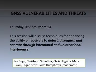
Thursday, 3:55pm, room 24
by payton
This . session will discuss techniques for enhanci...
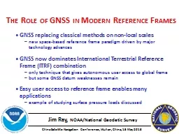
Jim Ray, NOAA/National Geodetic Survey
by cappi
The Role of GNSS in Modern Reference Frames. . GN...
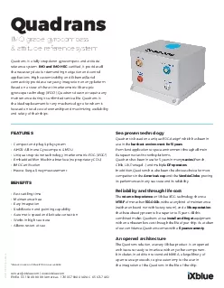
IMO grade gyrocompass
by evans
Quadrans attitude reference systemQuadrans is a fu...
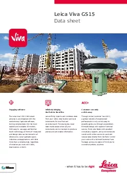
Leica Viva GS15Data sheet
by jade
Customer care only a click away Through Active Cus...
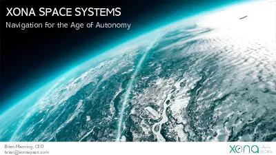
XONA SPACE SYSTEMS
by susan
Navigation for the Age of Autonomy Brian Manning, ...
Jim Ray, NOAA/National Geodetic Survey
by faustina-dinatale
The Role of GNSS in Modern Reference Frames. . G...
ArcGIS Collector and Accuracy of Location and Data
by natalia-silvester
2017 Indiana GIS Day and Conference. Joe . Madej....
Positioning in a multi-Global Navigation Satellite
by tatiana-dople
Systems . (GNSS) World. Jacob Heck. December 14, ...
www.nottingham.ac.uk/iessg
by pasty-toler
The Implementation of the Cornell Ionospheric Sci...
Site survey and co-location
by kittie-lecroy
Sten Bergstrand. July 2017. SAFETY AND TRANSPORT....
The EURIPOS Project:
by stefany-barnette
Eu. ropean . R. esearch Network of . I. onospheri...
CAPT
by briana-ranney
David B. Moskoff, USMS. Professor of Marine Trans...
Geodesy
by min-jolicoeur
. is the . measurement . and representation of t...
CEG2710 -
by mitsue-stanley
GNSS THEORY AND . PRACTICE. Stuart Edwards/Matt K...
Activities on
by kittie-lecroy
GNSS Implementation. in Korea. APEC . GIT/15 . Me...
GNSS Absolute Antenna Calibration at the
by olivia-moreira
National Geodetic Survey. Andria . Bilich. &...
U.S.
by natalia-silvester
Space Based PNT . Policy. Civil GPS Service Inter...
GNSS Absolute Antenna Calibration at the National Geodetic
by alexa-scheidler
Background. Gerald L Mader. 2 . , Andria L Bilich...
CEG2710 -
by tawny-fly
GNSS THEORY AND . PRACTICE. Stuart Edwards/Matt K...
The EURIPOS Project:
by marina-yarberry
Eu. ropean . R. esearch Network of . I. onospheri...
Load More...