Search Results for 'land method'
land method published presentations and documents on DocSlides.
Detecting Land Cover Land Use Change in Las Vegas
by aaron
Sarah Belcher & Grant Cooper. December 8, 201...


Impacts of Predation Laws on Wyoming Land Owners
by myesha-ticknor
Wyoming Dept. Of Agriculture. Impacts of Predatio...
Westward Expansion: Georgia’s Growth & Development, 1789-1840
by sherrill-nordquist
Mrs. Kim West. 8. th. Grade Georgia Studies. GPS...
Westward Expansion: Georgia’s Growth & Development, 1789-1840
by mitsue-stanley
Mrs. Kim West. 8. th. Grade Georgia Studies. GPS...


Supporting Landmark Image Retrieval with Skyline Extraction
by faustina-dinatale
Date :. . 2012 . / . 04. . / . 12. 資訊碩一...
August 3, 2015 Environmental Considerations in
by trish-goza
RPS Calculator. CEC IEPR Workshop . Purpose of th...

Methodological Choice and Key Categories Analysis
by khaza664
Key Categories Analysis. Africa Regional Workshop ...
Parameters of İnfiltration Models as Affected by the Measurement Technique and Land Use
by eve
Gülay. . KARAHAN. . Kim SEONGYUN. ...

Characterizing patchy soil and bedrock cover is useful for hydrology, ecology, and geomorphology
by delcy
Airborne lidar is addressing the need, however: . ...

PLANNING OF METROPOLITAN CENTRES-Methodology for preparing Master Plan
by elyana
Master Plan- Introduction. Master Plans prepared ...

Yield and water productivity of cumin as influenced by irrigation techniques and land configuratio
by yvonne
Dr.. . Ravindra. Singh . ICAR-National . Researc...
Talking Freight: Freight and Livability
by relievinglexus
June 15, 1022. Michael Kray, Atlanta Regional Comm...
T-Drive : Driving Directions Based on Taxi Trajectories
by liane-varnes
Microsoft Research Asia. University of North Texa...

Westward expansion Social Studies Methods
by stefany-barnette
GPS Standards. SS4H6 The student will explain wes...
An Inexpensive Method for Evaluating the Localization Performance of a Mobile Robot Navigation Syst
by tatiana-dople
Harsha Kikkeri, Gershon Parent, Mihai Jalobeanu, ...

Tayler Denman Dennis W. Hancock, PhD
by pasty-toler
Department of Crop and Soil Sciences. University ...

Presentation: Designing an Approach that Roots Our Learners
by tatyana-admore
Assembly of First Nations Education Directors of ...


Methods of destruction include:
by pamella-moone
Destruction by fire is the . easiest . and quicke...


1 Methodologies, Tools and Best Practices for Managing Info
by trish-goza
AUTOMATED LAND INFORMATION SYSTEM (ALES). 2. STRU...
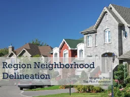
Region Neighborhood Delineation
by lindy-dunigan
Mingming. Zhang. The Piton Foundation. Community...
Runoff Processes Reading: Applied Hydrology Sections 5.6 to 5.8 and Chapter 6 for Thursday
by adia
Surface water. Watershed – area of land draining...

Transects and quadrants methods in landscape surveying
by candy
Online class for 5. th. Semester. Field Work and ...
e 161 De 1 4 and T5 e De is the spectral variation of emissi
by alyssa
(2) where q is the satellite observation angle an...
Statistics of Fingerprints
by natalia-silvester
Dakota Boyd, Dustin Short, Elizabeth Lee, John . ...

Advanced Methods of Underground Utility Data Collection
by marina-yarberry
Matthew . Miley. . City of Lorain. @. Matthew_Mi...



How a Revolution in Agriculture Made An Industrial Revolution Possible
by lindy-dunigan
And How Imitation . is . T. he . Greatest Form of...
Methods for Determining Maximum Flood Elevations Landward of Failed Levees:
by jane-oiler
An Example from the Great Missouri . River Flood ...

Last Reviewed:- Last Amended:-
by giovanna-bartolotta
Configuration Slide. 15 May 13. 15 May 13. Sensor...