
SLAM Robot using ros & lidar with raspberry pi,

Description: SLAM Robot using ros lidar with raspberry pi, matlab Mapping robot using ros and matlab Introduction Turtle bot is a well-known product, which uses the technology like SLAM and Navigation best suitable for home service robots. It also
Related Topics
Download Presentation
"SLAM Robot using ros & lidar with raspberry pi," is the property of its rightful owner. Permission is granted to download and print the materials on this website for personal, non-commercial use only, and to display it on your personal computer provided you do not modify the materials and that you retain all copyright notices contained in the materials. By downloading content from our website, you accept the terms of this agreement.
Presentation Transcript
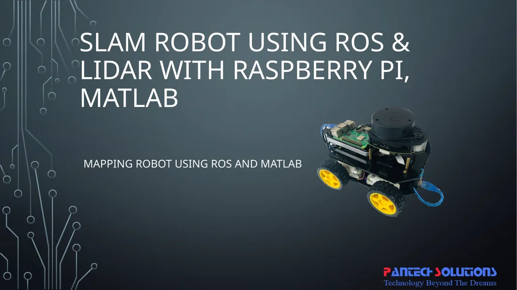
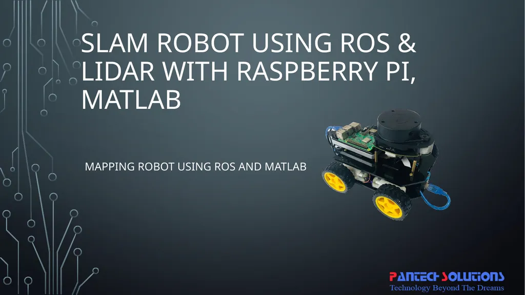
slide1. SLAM Robot using ros & lidar with raspberry pi, matlab Mapping robot using ros and matlab<br>
slide2. Introduction Turtle bot is a well-known product, which uses the technology like SLAM and Navigation best suitable for home service robots. It also contains multiple versions based on structure and features. The bot, which is embedded with the gyro, Kinect sensors, Lidar, and laptop, which has Mapping feature.
Same mapping is done here to localize and navigation using ROS in Raspberry pi communicated with the Matlab using ROS software packages<br>
slide3. Short about ROS ROS is the Robot Operating System, which is the group of software libraries used for building the Robotic applications which also has some algorithms with some development tools.
ROS is open source which is compatible in every Operating system and also by using Robotic Operating System Software package available in Matlab, we can access the ROS bot from the Matlab.
There are a lot of versions of ROS. Like ordered alphabetically.
Hydro
Indigo
Jade
Kinetic<br>
slide4. Short about SLAM SLAM is Simultaneous Localisation and Mapping. By starting with an example, Let us take Google Map which has a complete path of the whole world, Mapping in SLAM resembles that part.
Similarly by using GPS (Global Positioning System) every individual is located in that map using the coordinates of Latitude and Longitude.
With another example, by using Lidar we can Map the environment as well as by using SLAM Algorithm we can do localization and Mapping at the same time.<br>
slide5. Short about Lidar LIDAR is Light Detection and Ranging uses Light in the form of a pulsed laser to detect the obstacle with its ranges.
And by having continuous obtaining of ranges throughout the environment with precise angle difference between every ranges it is possible to map the whole environment which is known as Laser scans, which includes Ranges, Angles, Cartesian coordinates and Number of the value obtained. Based on Physical and Scattering process and platform LIDAR has many classifications.
Among those 360 degrees, lidar can be used for major applications.<br>
slide6. Abstract This is one of the bots, which has simple structure uses ROS (Robotic Operating System) software library of version ROS Kinetic booted with Raspberry Pi and also interfaced with RPLidar in the front top portion of the Bot.
This low-cost mapping bot emerges with features like SLAM (Simultaneous Localization and Mapping).
which has the capability to form the Map of the environment using Lidar scans using Matlab’s Robotic Operating System Software package to communicate with ROS in the Raspberry Pi using ROS Network Configurations.<br>
slide7. Existing system In the existing robots, High-cost sensors and interfaces are used like Kinect camera and controllers or Laptops merged with RPlidar which makes it as expensive Bot than others.<br>
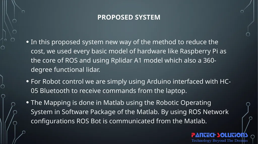
slide8. Proposed system In this proposed system new way of the method to reduce the cost, we used every basic model of hardware like Raspberry Pi as the core of ROS and using Rplidar A1 model which also a 360-degree functional lidar.
For Robot control we are simply using Arduino interfaced with HC-05 Bluetooth to receive commands from the laptop.
The Mapping is done in Matlab using the Robotic Operating System in Software Package of the Matlab. By using ROS Network configurations ROS Bot is communicated from the Matlab.<br>
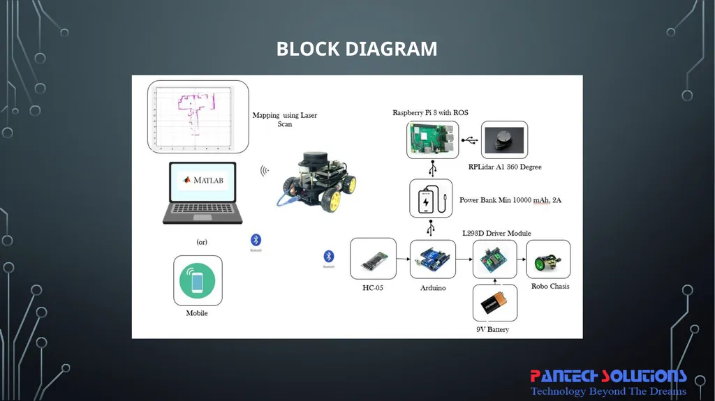
slide9. Block Diagram<br>
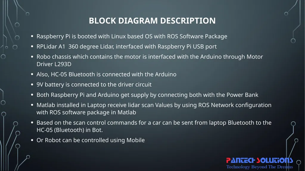
slide10. Block Diagram Description Raspberry Pi is booted with Linux based OS with ROS Software Package
RPLidar A1 360 degree Lidar, interfaced with Raspberry Pi USB port
Robo chassis which contains the motor is interfaced with the Arduino through Motor Driver L293D
Also, HC-05 Bluetooth is connected with the Arduino
9V battery is connected to the driver circuit
Both Raspberry Pi and Arduino get supply by connecting both with the Power Bank
Matlab installed in Laptop receive lidar scan Values by using ROS Network configuration with ROS software package in Matlab
Based on the scan control commands for a car can be sent from laptop Bluetooth to the HC-05 (Bluetooth) in Bot.
Or Robot can be controlled using Mobile<br>
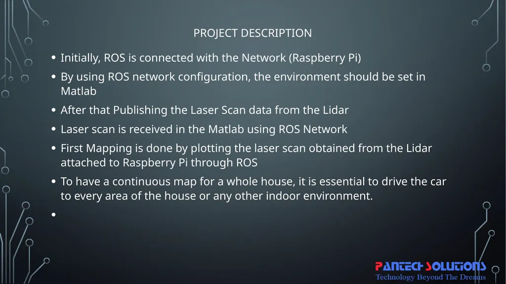
slide11. Project Description Initially, ROS is connected with the Network (Raspberry Pi)
By using ROS network configuration, the environment should be set in Matlab
After that Publishing the Laser Scan data from the Lidar
Laser scan is received in the Matlab using ROS Network
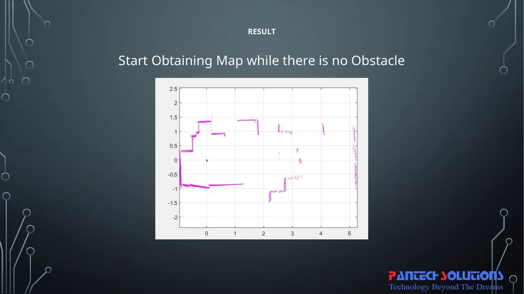
First Mapping is done by plotting the laser scan obtained from the Lidar attached to Raspberry Pi through ROS
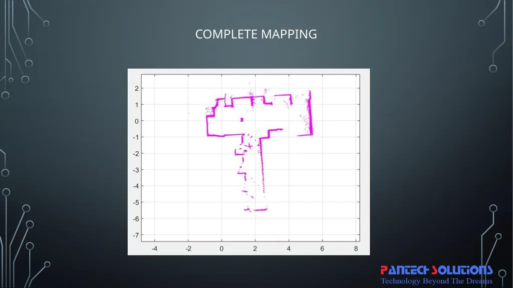
To have a continuous map for a whole house, it is essential to drive the car to every area of the house or any other indoor environment.<br>
slide12. Project Description Thus the movement of the robot can be performed in two ways, one is by connecting the HC-05 module with the laptop to take control from Matlab itself using GUI buttons for the direction of the movement. Another way is to use an Android mobile app, here we used “Arduino RC” App.
While driving throughout every area, the map is automatically obtained. We can save that map in the format of the .mat file for later use in the same directory
It can be reloaded using Load command in Matlab<br>
slide13. Hardware Required Raspberry Pi 3
SD Card 16 GB class 10
RPLidar A1
Robo Setup
Power Bank (10000 mAh, 2 A minimum)
Arduino UNO
HC-05 Bluetooth Module
L293D Driver module<br>
slide14. Software Required ROS kinetic OS image for Raspberry Pi
Matlab, which has a Robotic Operating System Software Package
Arduino IDE
SD Card Formatter
Etcher/win32Disk Imager/Rufus
Arduino RC (Android app) (Optional)<br>
slide15. Result Start Obtaining Map while there is no Obstacle<br>
slide16. Complete Mapping<br>
slide17. Thank you<br>
slide2. Introduction Turtle bot is a well-known product, which uses the technology like SLAM and Navigation best suitable for home service robots. It also contains multiple versions based on structure and features. The bot, which is embedded with the gyro, Kinect sensors, Lidar, and laptop, which has Mapping feature.
Same mapping is done here to localize and navigation using ROS in Raspberry pi communicated with the Matlab using ROS software packages<br>
slide3. Short about ROS ROS is the Robot Operating System, which is the group of software libraries used for building the Robotic applications which also has some algorithms with some development tools.
ROS is open source which is compatible in every Operating system and also by using Robotic Operating System Software package available in Matlab, we can access the ROS bot from the Matlab.
There are a lot of versions of ROS. Like ordered alphabetically.
Hydro
Indigo
Jade
Kinetic<br>
slide4. Short about SLAM SLAM is Simultaneous Localisation and Mapping. By starting with an example, Let us take Google Map which has a complete path of the whole world, Mapping in SLAM resembles that part.
Similarly by using GPS (Global Positioning System) every individual is located in that map using the coordinates of Latitude and Longitude.
With another example, by using Lidar we can Map the environment as well as by using SLAM Algorithm we can do localization and Mapping at the same time.<br>
slide5. Short about Lidar LIDAR is Light Detection and Ranging uses Light in the form of a pulsed laser to detect the obstacle with its ranges.
And by having continuous obtaining of ranges throughout the environment with precise angle difference between every ranges it is possible to map the whole environment which is known as Laser scans, which includes Ranges, Angles, Cartesian coordinates and Number of the value obtained. Based on Physical and Scattering process and platform LIDAR has many classifications.
Among those 360 degrees, lidar can be used for major applications.<br>
slide6. Abstract This is one of the bots, which has simple structure uses ROS (Robotic Operating System) software library of version ROS Kinetic booted with Raspberry Pi and also interfaced with RPLidar in the front top portion of the Bot.
This low-cost mapping bot emerges with features like SLAM (Simultaneous Localization and Mapping).
which has the capability to form the Map of the environment using Lidar scans using Matlab’s Robotic Operating System Software package to communicate with ROS in the Raspberry Pi using ROS Network Configurations.<br>
slide7. Existing system In the existing robots, High-cost sensors and interfaces are used like Kinect camera and controllers or Laptops merged with RPlidar which makes it as expensive Bot than others.<br>
slide8. Proposed system In this proposed system new way of the method to reduce the cost, we used every basic model of hardware like Raspberry Pi as the core of ROS and using Rplidar A1 model which also a 360-degree functional lidar.
For Robot control we are simply using Arduino interfaced with HC-05 Bluetooth to receive commands from the laptop.
The Mapping is done in Matlab using the Robotic Operating System in Software Package of the Matlab. By using ROS Network configurations ROS Bot is communicated from the Matlab.<br>
slide9. Block Diagram<br>
slide10. Block Diagram Description Raspberry Pi is booted with Linux based OS with ROS Software Package
RPLidar A1 360 degree Lidar, interfaced with Raspberry Pi USB port
Robo chassis which contains the motor is interfaced with the Arduino through Motor Driver L293D
Also, HC-05 Bluetooth is connected with the Arduino
9V battery is connected to the driver circuit
Both Raspberry Pi and Arduino get supply by connecting both with the Power Bank
Matlab installed in Laptop receive lidar scan Values by using ROS Network configuration with ROS software package in Matlab
Based on the scan control commands for a car can be sent from laptop Bluetooth to the HC-05 (Bluetooth) in Bot.
Or Robot can be controlled using Mobile<br>
slide11. Project Description Initially, ROS is connected with the Network (Raspberry Pi)
By using ROS network configuration, the environment should be set in Matlab
After that Publishing the Laser Scan data from the Lidar
Laser scan is received in the Matlab using ROS Network
First Mapping is done by plotting the laser scan obtained from the Lidar attached to Raspberry Pi through ROS
To have a continuous map for a whole house, it is essential to drive the car to every area of the house or any other indoor environment.<br>
slide12. Project Description Thus the movement of the robot can be performed in two ways, one is by connecting the HC-05 module with the laptop to take control from Matlab itself using GUI buttons for the direction of the movement. Another way is to use an Android mobile app, here we used “Arduino RC” App.
While driving throughout every area, the map is automatically obtained. We can save that map in the format of the .mat file for later use in the same directory
It can be reloaded using Load command in Matlab<br>
slide13. Hardware Required Raspberry Pi 3
SD Card 16 GB class 10
RPLidar A1
Robo Setup
Power Bank (10000 mAh, 2 A minimum)
Arduino UNO
HC-05 Bluetooth Module
L293D Driver module<br>
slide14. Software Required ROS kinetic OS image for Raspberry Pi
Matlab, which has a Robotic Operating System Software Package
Arduino IDE
SD Card Formatter
Etcher/win32Disk Imager/Rufus
Arduino RC (Android app) (Optional)<br>
slide15. Result Start Obtaining Map while there is no Obstacle<br>
slide16. Complete Mapping<br>
slide17. Thank you<br>