/
in Chena River State Recreation Area in Chena River State Recreation Area

in Chena River State Recreation Area - PDF document

vivian
vivian . @vivian
Follow
342 views
Uploaded On 2021-08-20

in Chena River State Recreation Area - PPT Presentation

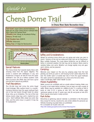
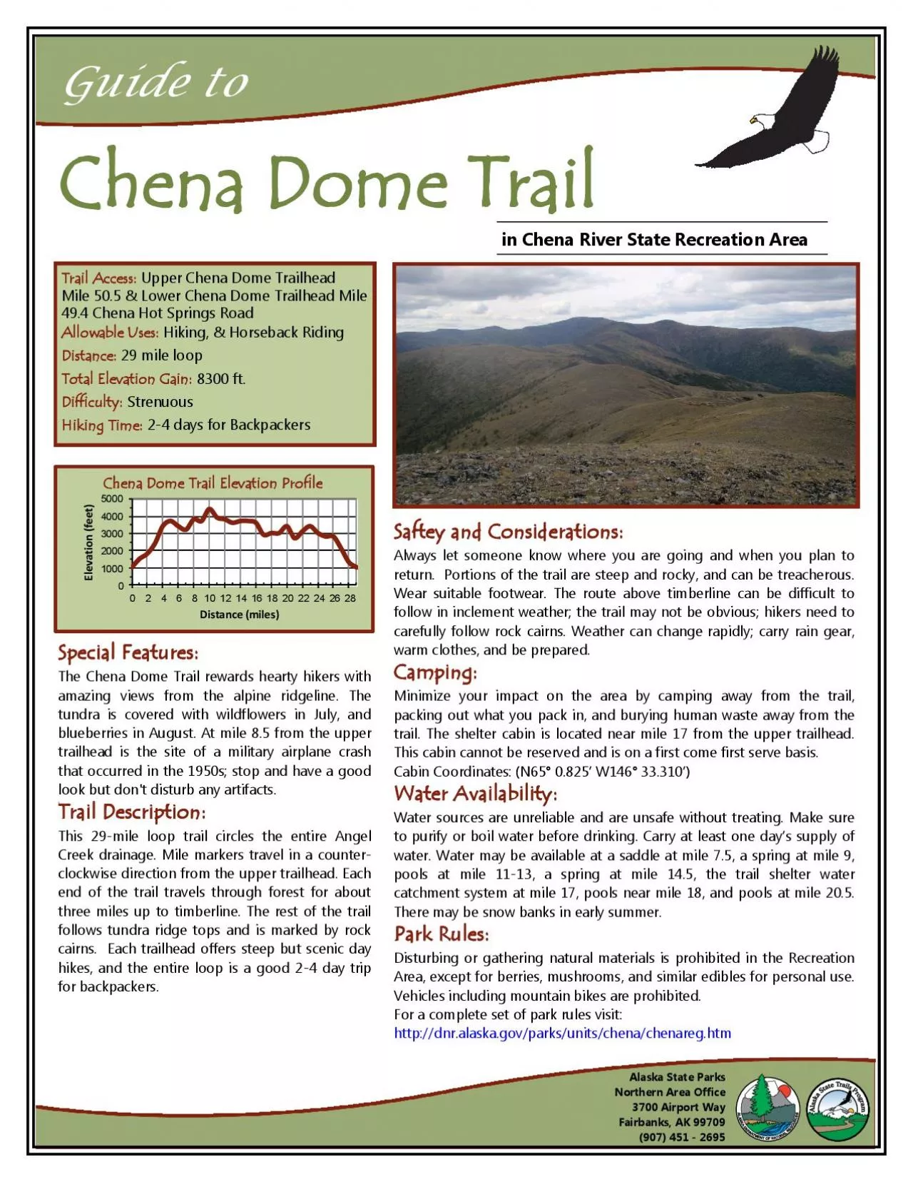
Guide toChena Dome TrailTrail Access Upper Chena Dome Trailhead Mile 505 Lower Chena Dome Trailhead Mile 494 Chena Hot Springs RoadAllowable Uses Hiking Horseback RidingDistance 29 mile loop8300 ft ID: 867377

mile trail water chena trail mile chena water dome area upper trailhead miles cabin pools elevation loop shelter feet

Share:

Link:

Embed:

Download Presentation from below link

Download Pdf The PPT/PDF document "in Chena River State Recreation Area" is the property of its rightful owner. Permission is granted to download and print the materials on this web site for personal, non-commercial use only, and to display it on your personal computer provided you do not modify the materials and that you retain all copyright notices contained in the materials. By downloading content from our website, you accept the terms of this agreement.


Presentation Transcript

1 Guide to in Chena River State Recreati
Guide to in Chena River State Recreation Area Chena Dome Trail Trail Access: Upper Chena Dome Trailhead Mile 50.5 & Lower Chena Dome Trailhead Mile 49.4 Chena Hot Springs Road Allowable Uses: Hiking, & Horseback Riding Distance: 29 mile loop 8300 ft. Difficulty: Strenuous Hiking Time: 2 - 4 days for Backpackers Special Features: The Chena Dome Trail rewards hearty hikers with amazing views from the alpine ridgeline. The tundra is covered with wildflowers in July, and blueberries in August. At mile 8.5 from the upper that occurred in the 1950s; stop and have a good look but don't disturb any artifacts. Trail Description: This 29 - mile loop trail circles the entire Angel Creek drainage. Mile markers travel in a counter - clockwise direction from the upper trailhead. Each end of the trail travels through forest for about three miles up to timberline. The rest of the trail follows tundra ridge tops and is marked by rock hikes, and the entire loop is a good 2 - 4 day trip for backpackers. Saftey and Considerations: Always let someone know where you are going and when you plan to return. Portions of the trail are steep and rocky, and can be treacherous. Wear suitable footwear. The route above timberline can be difficult to carefully follow rock cairns. Weather can change rapidly; carry rain gear, warm clothes, and b

2 e prepared. Camping: Minimize your
e prepared. Camping: Minimize your impact on the area by camping away from the trail, packing out what you pack in, and burying human waste away from the trail. The shelter cabin is located near mile 17 from the upper trailhead. This cabin cannot be reserved and is on a first come first serve basis. Cabin Coordinates: (N65° 0.825’ W146° 33.310’) Water Availability: Water sources are unreliable and are unsafe without treating. Make sure to purify or boil water before drinking. Carry at least one day’s supply of water. Water may be available at a saddle at mile 7.5, a spring at mile 9, pools at mile 11 - 13, a spring at mile 14.5, the trail shelter water catchment system at mile 17, pools near mile 18, and pools at mile 20.5. There may be snow banks in early summer. Disturbing or gathering natural materials is prohibited in the Recreation Area, except for berries, mushrooms, and similar edibles for personal use. Vehicles including mountain bikes are prohibited. For a complete set of park rules visit: http://dnr.alaska.gov/parks/units/chena/chenareg.htm Alaska State Parks Northern Area Office 3700 Airport Way Fairbanks, AK 99709 (907) 451 - 2695 Chena Dome Trail Elevation Profile Distance (miles) Elevation (feet) 0 1000 2000 3000 4000 5000 0 2 4 6 8 10 12 14 16 18 20 22 24 26 28 Elevation (feet) Trail Miles Chena Dome Trail