/
 Tuesday  8/9/16 Agenda :   Tuesday  8/9/16 Agenda :

Tuesday 8/9/16 Agenda : - PowerPoint Presentation

liane-varnes
liane-varnes . @liane-varnes
Follow
351 views
Uploaded On 2020-04-08

Tuesday 8/9/16 Agenda : - PPT Presentation

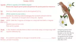
Write in agenda Get Syllabus signed Review the regions power point and preview the power point for tomorrow EQ How has climate played a role in development G1c WU Write answer in your notes ID: 776390

georgia regions islands region georgia regions islands region climate mountains river power notes state write barrier point fall line

Share:

Link:

Embed:

Download Presentation from below link

Download Presentation The PPT/PDF document " Tuesday 8/9/16 Agenda : " is the property of its rightful owner. Permission is granted to download and print the materials on this web site for personal, non-commercial use only, and to display it on your personal computer provided you do not modify the materials and that you retain all copyright notices contained in the materials. By downloading content from our website, you accept the terms of this agreement.


Presentation Transcript

Slide1

Tuesday 8/9/16Agenda: (Write in agenda.) Get Syllabus signed. Review the regions power point and preview the power point for tomorrow. EQ: How has climate played a role in development? (G1c)WU: (Write answer in your notes.) Identify the enduring understanding(s) that would be labeled with the establishing of Savannah as Georgia’s first colony/city. Explain.Open: QUIZ: Label the 5 regions of Georgia on a map add and label a Compass Rose. (1/4) Students may not use notes. Take up for a grade. Work: 1. The students will take Notes in their note books using a Georgia map with the regions outlined.(1/2) Close: If I could live anywhere in Georgia it would be in the _____________ region because (at least 2 reasons).

Georgia's governor first proclaimed the brown thrasher

as

the State Bird in 1935, and it was finally recognized by the Georgia legislature as the official State Bird

1970.

Slide2

8-9

c

. Locate and evaluate the importance of key physical features on the development of Georgia; include the Fall Line, Okefenokee Swamp, Appalachian Mountains, Chattahoochee and Savannah Rivers, and barrier islands

.

HW: Bring in Notecards and color pencils to make “Trading Cards” on regions tomorrow.

Slide3

Chattahoochee River

Savannah

River

Slide4

Chattahoochee River

Starts in the mountains of North Georgia (Blue Ridge Region) and empties into the Gulf of Mexico

Forms part of the natural border between Georgia and Alabama

Major source of water for Atlanta and surrounding cities

Water war between Georgia, Alabama, and

Florida

The name Chattahoochee is thought to come from a Muskogean word meaning "rocks-marked" (or "painted"), from

chato

("rock") plus

huchi

("marked"). This possibly refers to the many colorful granite outcroppings along the northeast-to-southwest segment of the river.

Slide5

Savannah River

Forms border between Georgia and South Carolina

Begins in Hart County, forms Lake Hartwell, and then flows to the Atlantic Ocean. The only river that flows into Georgia from outside of its borders.

In addition to shipping, the river is used as a major source of drinking water for Savannah and Augusta, to cool two nuclear power plants in South Carolina, and to generate hydroelectric power.

Slide6

Appalachian Mountains

The southernmost point of the Appalachian Mountains is located in Georgia.Stretch across all three mountain regions in the northern part of the state.Also know as the Blue Ridge mountains because of the blue haze that appears around their peaks.One of the oldest mountains in the world.Over time, weather has worn them down and they are more rounded and less jagged than new mountains such as the Rockies in western U.S.

Slide7

Slide8

Fall Line

Fall Line

Slide9

Fall Line

Separates the Coastal Plain region from the Piedmont region

Runs through Columbus, Macon, and Augusta

Narrow rivers in the northern part of the state flow over the last hard rock of the Piedmont, creating waterfalls and rapids

As the rivers flow into the softer and sandier soil of the Coastal Plain, the rivers spread out and become wider and slower.

Slide10

Fall Line

Use to mark the beginning of the Atlantic Ocean.Prevented early explorers from traveling further.Excellent source of power.

Slide11

Barrier Islands

The Barrier Islands, also known as the Sea Islands or Golden Isles, are a chain of sandy islands off the coastline of Georgia. These islands protect the mainland from wind and water erosion.

Slide12

Barrier Islands

There are 14 Barrier Islands off Georgia’s coast including Tybee, St. Simons, Jekyll, and Cumberland.

Some of the islands, such as Cumberland, are wild life refuges and are national or state parks. Others, like St. Simons, have been developed and three (Little Cumberland, Little St. Simons, and St. Catherine’s) are still privately owned.

Today, the islands are mainly tourist and recreation destinations though the fishing and paper industries are still important economic enterprises.

Slide13

Okefenokee Swamp

Name means land of the trembling earthLocated in the Coastal Plain RegionCovers 700 square miles making it the largest swamp in North AmericaProtected by the federal government with hundreds of animals species living in the area… most known the American alligator.

Slide14

Wednesday 8/10/16

(Woliver/Aiken – Adv.)Agenda: (Write in agenda.) Get Syllabus signed. Review the regions power point and preview the power point for tomorrow. EQ: How has climate played a role in development? (G1c)WU: (Write answer in your notes.) Connect two things you have learned about geography, Georgia’s regions and physical features.Open: (Write answer in your notes.) Make predictions about the climates that are found in each region of Georgia. Overall how would you characterize our climate?Work: 1. The students will take Notes in their note books incorporating self- drawn weather symbols to express climatological differences throughout Georgia on a map with the regions outlined. (1/2 sheet) 2. Investigate (use BYOT) the cash crops of each region, hypothesize how the climate impacts what is grown.Close: To close the notes students will write a summary of the overall climate found in the state.

Hot Questions

L1

: What is Georgia’s climate like?

L2: How do the different physical features/regions impact Georgia’s climate.

L3: What conclusions about the climate can you draw about regions from the type of produce that is grown?

L4: Explain the relationship between climate and economic opportunities.

Slide15

How does the climate effect the economy?What changes have to be made either in production or agriculture?

Slide16

Check the Map 1 last time…Lets see what you know!

Slide17

Check the Map 1 last time…Lets see what you know!

Slide18

Which letter represents the correct location of the Blue Ridge Mountains region?

A

B

C

D

E

Slide19

Which letter represents the correct location of the Coastal Plain region?

A

B

C

D

E

Slide20

Which letter represents the correct location of the Piedmont region?

A

B

C

D

E

Slide21

Which letter represents the correct location of the Valley and Ridge region?

A

B

C

D

E