/
African Intertropical Front African Intertropical Front

African Intertropical Front - PowerPoint Presentation

pamella-moone
pamella-moone . @pamella-moone
Follow
370 views
Uploaded On 2017-05-23

African Intertropical Front - PPT Presentation

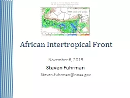
November 6 2015 Steven Fuhrman Stevenfuhrmannoaagov What is the ITF The line of convergence between moist southerly flow and dry northerly flow over westerneastern Africa Boundary between moist monsoonal air and very dry Saharan dessert air ID: 551146

2015 itf cpc evolution itf 2015 evolution cpc dry central africa ftp monitor noaa gov important african dekad moist

Share:

Link:

Embed:

Download Presentation from below link

Download Presentation The PPT/PDF document "African Intertropical Front" is the property of its rightful owner. Permission is granted to download and print the materials on this web site for personal, non-commercial use only, and to display it on your personal computer provided you do not modify the materials and that you retain all copyright notices contained in the materials. By downloading content from our website, you accept the terms of this agreement.


Presentation Transcript

Slide1

African Intertropical Front

November

6, 2015Steven FuhrmanSteven.fuhrman@noaa.govSlide2

What is the ITF

?

The line of convergence between moist southerly flow and dry northerly flow over western/eastern Africa.Boundary between moist monsoonal air and very dry Saharan dessert air.A surface feature which can manifest itself as a region of

pronounced

temperature and

dew point gradients, as well as abrupt shift in wind direction.

equator

B

oundary

slopes back southward forming a wedge. ITCZ considered to be south

of ITF.

Moist

dry

A

: Knight and Smith (1944)Slide3

What is the ITF?

Propagates northward from April through July

Lags slightly behind the zenith angle of the sun Quicker southward retreat from August through October.Can reach as far north as about 20°NRoughly residing across southern Mauritania, central Mali, central Niger, Central chad and Southern Sudan. Slide4

Where is

it located?Slide5

Why Is the ITF

Important?

Important for seasonal-to-interannual climate variabilityCan literally mean feast or famine for the African Sahel.Provides a boundary of the northernmost extent of Monsoonal rains

.

Moisture and instability stays to its southSlide6

Why Is the ITF

Important?

Consequently, farmers, ranchers, and other stakeholders are very interested in the ITF’s position.Delayed or lessened northward propagation can result in drought and failed cropping seasonsImportant impacts on

Vector

borne

diseases and locust outbreaks, in addition to growing season.Slide7

How Do W

e Monitor it?

We report on ITF position once a dekad.Average each of the 10 daily analyses over a dekadal period.Final ITF is average of 3 meteorologist's analysis.

Values

every 5°

lon between 15° W and 35° E Begin monitoring the first

dekad of April and end the third

dekad of October. Slide8

How Do We

Monitor it?

Hand drawn analysis2 variable fields12Z GDAS Surface windsMean 9z-15z GTS gauge dewpointLine of convergence or change in direction of wind15°C isodrosothermSlide9

How Do We Monitor it?Compare to normal

and previous dekad’s ITFAlso a sanity check; make sure its realistic. Write discussionNotes:

As much an art as a scienceAttempt a somewhat smooth analysis.Be cautious of missing data and be cognizant that observations will be sparse.Slide10

Distribution

Posted to our CPC website:http://www.cpc.ncep.noaa.gov/products/african_desk/cpc_intl/africa/africa.shtmlPDF available for download via

FTPftp://ftp.cpc.ncep.noaa.gov/fews/itcz/Used as part of some of FEWS NET’s own publications Slide11

ITF E

volution In 2015Slide12

ITF Evolution In 2015Slide13

ITF Evolution In 2015Slide14

How did the ITF evolve this yearSlide15

ITF Evolution In 2015Slide16

ITF Evolution In 2015Slide17

ITF Evolution In 2015