Explore
Featured
Recent
Articles
Topics
Login
Upload
Featured
Recent
Articles
Topics
Login
Upload
Search Results for 'Maps-And-Gis'
Maps-And-Gis published presentations and documents on DocSlides.
Beginners Guide: Embed GIS Maps Tutorial
by ellena-manuel
and Walkthrough w/Examples. How to Add GIS Maps t...
Ten Years of Gulfport GIS
by kittie-lecroy
Survival and Evolution . since . Hurricane Katrin...
Maps and GIS Historical Maps
by melanie
The oldest map?. Konya . town map, Turkey, c. 6200...
My Maps and Google Maps https://goo.gl/jOz9uq
by kittie-lecroy
. Presenter: Alicia McGee. Email: . amcge...
Geographic Information Systems (GIS) – climate hazards
by valerie
Getting started. You’ll need a notepad on which ...
GIS for Information Technology
by helene
Prepared by . Information . Technology Services . ...
Part I: GIS Tools for Water Planners
by lois-ondreau
and. Part II: Sierra Nevada Conservancy . GIS Wat...
GIS at a Regional Level
by celsa-spraggs
Regional Planning & Development Councils and...
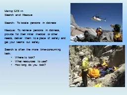
Using GIS in
by cheryl-pisano
Search and Rescue. Search: . To locate persons in...
GIS Matthew Rosencrans
by test
Tom . DiLiberto. Outline . What is GIS?. What can...
12. Cartography and Map Production
by liane-varnes
Outline. Nature of maps and cartography. Principl...
Geographic Information Systems - GIS
by ashley
Jessica Griffin. Intro to GIS. Geography is the sc...
EPID 799C Fall 2018 Maps 1
by min-jolicoeur
https://geocompr.robinlovelace.net/adv-map.html. ...
Maps and GIS
by alida-meadow
Historical Maps. The oldest map?. Konya . town ma...
My Maps and Google Maps https://goo.gl/jOz9uq
by celsa-spraggs
. Presenter: Alicia McGee. Email: . amcge...
Types of maps Types of maps
by eddey
How to read a map. Maps . are pictures of the Eart...
Reading Contour Maps (Including Topographic Maps):
by badra
Visualizing 3D Surfaces. Carol J. Ormand. , . SERC...
Minnesota DNR GIS Service Delivery and Governance
by candy
Tim . Loesch. GIS Section Manager. Camp Ripley. 19...
GIS MAPPING AND VULNERABILITY ASSESSMENT
by roxanne
IN UPHCS OF MADURAI CORPORATION UNDER NUHM . Prese...
Remote Sensing and GIS Application
by blindnessinfluenced
Lecturer. Ruba. . Yousif. . Hussain. Third Year....
Remote Sensing and GIS Application
by rayfantasy
Lecturer. Ruba. . Yousif. . Hussain. Third Year....
The GIST of making informed decisions and workflow of buying, borrowing, downloading or viewing.
by phoenixbristle
Tim Bowersox, Cyril Oberlander, Kate Pitcher, Mark...
Remote Sensing and GIS Application
by hoodrona
Lecturer. Ruba. . Yousif. . Hussain. Third Year....
Putting trash in its place: Participatory GIS, social networking, and targeting unofficial trash si
by min-jolicoeur
Frank Lafone. Trevor Harris. Department of Geolog...
Putting trash in its place: Participatory GIS, social networking, and targeting unofficial trash si
by test
Frank Lafone. Trevor Harris. Department of Geolog...
GIS and Network Analyst A. Goodchild
by jane-oiler
CEE 587. 25 . April . 2011. What is GIS?. Geograp...
GIST making informed decisions and workflow of buying, borrowing, downloading or viewing… easier.
by tatiana-dople
Tim Bowersox, Cyril Oberlander, Kate Pitcher, Mar...
What is a GIS? Geospatial technologies are technolo-gies for collecting and dealing with geographic
by tawny-fly
three main types: . . Global Positioning Systems...
GIS as Applied to Disaster Management in Outlying and Non-Metro Illinois Counties
by luanne-stotts
James Cueno. 596 A Peer Presentation - Spring 2 �...
GIS And Enterprise Architecture
by tatyana-admore
Presented by . John R. Woodard MS, GISP. A Quick ...
Spatial Thinking and the GIS User Interface
by natalia-silvester
Michael F. Goodchild. University of California. S...
GIS as Applied to Disaster Management in Outlying and Non-M
by alida-meadow
James Cueno, City of Galesburg. jcueno@ci.galesbu...
A GIS-based comparison of pre- and post-lignite strip mine
by marina-yarberry
A Progress Report by. L. Joy Mercier. on Tuesday,...
Chapter 10: Health and GIS
by kittie-lecroy
An Introduction to the Geography of Health. Data ...
IDS/GIST Introduction and Best Practices.
by lois-ondreau
Deciding if GIST is right for your ILL office.. T...
LECTURING ON SATELLITE IMAGERY PROCESSING AND GIS BASED ON
by lois-ondreau
Fatwa . Ramdani. *. . *. Geo-environment, Instit...
A GIS-based comparison of pre- and post-lignite strip mine
by myesha-ticknor
A Progress Report by. L. Joy Mercier. on Tuesday,...
INTEGRATING SURVEYING AND GIS
by yoshiko-marsland
PREPARED FOR:. WVAGP SEMINAR. Jared D. Wilson. In...
Treatment of Imatinib -resistant GIST
by beatrice
: . The Next Generation. Dr. Michael Heinrich, M....
A GIS-Based Model to Assess
by fanny
Onsite Sewage . Facility . (. OSSF) . Contaminatio...
Load More...