/
The Nuts & Bolts of Enterprise Geographic Information Systems (EGIS): The Nuts & Bolts of Enterprise Geographic Information Systems (EGIS):

The Nuts & Bolts of Enterprise Geographic Information Systems (EGIS): - PowerPoint Presentation

phoebe
phoebe . @phoebe
Follow
342 views
Uploaded On 2021-12-20

The Nuts & Bolts of Enterprise Geographic Information Systems (EGIS): - PPT Presentation

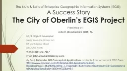
A Success Story The City of Oberlins EGIS Project Presented by John R Woodard MS GISP EA GISIT Project Developer Davey Resource Group Inc 295 South Water Street Kent Ohio 44240 Phone ID: 906097

enterprise gis layer city gis enterprise city layer amp data information egis system systems point water john project miles

Share:

Link:

Embed:

Download Presentation from below link

Download The PPT/PDF document "The Nuts & Bolts of Enterprise Geogr..." is the property of its rightful owner. Permission is granted to download and print the materials on this web site for personal, non-commercial use only, and to display it on your personal computer provided you do not modify the materials and that you retain all copyright notices contained in the materials. By downloading content from our website, you accept the terms of this agreement.


Presentation Transcript

Slide1

The Nuts & Bolts of Enterprise Geographic Information Systems (EGIS): A Success StoryThe City of Oberlin’s EGIS Project

Presented by:

John R. Woodard MS, GISP, EA

GIS/IT Project Developer

Davey Resource Group, Inc.

295 South Water Street

Kent, Ohio 44240

Phone:

330-573-7557

Email:

john.woodard@davey.com

My Book

Enterprise GIS Concepts & Applications

available from Amazon & CRC Press

https://www.amazon.com/Enterprise-GIS-Applications-John-Woodard/dp/1138478296/ref=sr_1_1?dchild=1&keywords=Enterprise+GIS+Concepts+and+Applications&qid=1600444722&sr=8-1

Slide2

Hello! My name is John (aka Woody)……

PROFESSIONAL:

Currently, I am the GIS/IT Project Developer for the Davey Resource Group, Inc.

20 years experience in GIS!

GISP (Geographic Information System Professional)Certification

EA (Enterprise Architecture) Certification

PROFESSIONAL CONTRIBUTIONS

Book “Enterprise Concepts for GIS” Jan. 2020, CRC Press

Adjunct Professor with Northeast Ohio Medical University, Rootstown Ohio

EDUCATION:

MS in Geography/GIS -University of Akron.

Masters in Digital Science (Enterprise Architecture)-Kent State University.

PERSONAL:

Scuba Diver

Beekeeper (Yes, I deal with over 400,000 bees and sell honey!)

NOTE:

10 years USNR Seabees (EO1 – Navy training instructor)

Slide3

The City formed a partnership relationship with Davey Resource Group DRG)'s GIS/IT division to help create the EGIS. This partnership accomplished establishing a system that now supports Public Works, Water Dept., Municipal Power & Light Services, for less than $50,000.00!

EXAMPLE OF CITY & COMMERCIAL PARTNERSHIP

Slide4

A NEED FOR AN ENTERPRISE SYSTEM

The City of Oberlin, Ohio, recognized the need to utilize all available technologies to allow its staff to manage commercial, industrial, academic, utility, and residential development in the City. One of the tools used by the City is GIS or Geographic Information Systems.

Slide5

POLL QUESTION (they made me do it!)

Slide6

THE DEPARTMENTS INVOLVED

Department Responsibilities

Oberlin Municipal Light & Power - City Electric Utility

Public Works - City infrastructure

Engineering - City Planning

Water Department - City water infrastructure

Fire Department - Fire hydrants

Stormwater Control - Stormwater issues, flooding

Slide7

LEGACY DATA/INFORMATION

The City of Oberlin had over 40 years worth of legacy infrastructure information housed within AutoCAD, paper, and an outdated MS Access database. This information needed to be updated and merged into one data system that would support the city’s departments.

Slide8

How the project began….

The City of Oberlin reached out to John Woodard, DRG’s GIS/TEAM Project Developer for advice and help. He did a strategic study of the City’s IT and GIS infrastructure that resulted in a report that described the “Current State” of the information system.

This report became the starting point for mapping out a plan to build the city’s future EGIS

over a strategic plan (enterprise architecture) as a

foundation. John met with city employees and supervisors (Dawn Ferro, Drew

Skolnicki

, Randall Roberts, John Lov

, and William Albrecht) and together they planned a series of steps to move the from the “Current State” to a fully functional EGIS (Future State) information system.DRG’s GIS/IT team became responsible for guiding the city through the processes of

developing and implementing enterprise GIS (EGIS).

Slide9

DAVEY RESOURCE GROUP (DRG) GIS/IT TEAM

DRG’s GIS/IT Team used a balanced approach to designing and implementing the EGIS program. This balanced approach over time respected the municipal budget yet quickly started to produce operational and cost benefits. The system is available to City personnel and includes roadways, addresses, parcel data, sanitary sewers, water mains, storm sewers, aerial photographs, streams, lakes, stormwater management facilities, storm sewer outfalls. City personnel can utilize the EGIS systems to review infrastructure, zoning, recreation areas, development, etc. without having to leave their desktop and look for paper records.

Slide10

THE CITY’S EGIS IS BASED ON DRG’s ASSET MANAGER

What is Asset Manager? It is a low-cost GIS solution for local governments, municipalities, or any organization to manage assets and resources. These assets can be catch basins, sewers, signs, pavement, or another type of assets. Supervisors can view work orders, work progress and status, create reports that detail infrastructure conditions, costs, and show deprecation.

Slide11

A NEW LOOK FOR ALL OF THE CITY’S DATA!

Data clean up and consistent formatting enables the system to display the information in easy to read table.

Clean and well- organized data can be sorted, queried, or analyzed to find answers to issues facing the municipality.

The raw data has been converted into information

.

Slide12

PROJECT ACCOMPLISHMENTS

A fully functional enterprise GIS system was created for the City of Oberlin.

The

City’s legacy data converted into proper GIS formats and uploaded to the EGIS.

9,161 points digitized with 492 points field verified by GPS.

64 miles of sewer

49 miles of watermains

EGIS system established:

10 layers of point data (outfalls, hydrants, water valves, manholes, etc.).

4 polyline layers (streets, sewers, watermains)

1 polygon layer (City owned parcels)

Slide13

PROJECT NUMBERS

Oberlin Municipal Light & Power Service (OMLPS)

920

lights – point layer

1135 meters – point layer

2,694 poles – point layer

Public Works

Storm sewer Infrastructure1,098 catch basins – point layer

450 storm manholes – point layer

86 outfalls – point layer

35 miles of storm sewer – polyline layer

Sanitary sewer Infrastructure

698 sanitary manholes – point layer

29 miles of sanitary sewer – polyline layer

Other information

1,539 signs – point layer

169 city owned parcels – polygon layer

25 miles City streets – polyline layer

Water Department

541 fire hydrants – point layer

Integrated with Fire Department’s IT system

492 water valves – point layer

DRG field team located/verified via GPS

49 miles of watermains – polyline layer

County data (base map)

County parcels – polygon layer

County roads – polyline layer

Summary of data

Digitized

9,161 points

64 miles of storm and sanitary sewers

49 miles of watermains

Field located (GPS verified =/- 3 FT)

492 points (water valves)

Slide14

COST

Phase 1 – 2019

Current state determined and path to Future (ideal vision) state planned

Start Legacy data conversion to GIS formats and upload to EGIS

.

GASBE 34 protocols established (financial reporting programmed)

EGIS system

Designed, created, and implemented.

Data uploaded

Cost -

$48,000.00

Phase 2 – 2020

Data architecture established

Finish Legacy data conversion to GIS formats and upload to EGIS

.

Water, Stormwater control (and inspections), Zoning departments added to project

Cost -

$48,000.00

Total Cost for two years $96,000.00

Slide15

PROJECT’S SUCCESS REWARDED

The Ohio Geographically Referenced Program (OGRIP) awarded this project a 2019 Best Practice Award. This award

recognizes organizations in Ohio that are establishing or maintaining GIS projects which adhere to OGRIP’s goals, objectives, and are of the highest quality. The City of Oberlin received this award at the 2019 Ohio GIS Conference, held every year in Columbus, Ohio.

Slide16

For more information about Enterprise Systems & Projects

https://www.amazon.com/Enterprise-GIS-Applications-John-Woodard/dp/1138478296/ref=sr_1_1?dchild=1&keywords=Enterprise+GIS+Concepts+and+Applications&qid=1600444722&sr=8-1

FREE Lunch/learn online seminars about Enterprise Systems/GIS and Architecture. Feel free to contact me about a lunch and learn or online seminar.

Enterprise Systems: What is an enterprise system?

Enterprise Systems: A path to the future

Enterprise Systems: Goals & Responsibilities

Enterprise Systems: Data into Information

Enterprise Systems: Technology & Applications

Enterprise Systems: Geographic Information Systems

Slide17

THANK YOU!

I would like to thank all of you for your time and attending this presentation.

Do you have any questions?

If you think of a question later my contact information is below.

John R. Woodard, MS, GISP, EA

GIS/IT Project Developer 295 South Water Street Kent, Ohio 44240

Cell phone: 330-573-7557 Email: john.woodard@davey.com