
Intermediate Aircrew School Lt Col Bruce Brunkow





Description: Intermediate Aircrew School Lt Col Bruce Brunkow Curriculum Director 618-604-5720 422502tncap.us Administration Daily Sign In Rest Rooms Fire Exits Breaks Instructors Crew Assignments Weeks Agenda Sunday MAS Intro Col Robert
Related Topics
Download Presentation
"Intermediate Aircrew School Lt Col Bruce Brunkow" is the property of its rightful owner. Permission is granted to download and print the materials on this website for personal, non-commercial use only, and to display it on your personal computer provided you do not modify the materials and that you retain all copyright notices contained in the materials. By downloading content from our website, you accept the terms of this agreement.
Presentation Transcript
slide1. Intermediate Aircrew School Lt Col Bruce Brunkow
Curriculum Director
618-604-5720
422502@tncap.us<br>
slide2. Administration Daily Sign In
Rest Rooms
Fire Exits
Breaks
Instructors / Crew Assignments<br>
slide3. Week’s Agenda Sunday
MAS Intro – Col Robert Freese/Commandant
Publications Handouts
Uniform Requirements
Black Shorts / Tan NESA T-Shirt with NESA Hat
Any CAP Uniform
Training Materials
Aircraft Handling Video<br>
slide4. Week’s Agenda cont. Monday
Classroom
Crew Assignments
Flying
Safety Sortie
Route Search
Tuesday
Classroom
Flying –Parallel
Wednesday
Classroom
Flying – Creeping Line<br>
slide5. Week’s Agenda cont. Thursday
Classroom - Test
Flying – Point Based
Expanding Square
Sector
Friday
Classroom
Flying - Electronic
Saturday
Graduation<br>
slide6. Overview Responsibilities
MO Responsibilities
MP Responsibilities
Basic Information
Weather
Aircraft Description
Navigation
In-flight services
Search Planning & Operation
Search Area
POD
Visual
Electronic
Other
Other Information
CRM
Documents<br>
slide7. MO Responsibilities Mission Expert
Visual Search
Navigation
Operate Aircraft & CAP Radio
Monitor Crew
CRM
Maintain Sortie Log
Assist With WMIRS<br>
slide8. MO Responsibilities Primary Duty in Search Area is Visual
Eyes Out – 80%
Eyes In – 20%
Attend Sortie Briefing w/MP
Record Pertinent Info in MO Log
Assist With e104 Briefing Entries
Assist MP With Planning Sortie
Identify Entry Point
Plot Course
Operate GPS
Flight Plan
User Waypoints
System Changes<br>
slide9. MO Responsibilities Operate Aircraft Radios
Provide ICP With Sortie Status IAW Comm Plan
Engine Start
Wheels Up
In/Out of Target Area
Wheels Down
Ops Norm
Assist MP With Aircraft Voice and Nav Radios
Monitor Crew
Fatigue
Hydration<br>
slide10. MO Responsibilities Assist MP With Flight Parameters
Fuel
Must Land With Minimum of One Hour of Fuel
Altitude, Airspeed, and Track
1000’ AGL
90 KIAS
+/- 0.2nm
Maintain Log
Assist With Debriefing
Assist With WMIRS<br>
slide11. MP Responsibilities Safety of the Crew and the Aircraft
Monitor Crew
Mission Expert
Accurate Execution of Search Pattern
Complete Mission Documents<br>
slide12. MP Responsibilities Primary Responsibility is Safety of Crew and Aircraft
Monitor Crew
Hydrate
Performance
Well Being
Assess Risks and Mitigate
Receive Mission Briefing
Understand Overall Requirements
SAR
Missing Person
Damage Assessment<br>
slide13. MP Responsibilities Understand How Specific Sortie Fits Into Mission
Know Sortie Specifics
Entry Point
Pattern To Fly
Comm Plan
Develop Plan
Assign Crew Duties
How to Enter Area
Aircraft Configuration<br>
slide14. MP Responsibilities Fly Mission As Briefed
Stable Pattern
90 KIAS
10 Degrees of Flaps
1000 ft AGL
On Track
Accurate
Goals
Airspeed: +/- 5 kts
Altitude: + 100 ft
XTK: +/- 0.03 nm<br>
slide15. MP Responsibilities After Landing
Refuel
Complete AIF
Return Equipment
Secure Aircraft
Debrief Sortie
Be Honest
Provide Crew Assessment of Sortie Accomplishment
Complete WMIRS<br>
slide16. MP Responsibilities Airport Operations
Use Airport Diagram
Runways
Taxiways
Obstacles
Services
Local NOTAMS
Know Airfield Signs And Markings
Taxiways
Runways
Light Gun Signals
Be Familiar With Airspace And Obstacles
Chart Supplement
Sectional Chart
ForeFlight
NOTAMS<br>
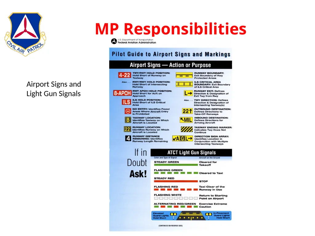
slide17. MP Responsibilities Airport Signs and Light Gun Signals<br>
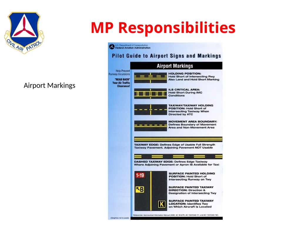
slide18. MP Responsibilities Airport Markings<br>
slide19. Weather What Causes Weather?
Circulation Patterns
Air Masses
Fronts
Clouds & Precipitation
Icing
Turbulance<br>
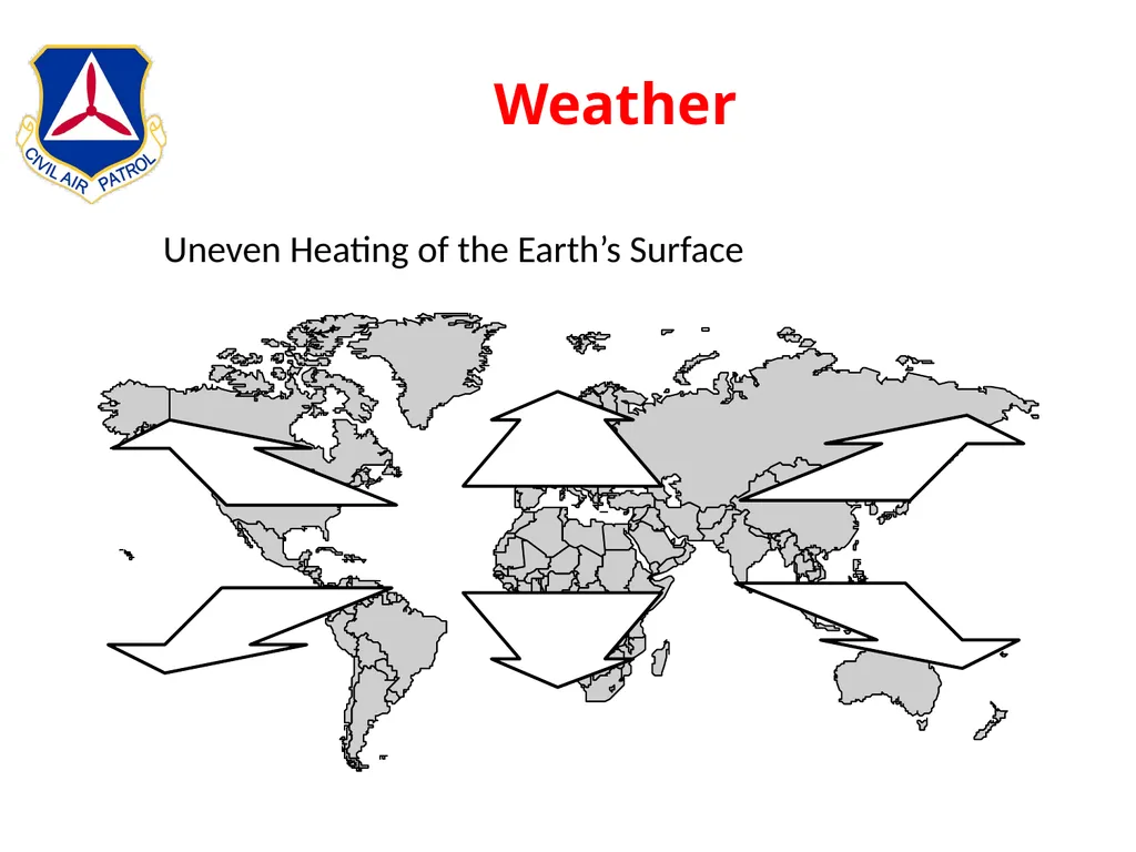
slide20. Weather Uneven Heating of the Earth’s Surface<br>
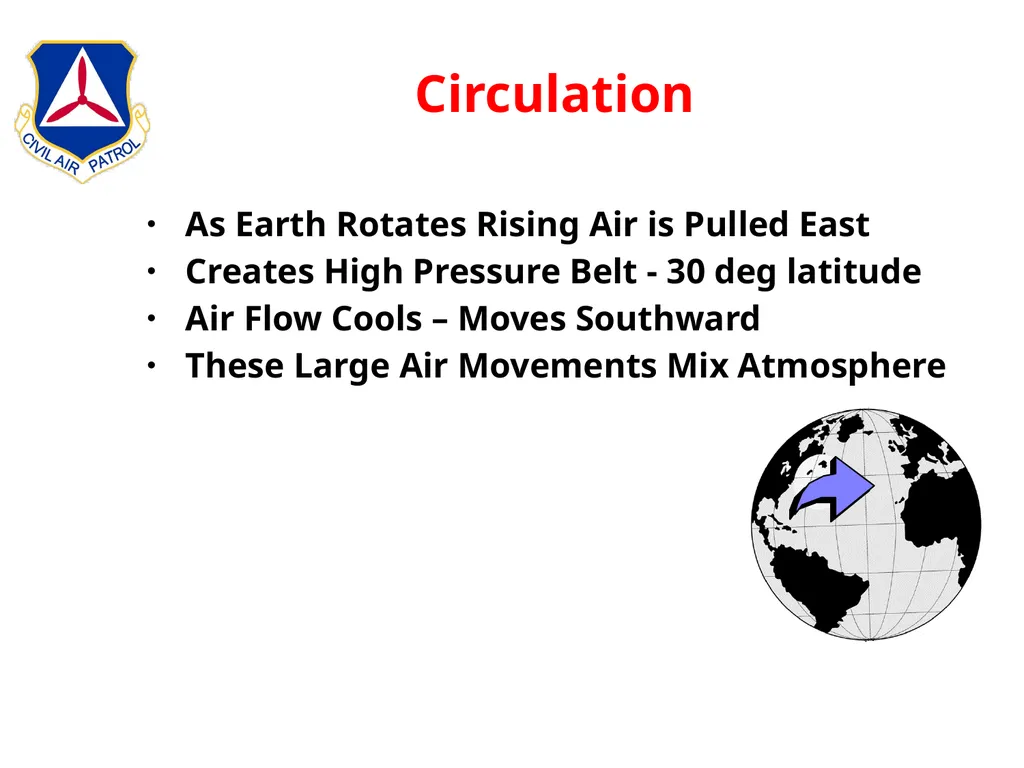
slide21. Circulation As Earth Rotates Rising Air is Pulled East
Creates High Pressure Belt - 30 deg latitude
Air Flow Cools – Moves Southward
These Large Air Movements Mix Atmosphere<br>
slide22. Air Masses Circulations Create Homogenous Air Masses
Similar Physical Properties
Temperature
Humidity
Winds
Named For General Location
Polar
Cold
Dry
Sub-tropical
Temperate
Tropical
Hot
Humid<br>
slide23. Hi / Low Pressure Areas High Pressure
Clockwise Circulation
Downward Air Flow
Outward Air Flow
Generally Fair Weather
Low Pressure
Counter-Clockwise Circulation
Upward Air Flow
Inward Air Flow
Rainy / Stormy Weather
Circulation Generates Frontal Areas<br>
slide24. Fronts Boundaries Between Air Masses
Fronts
Generally Defined By Temperature
Always Generate a Shift In Wind Direction
Types
Cold
Warm
Stationary
Occluded<br>
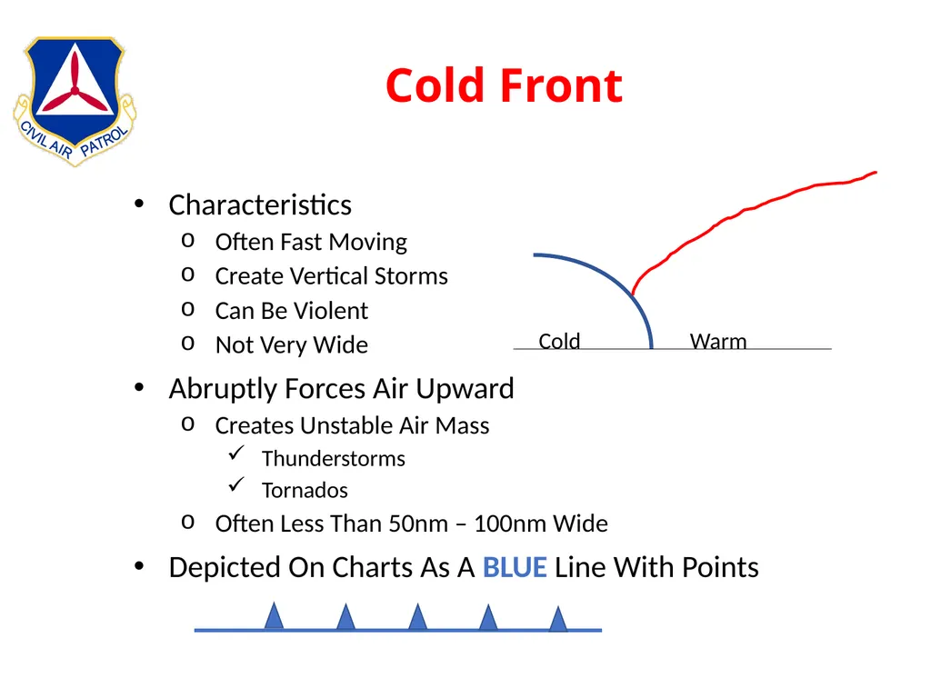
slide25. Cold Front Characteristics
Often Fast Moving
Create Vertical Storms
Can Be Violent
Not Very Wide
Abruptly Forces Air Upward
Creates Unstable Air Mass
Thunderstorms
Tornados
Often Less Than 50nm – 100nm Wide
Depicted On Charts As A BLUE Line With Points Cold Warm<br>
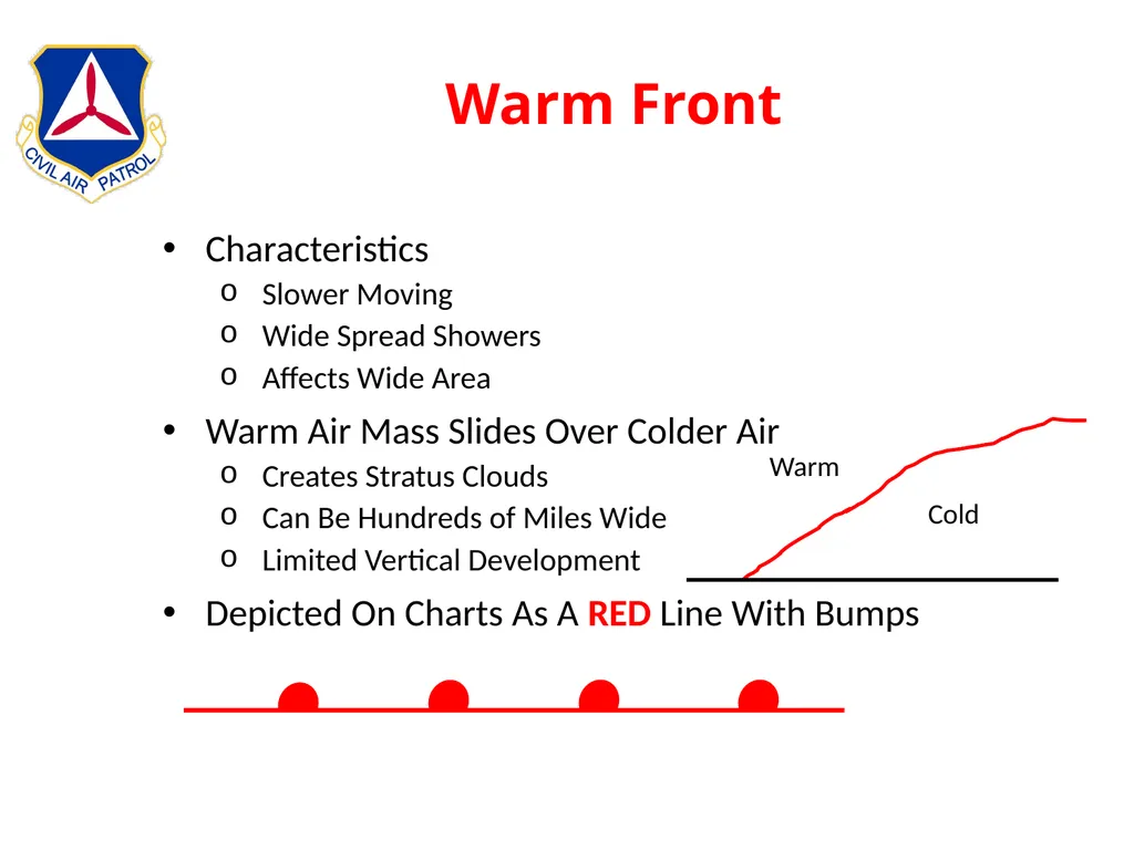
slide26. Warm Front Characteristics
Slower Moving
Wide Spread Showers
Affects Wide Area
Warm Air Mass Slides Over Colder Air
Creates Stratus Clouds
Can Be Hundreds of Miles Wide
Limited Vertical Development
Depicted On Charts As A RED Line With Bumps Warm Cold<br>
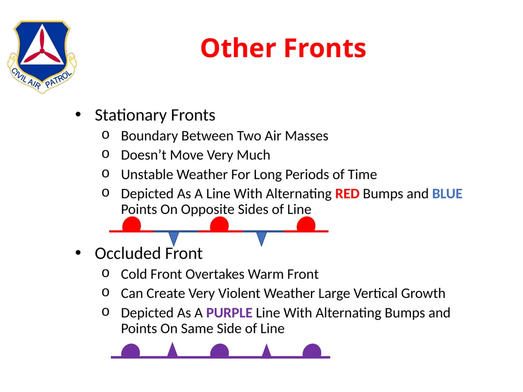
slide27. Other Fronts Stationary Fronts
Boundary Between Two Air Masses
Doesn’t Move Very Much
Unstable Weather For Long Periods of Time
Depicted As A Line With Alternating RED Bumps and BLUE Points On Opposite Sides of Line
Occluded Front
Cold Front Overtakes Warm Front
Can Create Very Violent Weather Large Vertical Growth
Depicted As A PURPLE Line With Alternating Bumps and Points On Same Side of Line<br>
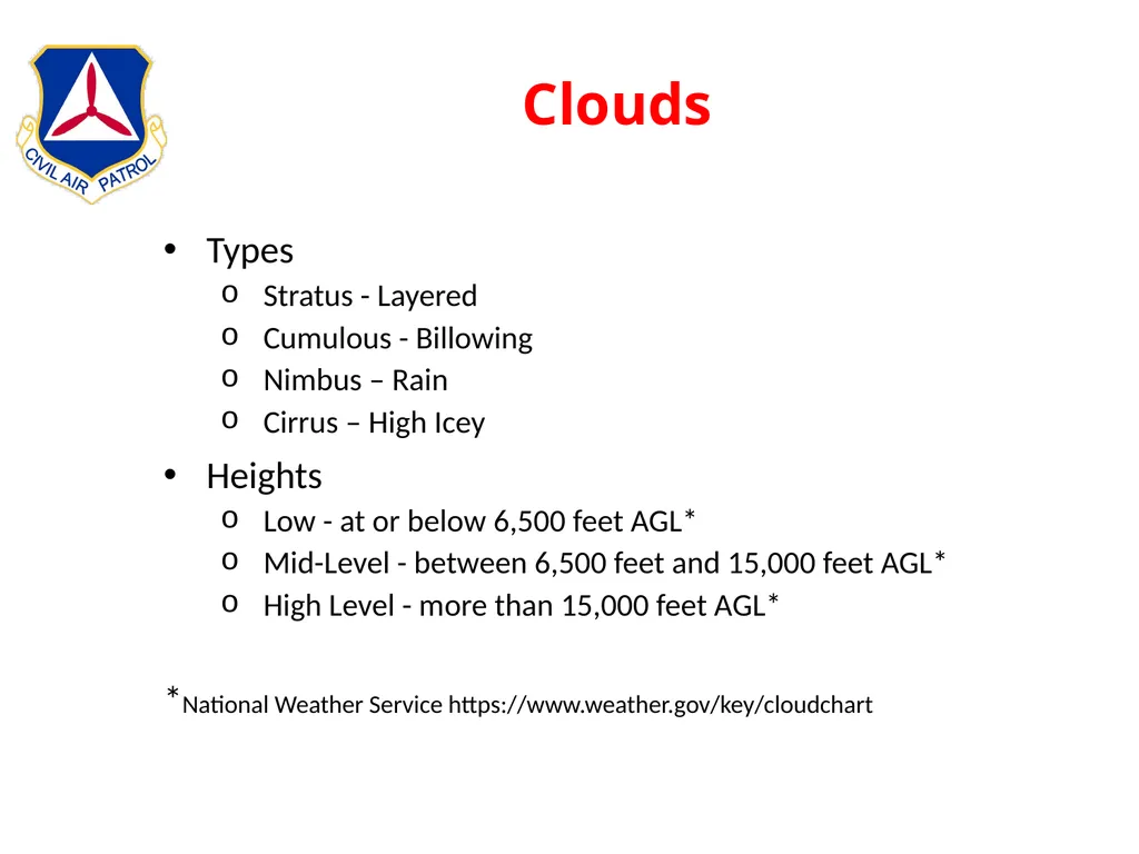
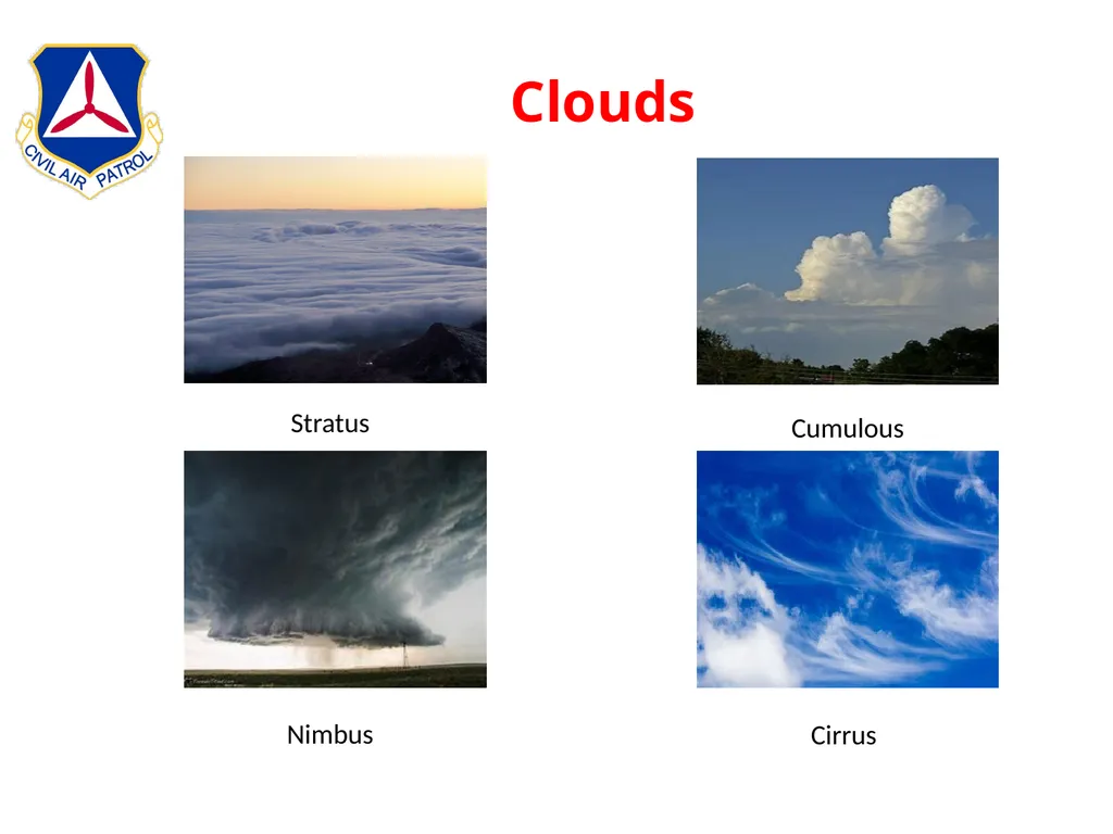
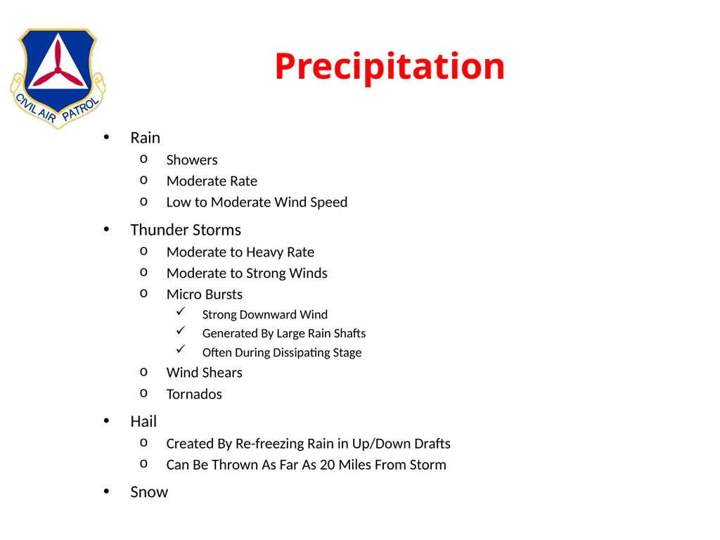
slide28. Clouds Types
Stratus - Layered
Cumulous - Billowing
Nimbus – Rain
Cirrus – High Icey
Heights
Low - at or below 6,500 feet AGL*
Mid-Level - between 6,500 feet and 15,000 feet AGL*
High Level - more than 15,000 feet AGL*
*National Weather Service https://www.weather.gov/key/cloudchart<br>
slide29. Clouds Stratus Cumulous Nimbus Cirrus<br>
slide30. Precipitation Rain
Showers
Moderate Rate
Low to Moderate Wind Speed
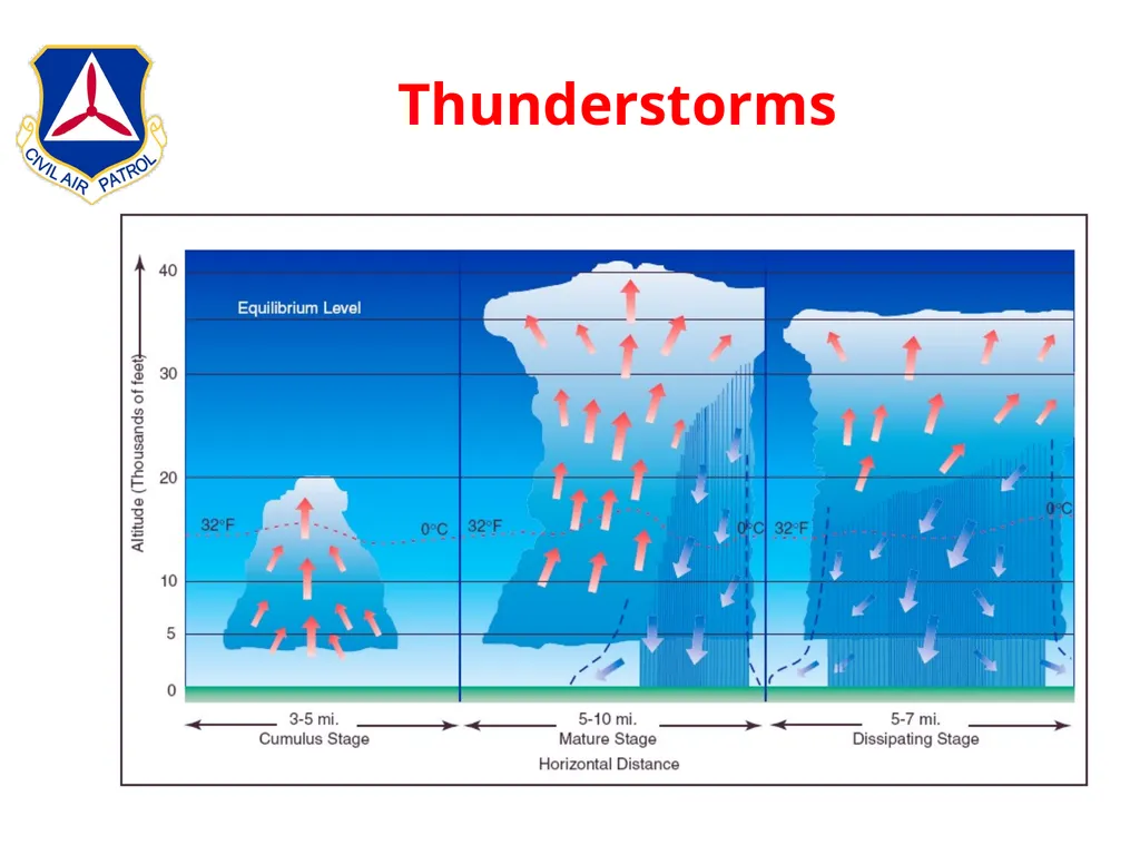
Thunder Storms
Moderate to Heavy Rate
Moderate to Strong Winds
Micro Bursts
Strong Downward Wind
Generated By Large Rain Shafts
Often During Dissipating Stage
Wind Shears
Tornados
Hail
Created By Re-freezing Rain in Up/Down Drafts
Can Be Thrown As Far As 20 Miles From Storm
Snow<br>
slide31. Thunderstorms<br>
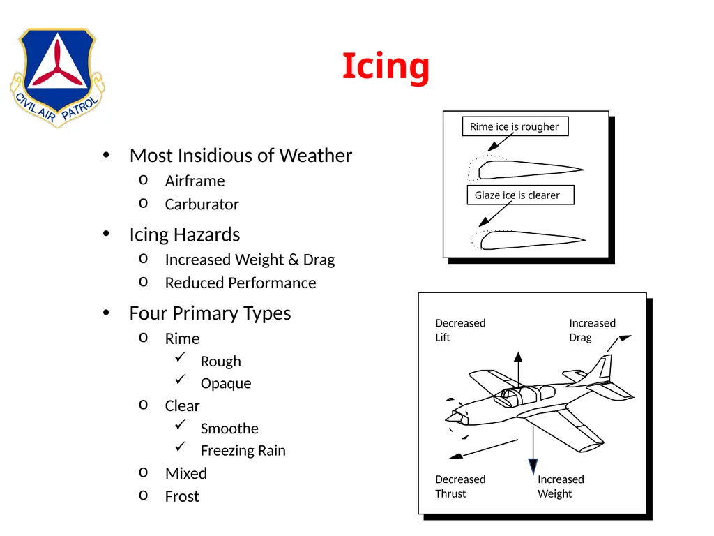
slide32. Icing Most Insidious of Weather
Airframe
Carburator
Icing Hazards
Increased Weight & Drag
Reduced Performance
Four Primary Types
Rime
Rough
Opaque
Clear
Smoothe
Freezing Rain
Mixed
Frost Increased
Weight Increased
Drag Decreased
Lift Decreased
Thrust<br>
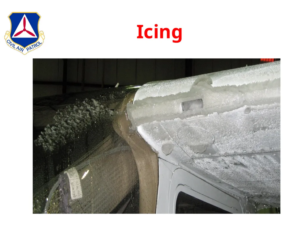
slide33. Icing<br>
slide34. Icing No Such Thing As A Little Ice
The only way to ensure that a wing is free from frost or ice is to touch it!<br>
slide35. Turbulence Mechanical
Obstacles
Mountains
Buildings
Weather Generated
Thunderstorms
Strong Up / Down Drafts
Micro Bursts
Wind Shear
Sudden Change in Direction
Sudden Change in Velocity<br>
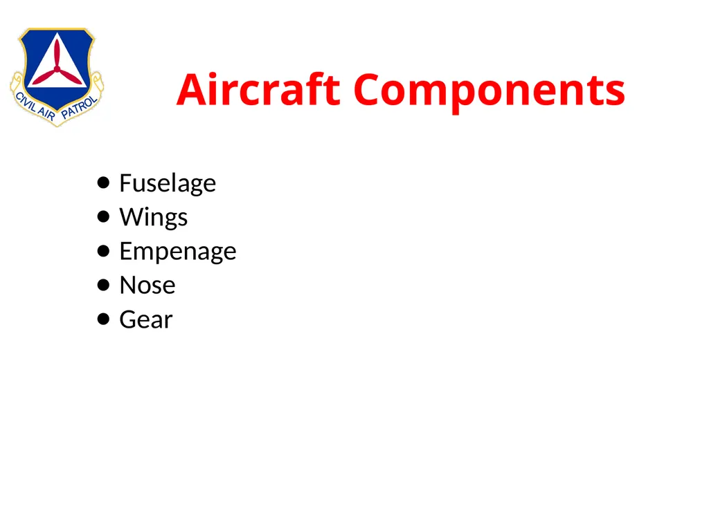
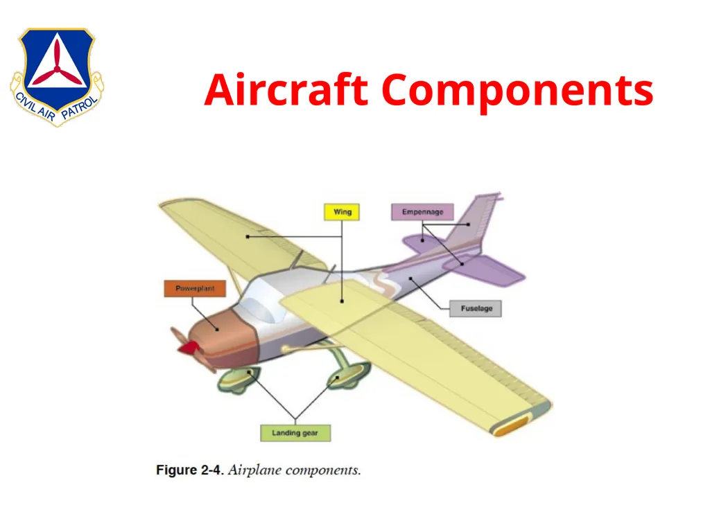
slide36. Aircraft Components Fuselage
Wings
Empenage
Nose
Gear<br>
slide37. Aircraft Components<br>
slide38. Instruments Flight
Communications
Engine
Electrical<br>
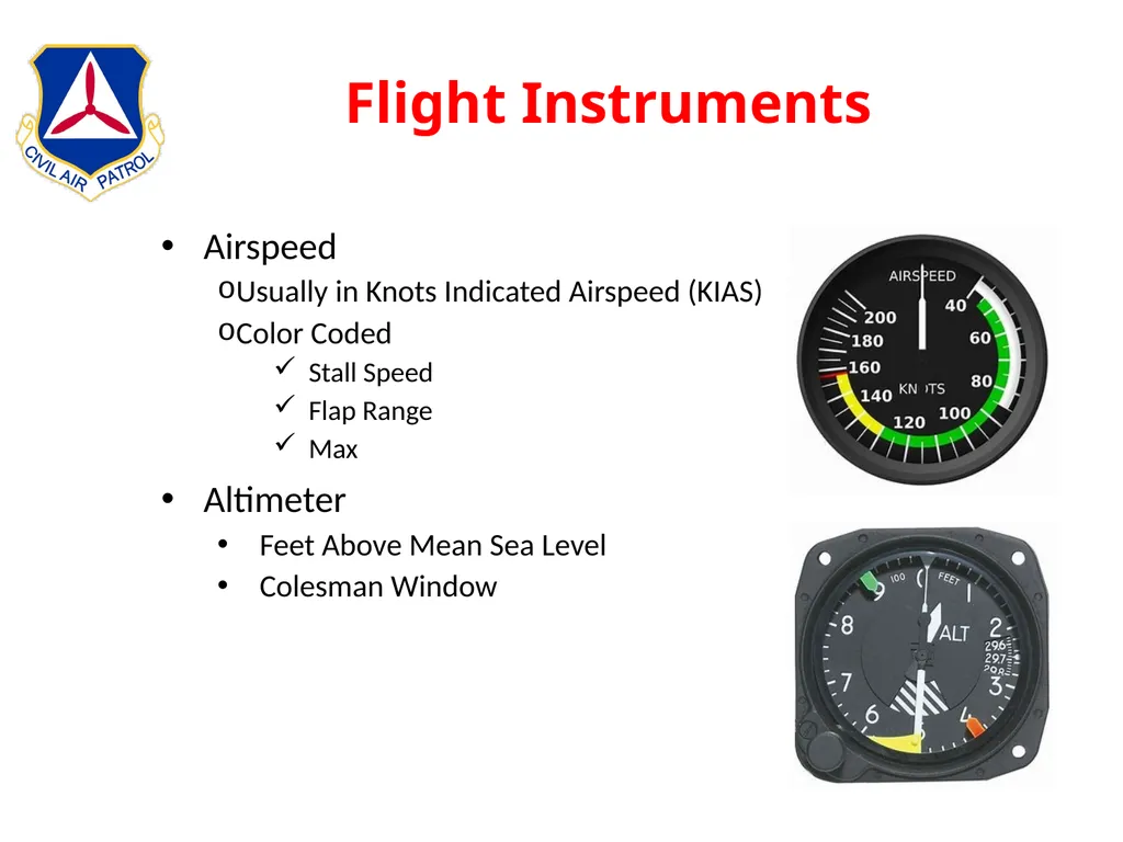
slide39. Flight Instruments Airspeed
Usually in Knots Indicated Airspeed (KIAS)
Color Coded
Stall Speed
Flap Range
Max
Altimeter
Feet Above Mean Sea Level
Colesman Window<br>
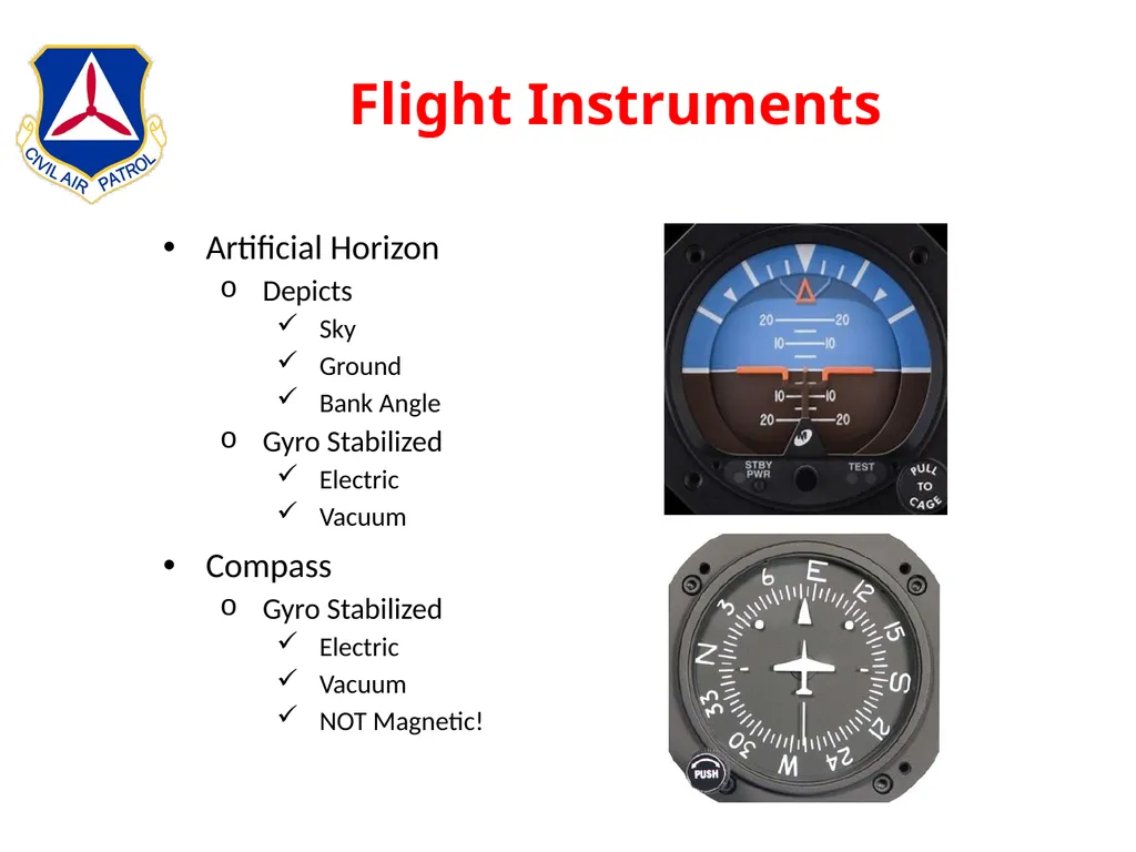
slide40. Flight Instruments Artificial Horizon
Depicts
Sky
Ground
Bank Angle
Gyro Stabilized
Electric
Vacuum
Compass
Gyro Stabilized
Electric
Vacuum
NOT Magnetic!<br>
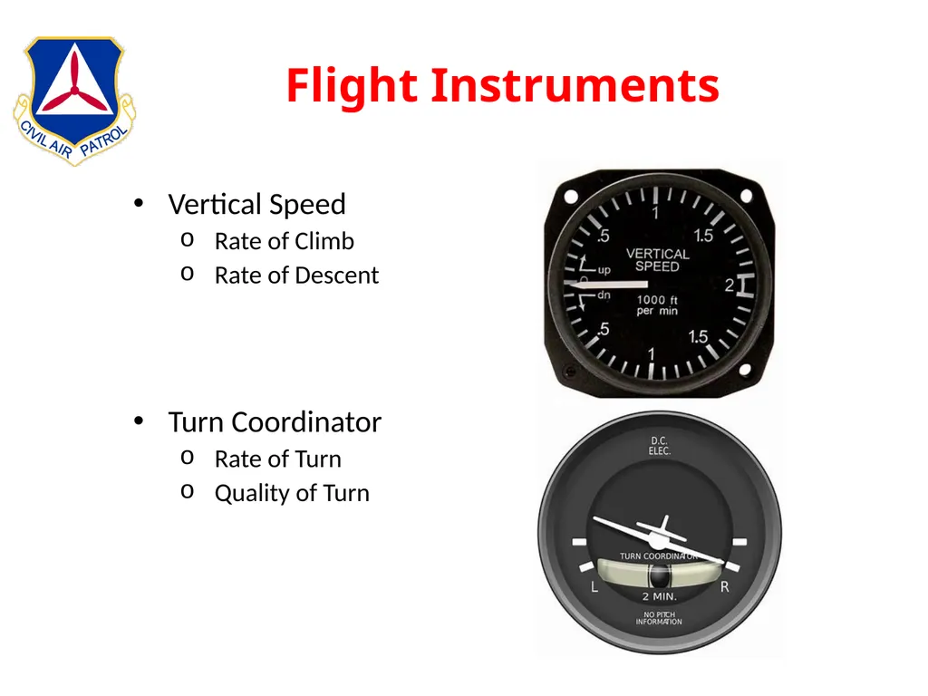
slide41. Flight Instruments Vertical Speed
Rate of Climb
Rate of Descent
Turn Coordinator
Rate of Turn
Quality of Turn<br>
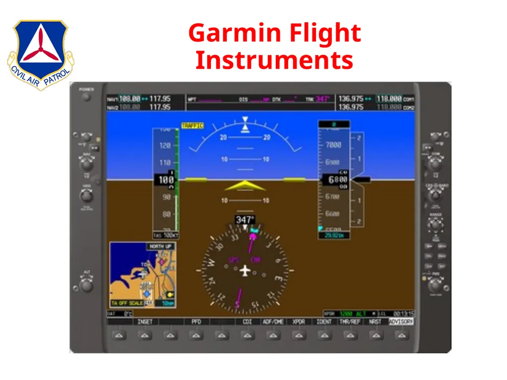
slide42. Garmin Flight Instruments<br>
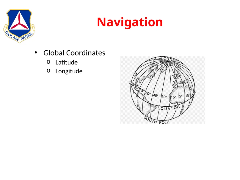
slide43. Navigation Global Coordinates
Latitude
Longitude<br>
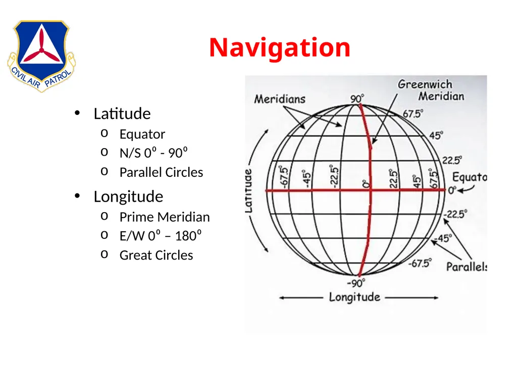
slide44. Navigation Latitude
Equator
N/S 0⁰ - 90⁰
Parallel Circles
Longitude
Prime Meridian
E/W 0⁰ – 180⁰
Great Circles<br>
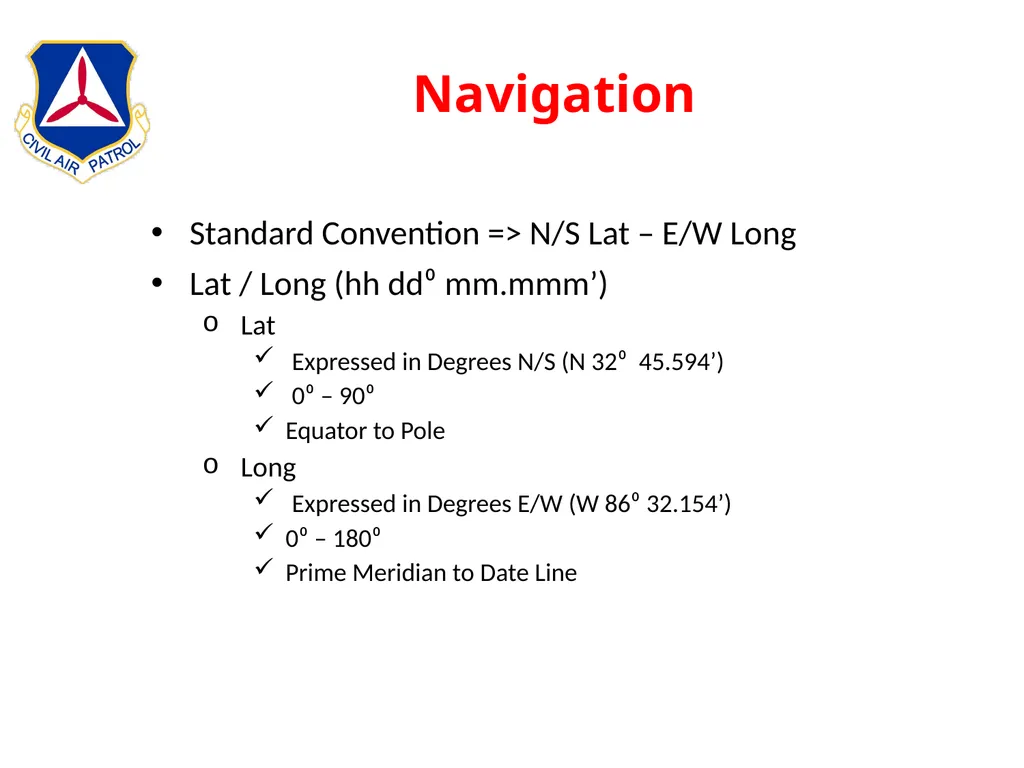
slide45. Navigation Standard Convention => N/S Lat – E/W Long
Lat / Long (hh dd⁰ mm.mmm’)
Lat
Expressed in Degrees N/S (N 32⁰ 45.594’)
0⁰ – 90⁰
Equator to Pole
Long
Expressed in Degrees E/W (W 86⁰ 32.154’)
0⁰ – 180⁰
Prime Meridian to Date Line<br>
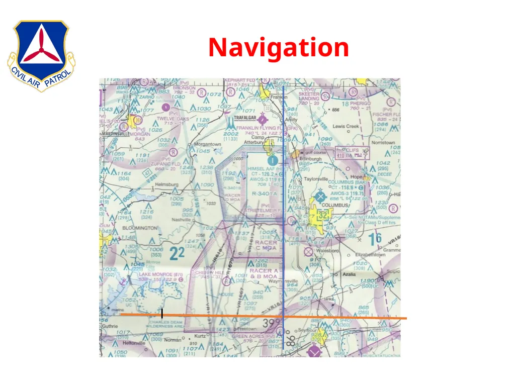
slide46. Navigation<br>
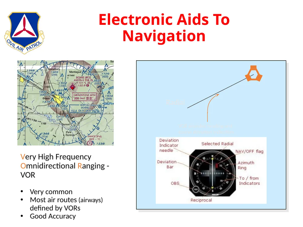
slide47. Electronic Aids To Navigation Very High Frequency Omnidirectional Range - VOR
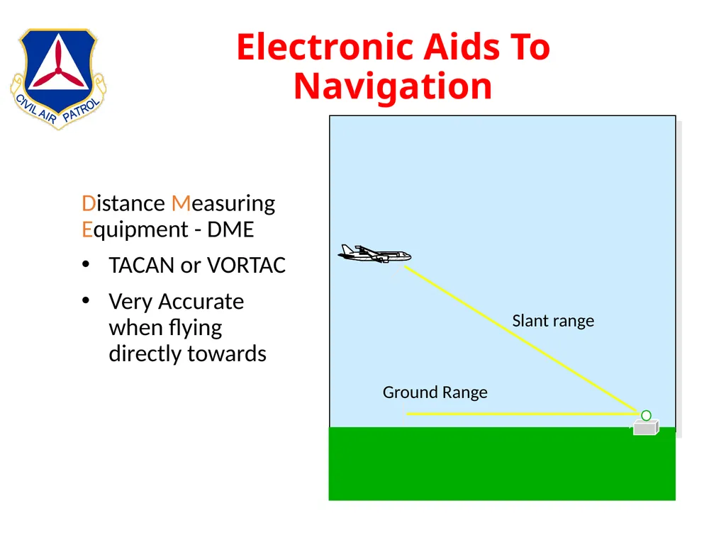
Distance Measuring Equipment - DME
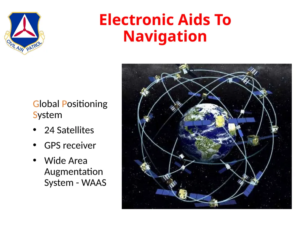
Global Positioning System - GPS<br>
slide48. Electronic Aids To Navigation Very High Frequency Omnidirectional Ranging - VOR
Very common
Most air routes (airways) defined by VORs
Good Accuracy<br>
slide49. Electronic Aids To Navigation<br>
slide50. Electronic Aids To Navigation<br>
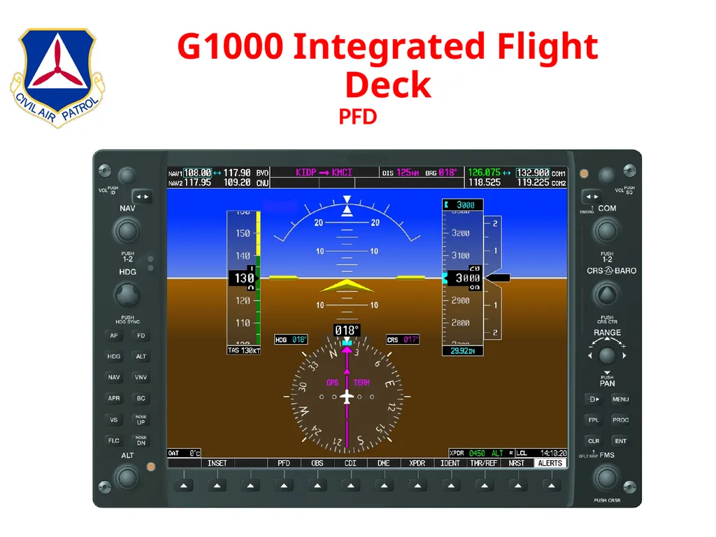
slide51. G1000 Integrated Flight Deck PFD<br>
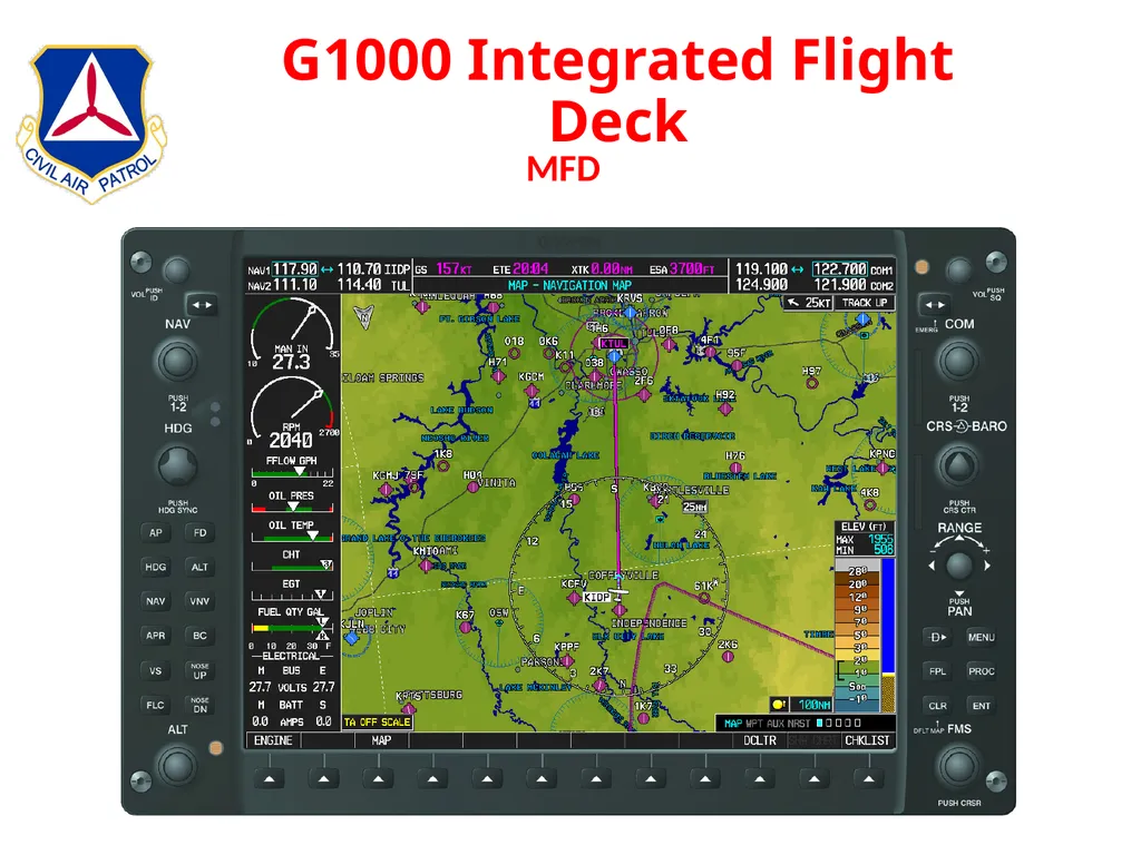
slide52. G1000 Integrated Flight Deck MFD<br>
slide53. G1000 Integrated Flight Deck Garmin G1000 Simulator
Buttons & Knobs
Folders & Pages
Nav / Comm Radios
Navigation Information / Autopilot
***Use The Flight Sims In Between Flights***<br>
slide54. High Altitude & Terrain Atmospheric Pressure
Measured With Barometer
Standard Pressure At Sea Level => 29.92”
Standard Temperature At Sea Level => 15⁰ C
Altimeter Adjusted With Local Barometric Pressure
Density Altitude
Factors Affecting Density Altitude
Temperature
Altitude
Humidity
Determined By Adjusting Pressure Altitude With Non-standard Temperature<br>
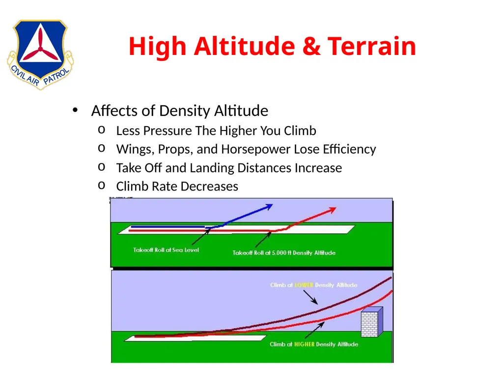
slide55. High Altitude & Terrain Affects of Density Altitude
Less Pressure The Higher You Climb
Wings, Props, and Horsepower Lose Efficiency
Take Off and Landing Distances Increase
Climb Rate Decreases<br>
slide56. High Altitude & Terrain Strategies to Cope With High Density Altitudes
Don’t Fly During Hot Part of Day
Accurately Calculate Density Altitude and Weight
Reduce Weight
Less Fuel
Less Baggage
Fewer People
Flight In Mountainous Terrain
Don’t Fly Searches Unless You Have Completed the Mountain Flying Course.
Maintain At Least a 2000’ Clearance
Be Prepared For Down Drafts On Leeward Side of Ridges
Expect High Winds In Passes<br>
slide57. In-Flight Services Flight Service Stations
ATIS
Approach Control
Air Route Traffic Control Center<br>
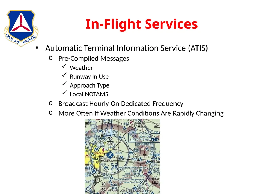
slide58. In-Flight Services Automatic Terminal Information Service (ATIS)
Pre-Compiled Messages
Weather
Runway In Use
Approach Type
Local NOTAMS
Broadcast Hourly On Dedicated Frequency
More Often If Weather Conditions Are Rapidly Changing<br>
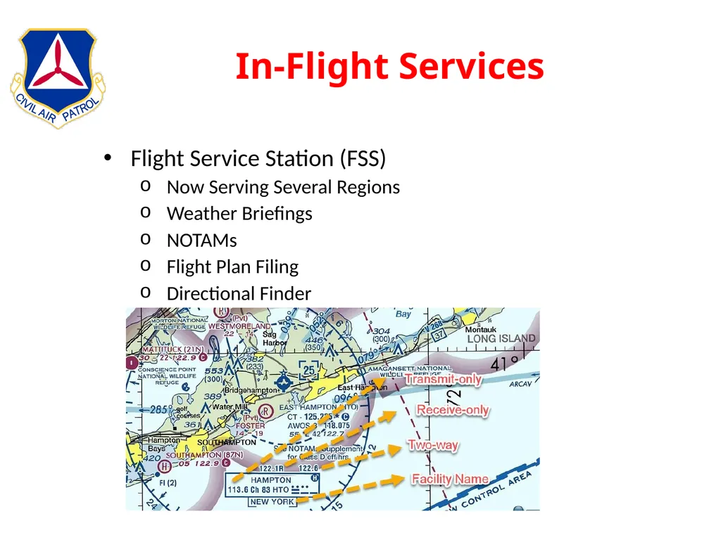
slide59. In-Flight Services Flight Service Station (FSS)
Now Serving Several Regions
Weather Briefings
NOTAMs
Flight Plan Filing
Directional Finder<br>
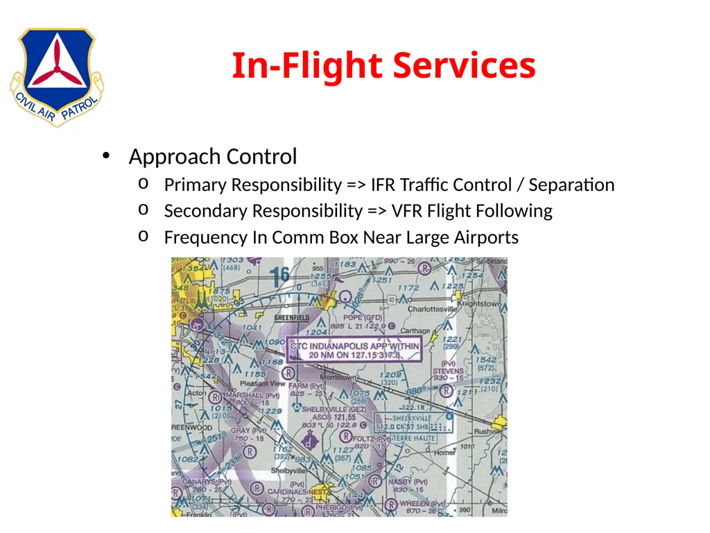
slide60. In-Flight Services Approach Control
Primary Responsibility => IFR Traffic Control / Separation
Secondary Responsibility => VFR Flight Following
Frequency In Comm Box Near Large Airports<br>
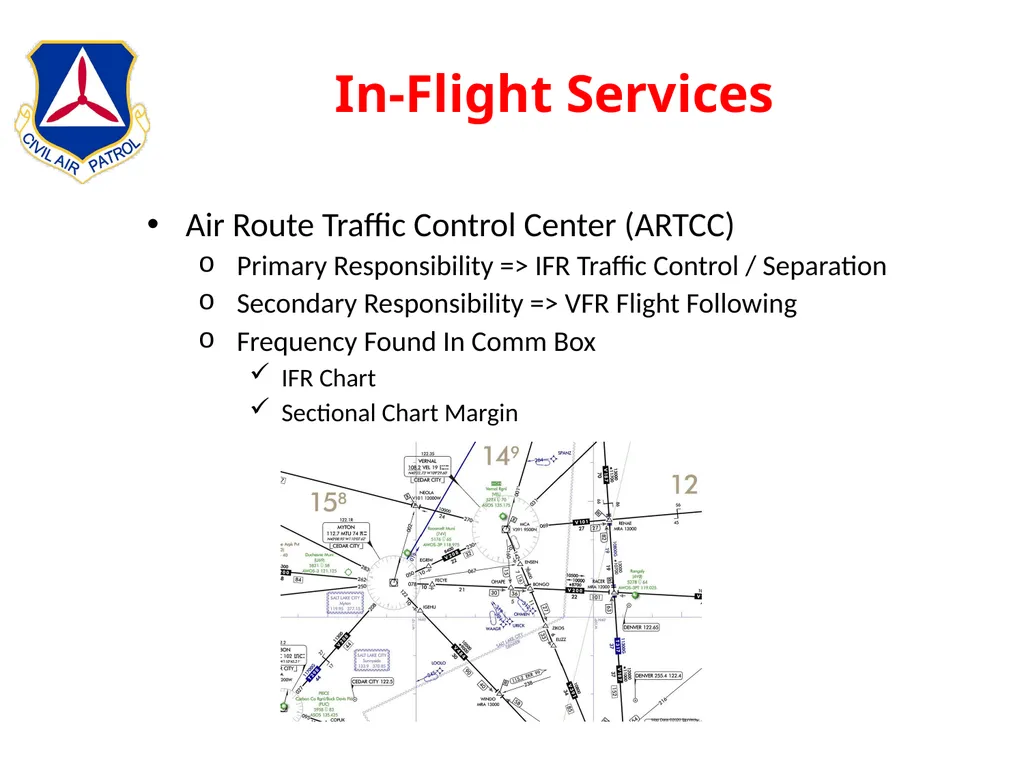
slide61. In-Flight Services Air Route Traffic Control Center (ARTCC)
Primary Responsibility => IFR Traffic Control / Separation
Secondary Responsibility => VFR Flight Following
Frequency Found In Comm Box
IFR Chart
Sectional Chart Margin<br>
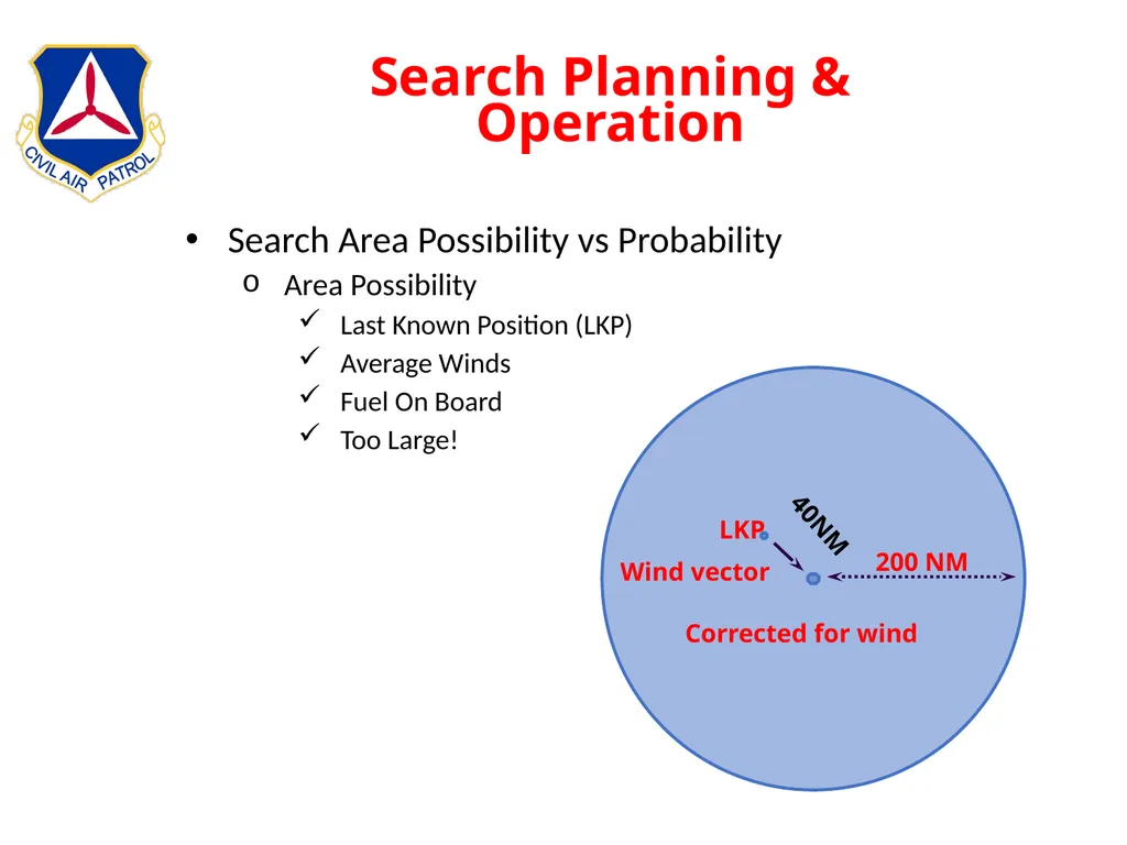
slide62. Search Planning & Operation Search Area Possibility vs Probability
Area Possibility
Last Known Position (LKP)
Average Winds
Fuel On Board
Too Large!<br>
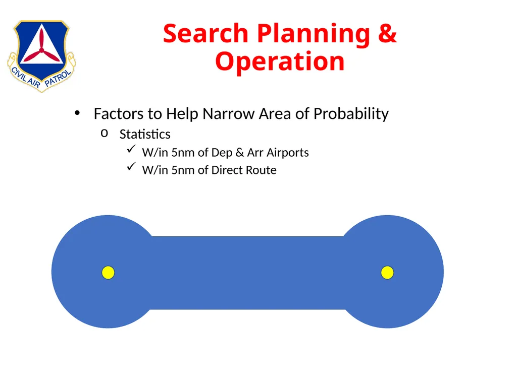
slide63. Search Planning & Operation Factors to Help Narrow Area of Probability
Statistics
W/in 5nm of Dep & Arr Airports
W/in 5nm of Direct Route<br>
slide64. Search Planning & Operation Other Factors
Flight plan
Weather information
National Track Analysis Program data
Airports along the intended flight track
Aircraft performance
Pilots flying habits
Radar coverage as a limiting factor
Nature of terrain along the flight track
Position reports — fuel stops, etc.<br>
slide65. Search Planning & Operation Search Area Priority
Areas of bad weather
Low clouds and poor visibility
Areas where weather was not as forecast
High terrain
Areas not covered by radar
Reports of low flying aircraft
Radio contacts or MAYDAY calls<br>
slide66. Search Planning & Operation General Items To Consider
Measurement
One minute latitude = 1 nm
One minute longitude = 0.6572nm to 0.9152nm
For Training Use One Minute Longitude = 1nm
Periodically Do A “Stupid Check”
Stabilized Pattern Entry
On Airspeed (90kts)
On Heading
On Altitude
Flaps 10 Degrees<br>
slide67. Search Planning & Operation Probability of Detection (POD)
“percent” search object was detected
Four interrelated factors used to calculate:
Track Spacing
Distance Between Tracks
Usually 1nm
Search Visibility
Distance An Object Can Be Identified
Can Tell the Difference Between A Horse and A Cow
Search Altitude
Normal is 1000’ AGL
Maybe 500’ AGL to Identify An Object
Type of Terrain<br>
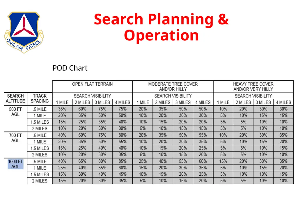
slide68. Search Planning & Operation POD Chart<br>
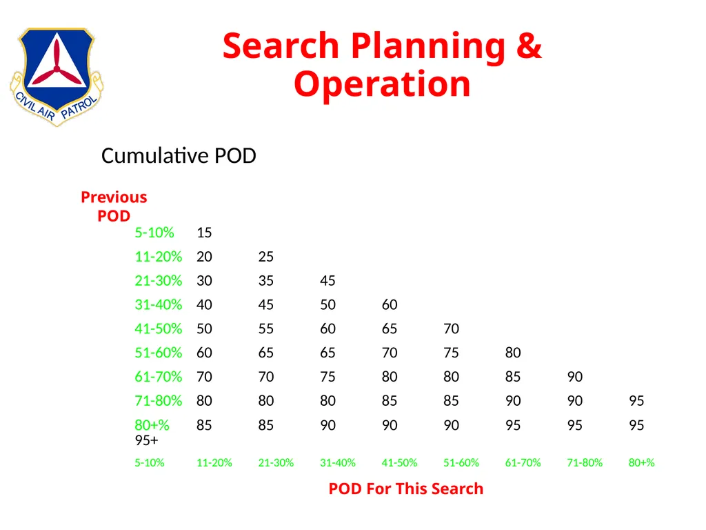
slide69. Search Planning & Operation Cumulative POD 5-10% 15
11-20% 20 25
21-30% 30 35 45
31-40% 40 45 50 60
41-50% 50 55 60 65 70
51-60% 60 65 65 70 75 80
61-70% 70 70 75 80 80 85 90
71-80% 80 80 80 85 85 90 90 95
80+% 85 85 90 90 90 95 95 95 95+
5-10% 11-20% 21-30% 31-40% 41-50% 51-60% 61-70% 71-80% 80+% POD For This Search Previous
POD<br>
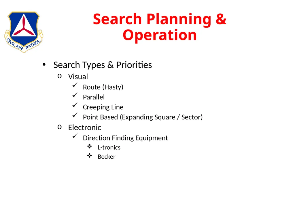
slide70. Search Planning & Operation Search Types & Priorities
Visual
Route (Hasty)
Parallel
Creeping Line
Point Based (Expanding Square / Sector)
Electronic
Direction Finding Equipment
L-tronics
Becker<br>
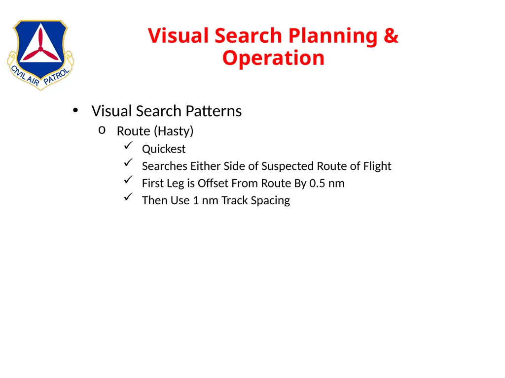
slide71. Visual Search Planning & Operation Visual Search Patterns
Route (Hasty)
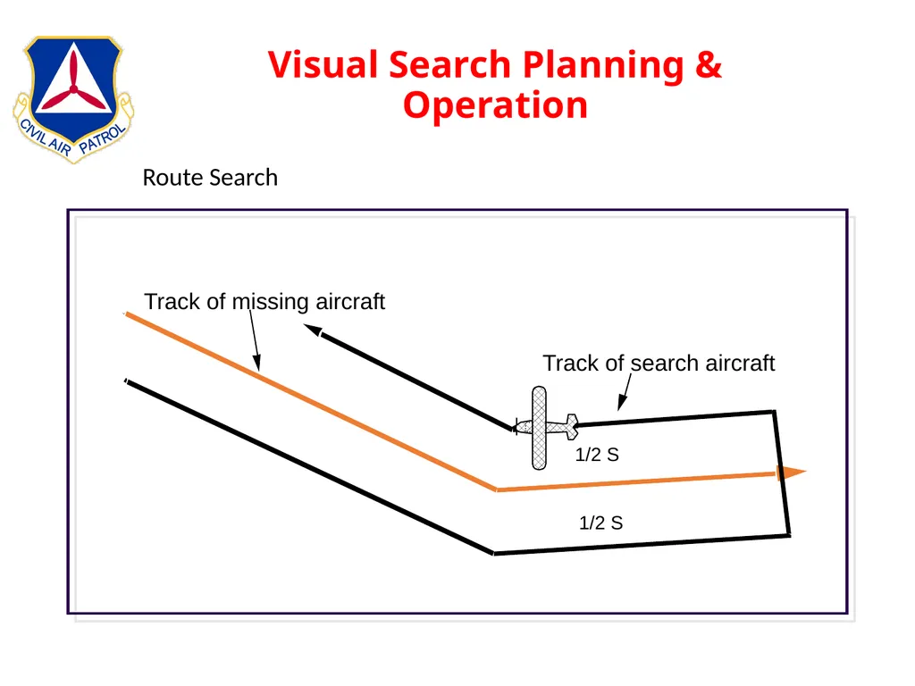
Quickest
Searches Either Side of Suspected Route of Flight
First Leg is Offset From Route By 0.5 nm
Then Use 1 nm Track Spacing<br>
slide72. Visual Search Planning & Operation Route Search<br>
slide73. Visual Search Planning & Operation Visual Search Patterns
Parallel (Grid)
Defined By Several Methods
CAP Grid
Standard Grid
Any Defined Entry Point & Parameters
CAP Grid
Sectional Name
Sequence Number of 15’ x 15’ Quadrants
Begin In Upper Left Corner of Sectional Chart
Overlap Defaults to Western Sectional (MKC vs STL)<br>
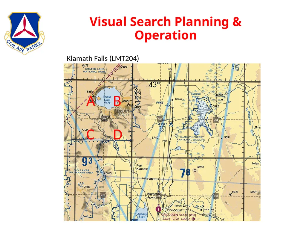
slide74. Visual Search Planning & Operation Klamath Falls (LMT204) A B C D<br>
slide75. Visual Search Planning & Operation Visual Search Patterns
Parallel (Grid)
Standard Grid
1⁰ x 1⁰ Rectangle
Lat/Long of Lower Right Corner Defines the Grid
Letters Define Sub-Groups
CAP Grid Is 1/16th of Standard Grid<br>
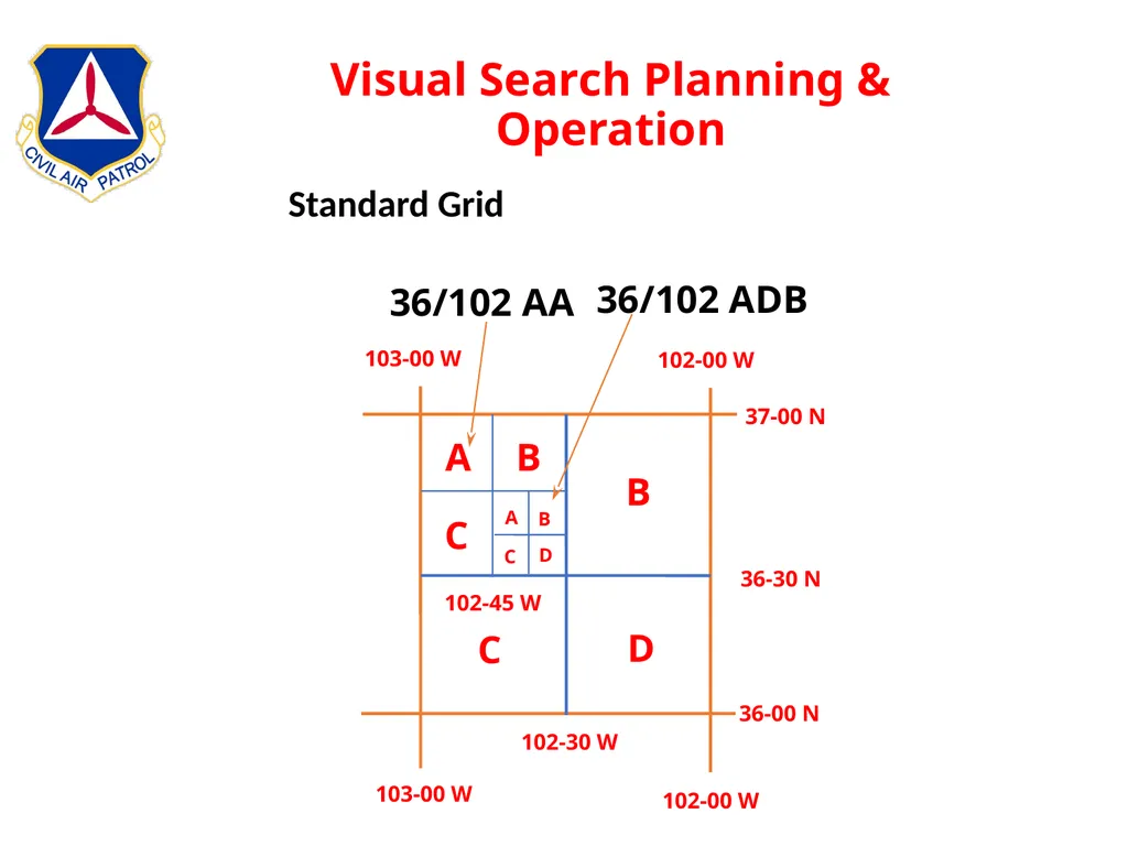
slide76. Visual Search Planning & Operation Standard Grid<br>
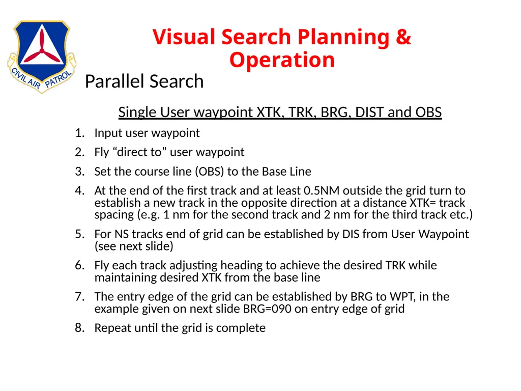
slide77. Visual Search Planning & Operation Single User waypoint XTK, TRK, BRG, DIST and OBS
Input user waypoint
Fly “direct to” user waypoint
Set the course line (OBS) to the Base Line
At the end of the first track and at least 0.5NM outside the grid turn to establish a new track in the opposite direction at a distance XTK= track spacing (e.g. 1 nm for the second track and 2 nm for the third track etc.)
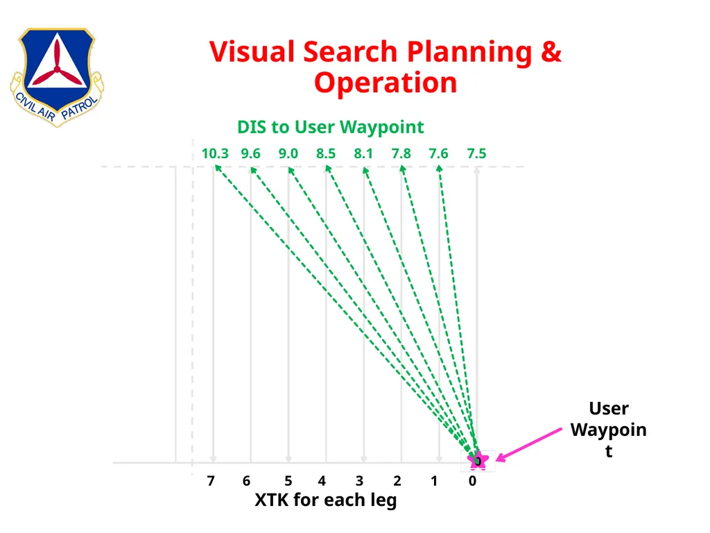
For NS tracks end of grid can be established by DIS from User Waypoint (see next slide)
Fly each track adjusting heading to achieve the desired TRK while maintaining desired XTK from the base line
The entry edge of the grid can be established by BRG to WPT, in the example given on next slide BRG=090 on entry edge of grid
Repeat until the grid is complete Parallel Search<br>
slide78. Visual Search Planning & Operation 78 0 7.6 8.1 7.8 8.5 9.0 9.6 10.3 7.5 1 3 2 4 5 6 7 0 XTK for each leg DIS to User Waypoint User Waypoint<br>
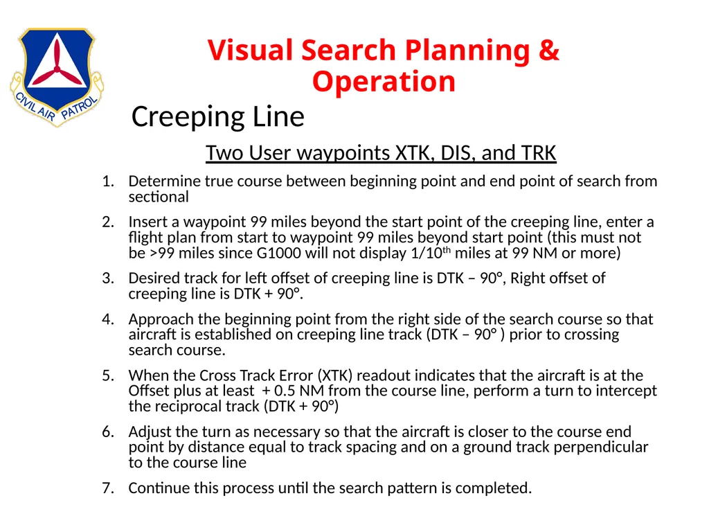
slide79. Visual Search Planning & Operation Two User waypoints XTK, DIS, and TRK
Determine true course between beginning point and end point of search from sectional
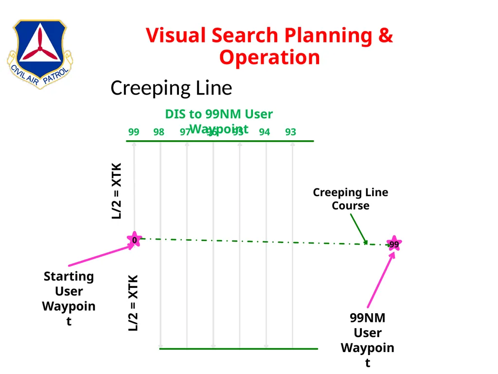
Insert a waypoint 99 miles beyond the start point of the creeping line, enter a flight plan from start to waypoint 99 miles beyond start point (this must not be >99 miles since G1000 will not display 1/10th miles at 99 NM or more)
Desired track for left offset of creeping line is DTK – 90°, Right offset of creeping line is DTK + 90°.
Approach the beginning point from the right side of the search course so that aircraft is established on creeping line track (DTK – 90° ) prior to crossing search course.
When the Cross Track Error (XTK) readout indicates that the aircraft is at the Offset plus at least + 0.5 NM from the course line, perform a turn to intercept the reciprocal track (DTK + 90°)
Adjust the turn as necessary so that the aircraft is closer to the course end point by distance equal to track spacing and on a ground track perpendicular to the course line
Continue this process until the search pattern is completed. Creeping Line<br>
slide80. Visual Search Planning & Operation 0 Starting User Waypoint 99 L/2 = XTK L/2 = XTK 93 95 94 96 97 98 99 DIS to 99NM User Waypoint 99NM User Waypoint Creeping Line Course Creeping Line<br>
slide81. Visual Search Planning & Operation<br>
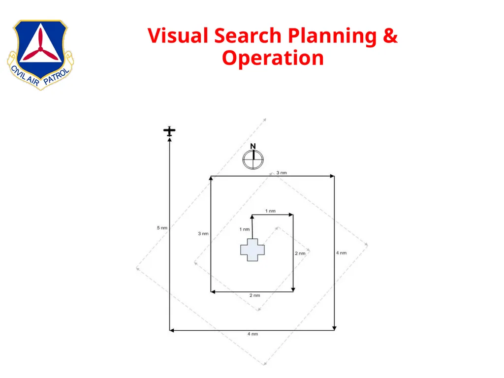
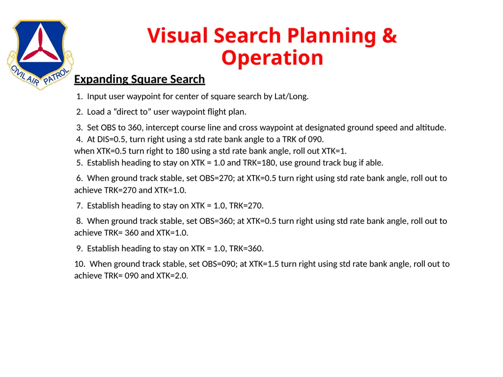
slide82. Visual Search Planning & Operation Expanding Square Search
1. Input user waypoint for center of square search by Lat/Long.
2. Load a “direct to” user waypoint flight plan.
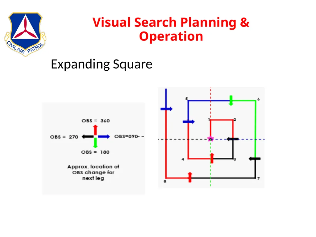
3. Set OBS to 360, intercept course line and cross waypoint at designated ground speed and altitude.
4. At DIS=0.5, turn right using a std rate bank angle to a TRK of 090.
when XTK=0.5 turn right to 180 using a std rate bank angle, roll out XTK=1.
5. Establish heading to stay on XTK = 1.0 and TRK=180, use ground track bug if able.
6. When ground track stable, set OBS=270; at XTK=0.5 turn right using std rate bank angle, roll out to achieve TRK=270 and XTK=1.0.
7. Establish heading to stay on XTK = 1.0, TRK=270.
8. When ground track stable, set OBS=360; at XTK=0.5 turn right using std rate bank angle, roll out to achieve TRK= 360 and XTK=1.0.
9. Establish heading to stay on XTK = 1.0, TRK=360.
10. When ground track stable, set OBS=090; at XTK=1.5 turn right using std rate bank angle, roll out to achieve TRK= 090 and XTK=2.0.<br>
slide83. Visual Search Planning & Operation Expanding Square<br>
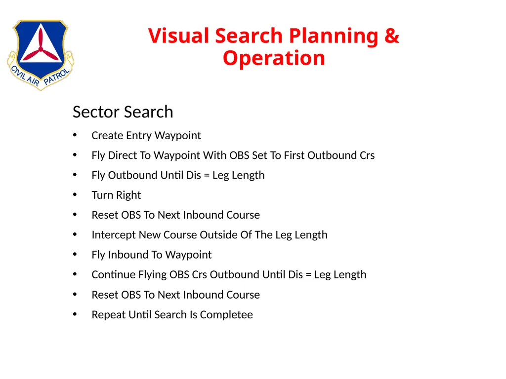
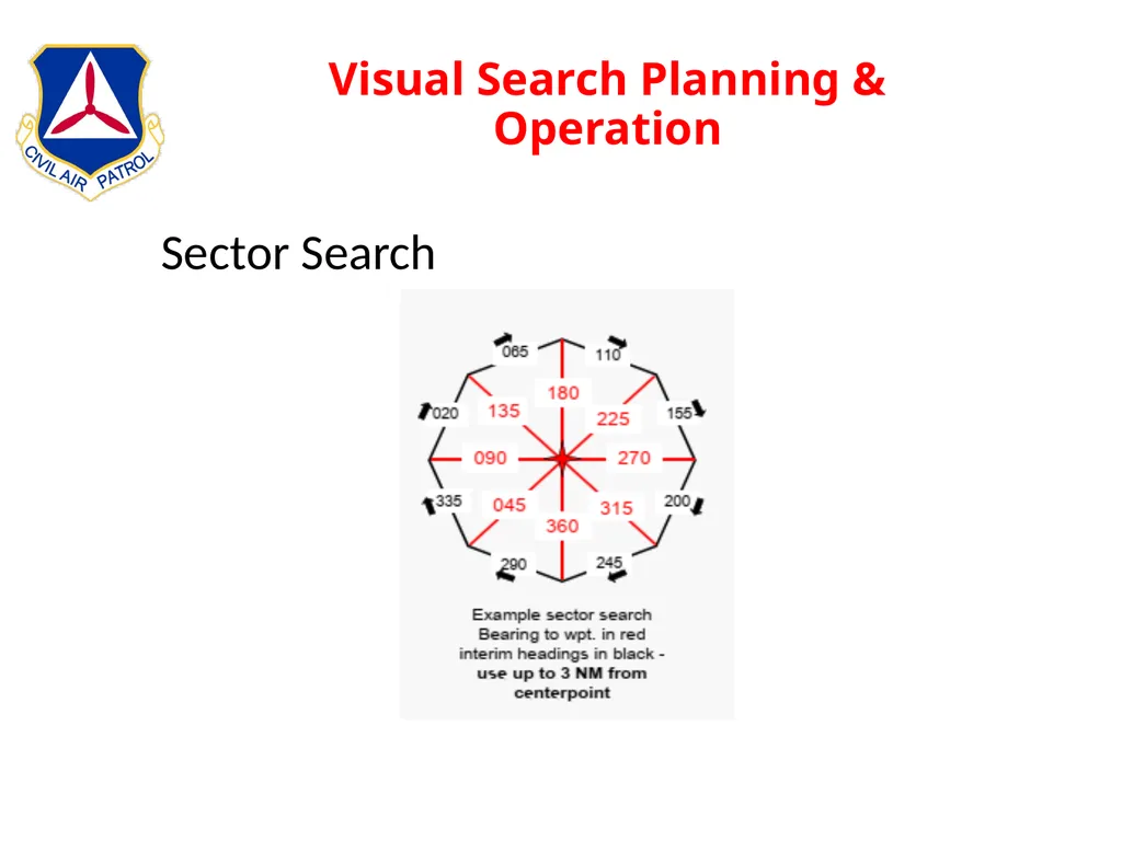
slide84. Visual Search Planning & Operation Sector Search
Create Entry Waypoint
Fly Direct To Waypoint With OBS Set To First Outbound Crs
Fly Outbound Until Dis = Leg Length
Turn Right
Reset OBS To Next Inbound Course
Intercept New Course Outside Of The Leg Length
Fly Inbound To Waypoint
Continue Flying OBS Crs Outbound Until Dis = Leg Length
Reset OBS To Next Inbound Course
Repeat Until Search Is Completee<br>
slide85. Visual Search Planning & Operation Sector Search<br>
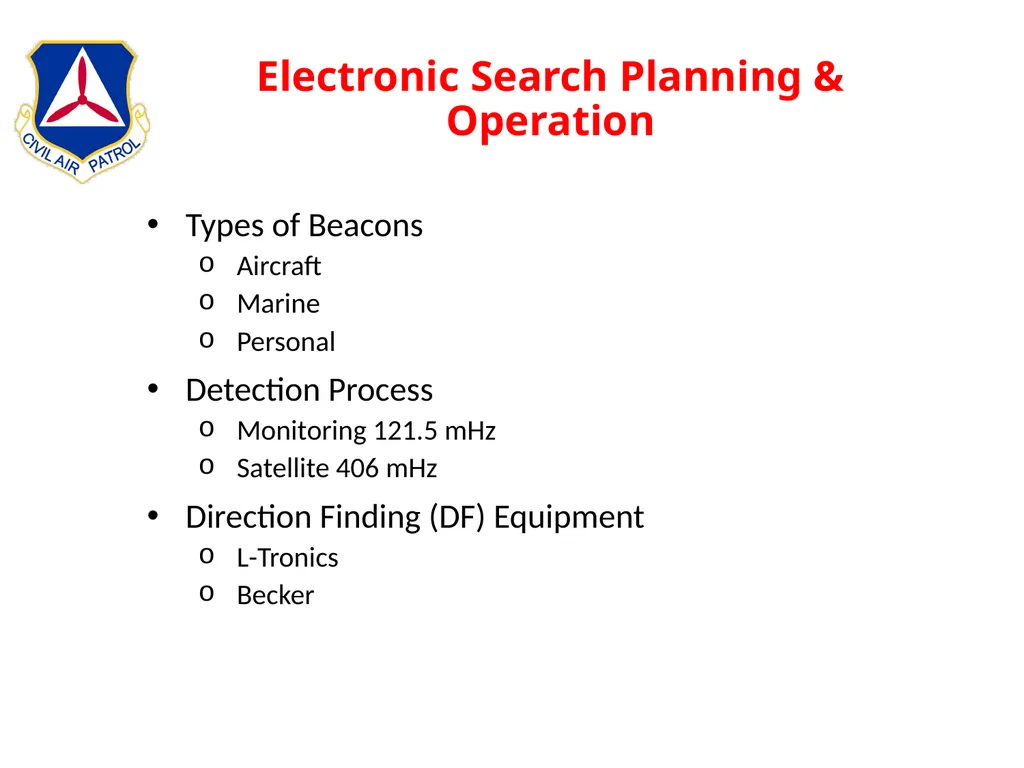
slide86. Electronic Search Planning & Operation Types of Beacons
Aircraft
Marine
Personal
Detection Process
Monitoring 121.5 mHz
Satellite 406 mHz
Direction Finding (DF) Equipment
L-Tronics
Becker<br>
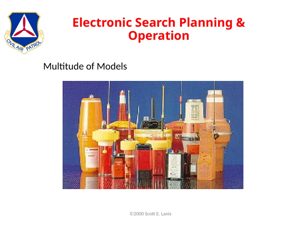
slide87. Electronic Search Planning & Operation Multitude of Models ©2000 Scott E. Lanis<br>
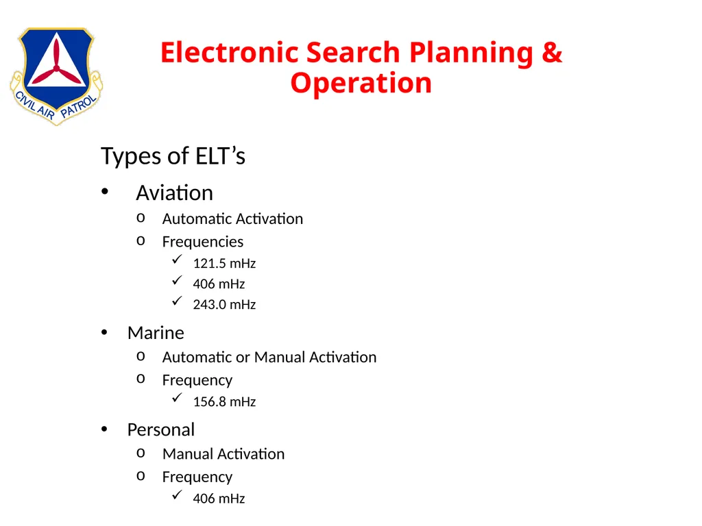
slide88. Electronic Search Planning & Operation Types of ELT’s
Aviation
Automatic Activation
Frequencies
121.5 mHz
406 mHz
243.0 mHz
Marine
Automatic or Manual Activation
Frequency
156.8 mHz
Personal
Manual Activation
Frequency
406 mHz<br>
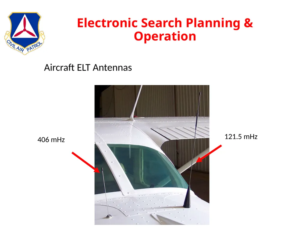
slide89. Electronic Search Planning & Operation Aircraft ELT Antennas 121.5 mHz 406 mHz<br>
slide90. Electronic Search Planning & Operation Marine
Emergency Position Indicating Radio Beacon
Similar to an ELT, an EPIRB is used on ships and boats
Most have installed the new 406 MHz EPIRBs (older units on 156.8 MHz)
Some activate automatically and others are manually activated<br>
slide91. Electronic Search Planning & Operation Personal
Personal Locator Beacon (PLB)
Hikers
Hunters
Boaters
Other remote wilderness travelers
Frequencies
406 mHz
121.5 mHz homing signal (generally, at only 25 milliwatts)
Some with a built-in GPS
Each PLB must be registered with NOAA<br>
slide92. Electronic Search Planning & Operation 406 mHz ELT Transmitters
General Information
406.025 + Low Power (100mw) 121.5mHz
50 Second Interval Data Burst
Owner’s Name
Address
Phone Numbers
Type of Aircraft
Coordinates If Connected to A GPS
Operates With SARSAT/COSPAS<br>
slide93. Electronic Search Planning & Operation Practice Beacons
Used For Training
121.775 mHz
Referred To As “PRACTICE BEACON” Not ELT<br>
slide94. Electronic Search Planning & Operation Inadvertent Activation
Hard Landings
Hard Ground Handling
Change of Switch Position
Removal/Installation
Malfunction<br>
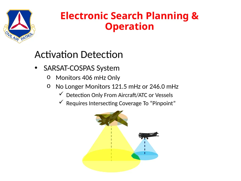
slide95. Electronic Search Planning & Operation Activation Detection
SARSAT-COSPAS System
Monitors 406 mHz Only
No Longer Monitors 121.5 mHz or 246.0 mHz
Detection Only From Aircraft/ATC or Vessels
Requires Intersecting Coverage To “Pinpoint”<br>
slide96. Electronic Search Planning & Operation On Activation
406 MHz ELT is activated
406.025 MHz At 5 Watts
19 Separate Channels
50-second intervals
Encoded Digital Message To NOAA-SARSAT
Serial Number of the Transmitter or Aircraft ID
Country Code
I.D. Code
Lat/Long If Coupled to Aircraft’s GPS
100 Yard Accuracy
Swept Tone at ~100 Milliwatts
121.5 mHz
243.0 mHz<br>
slide97. Electronic Search Planning & Operation ID Code
Allows AFRCC To Access Registration Database
Owner's Name
Owner's Address
Owner's Telephone Number
Aircraft Type
Aircraft Registration Number
Alternate Contact
Allows Contact With Owner
Is This A False Alarm?<br>
slide98. Electronic Search Planning & Operation No Position Information
Satellite Makes Several Passes
3 – 4 Hours May Be Needed For Satellite To Be Overhead
Uses Doppler To Determine Location
1 – 3 nm Accuracy<br>
slide99. Electronic Search Planning & Operation Every ELT Mission Should Be Treated As An Emergency<br>
slide100. Electronic Search Planning & Operation Directional Finder Equipment
L-Tronics
Older Technology
Unable to Track 406 mHz Beacon
Becker
Newer Technology
Based On Pseudo Doppler Shift
Becker SAR-DF 517
RhoTheta RT-600<br>
slide101. Electronic Search Planning & Operation L-Tronics Directional Finder
Compares Signal Strength
Antennas Normally On Bottom Of Aircraft
Centered TO or FROM
Points In Direction Of Signal
Similar To ADF Needle
Points Left or Right
Hence Left-Right Homing<br>
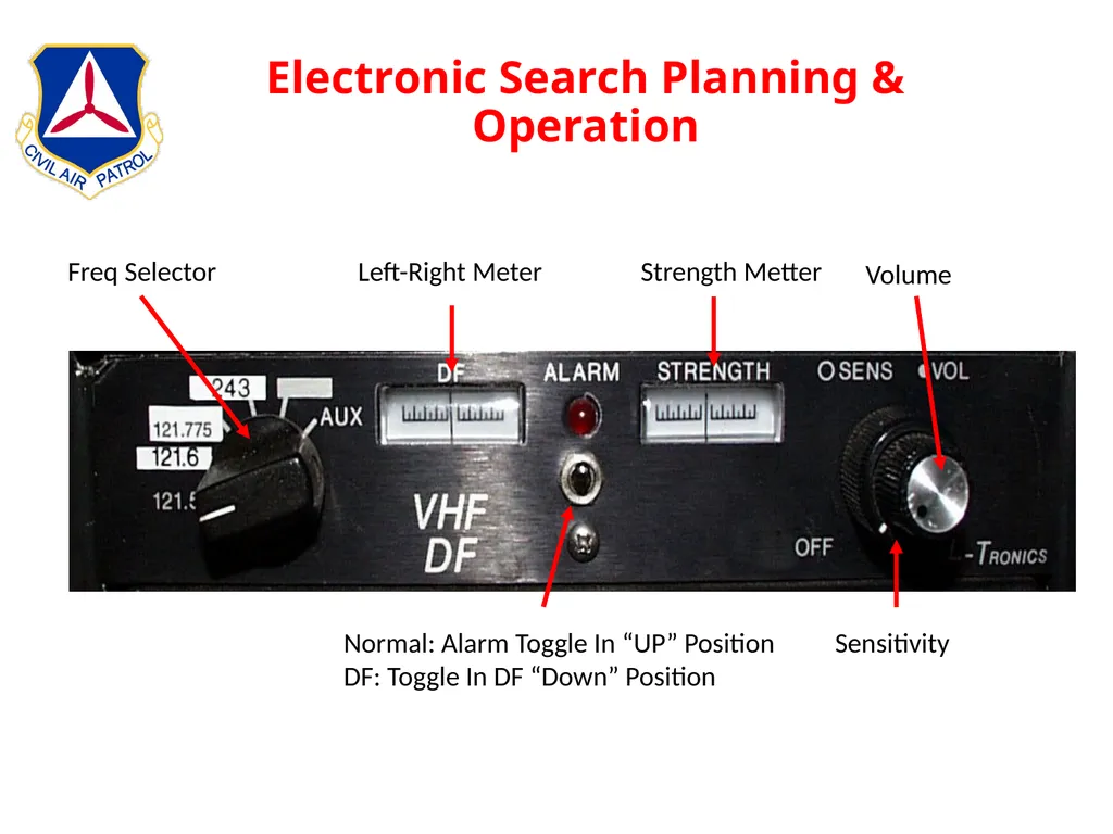
slide102. Electronic Search Planning & Operation Normal: Alarm Toggle In “UP” Position
DF: Toggle In DF “Down” Position Left-Right Meter Strength Metter Freq Selector Volume Sensitivity<br>
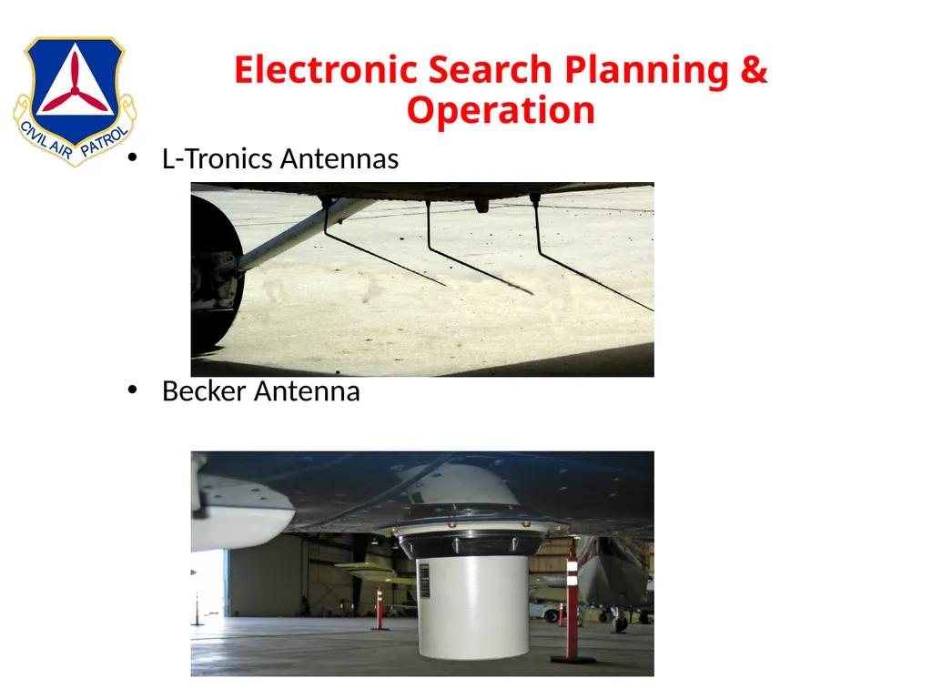
slide103. Electronic Search Planning & Operation L-Tronics Antennas
Becker Antenna<br>
slide104. Electronic Search Planning & Operation Becker DF Units
SAR DF-517
121.5 mHz
156.8 mHz
243.0 mHz
406 mHz
Only 3 Of 19 Channels
1 Reference Channel
2 Operational Channels
Rho-Theta RT-600
Same Frequencies
All 19 406 Channels<br>
slide105. Electronic Search Planning & Operation SAR DF-517
Must Search Using 121.5 mHz If ELT Transmit on Other Than Channels 2 or 3.
Left-Right DF Homing
Wing Shadow Method
Aural Search
Metered Search
Combinations of the above techniques
Best Technique
Select 121.5 mHz
Home to Signal
Signal Strength Usually Too Weak to Successfully Use Wing-Null<br>
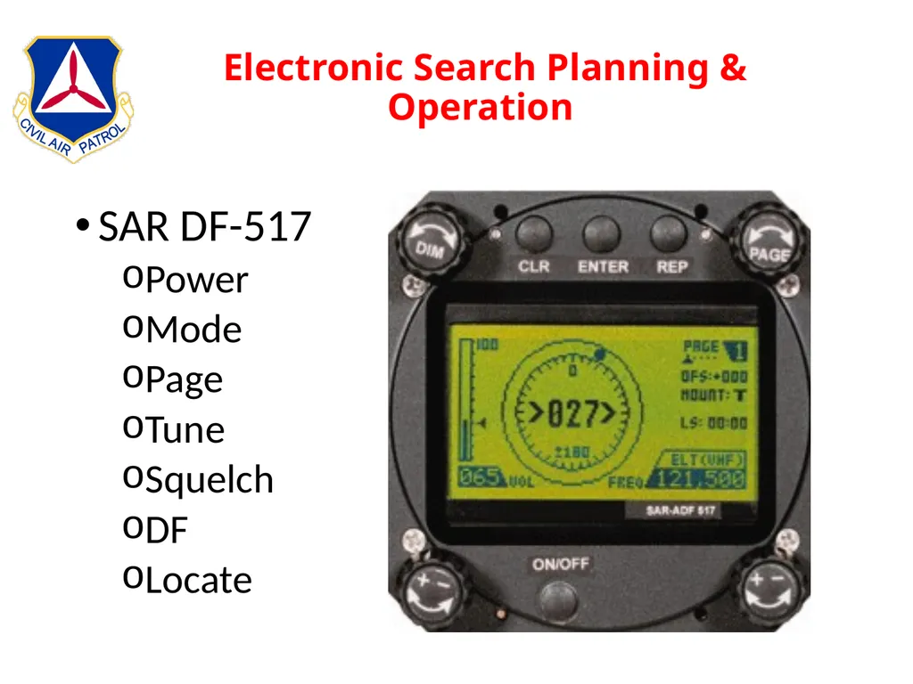
slide106. Electronic Search Planning & Operation SAR DF-517
Power
Mode
Page
Tune
Squelch
DF
Locate<br>
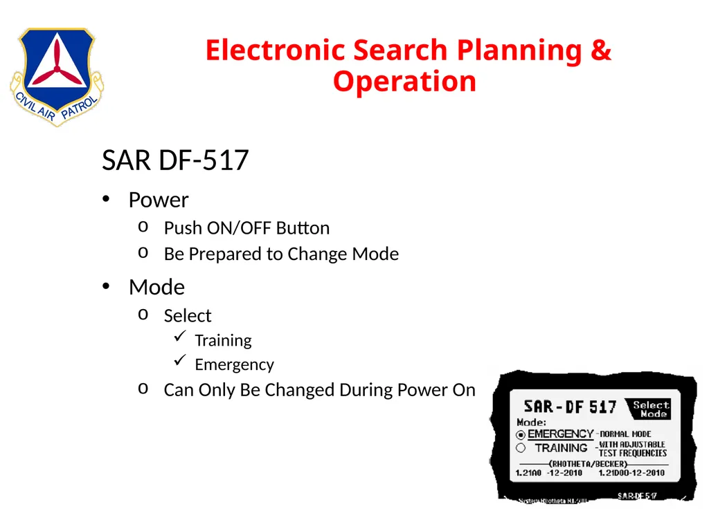
slide107. Electronic Search Planning & Operation SAR DF-517
Power
Push ON/OFF Button
Be Prepared to Change Mode
Mode
Select
Training
Emergency
Can Only Be Changed During Power On<br>
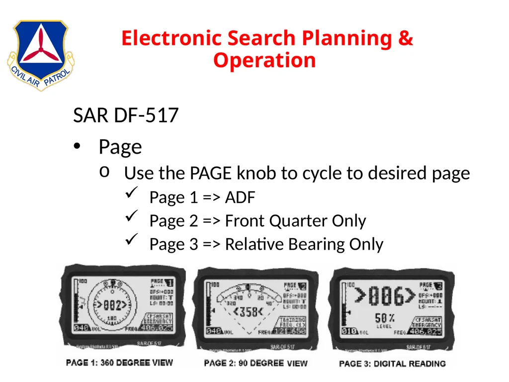
slide108. Electronic Search Planning & Operation SAR DF-517
Page
Use the PAGE knob to cycle to desired page
Page 1 => ADF
Page 2 => Front Quarter Only
Page 3 => Relative Bearing Only<br>
slide109. Electronic Search Planning & Operation SAR DF-517
Tune Frequency
Lower Right +/- Knob
121,500 => Actual SAR
121,775 => Training
243,000 => Actual SAR (Military)
243,550 => Training (Military)
406,025 => Actual SAR
156,800 => Marine Band Channel 16
Training Frequencies in Training Mode
SAR Frequencies in Emergency Mode<br>
slide110. Electronic Search Planning & Operation SAR Df-517
Squelch
Upper Left Knob
Adjust Until Below Top Of Ambient Noise Bar
Volume
Lower Left Knob
Adjust As Required<br>
slide111. Electronic Search Planning & Operation SAR DF-517 Squelch Knob Squelch Setting Triangle Ambient Noise Level<br>
slide112. Electronic Search Planning & Operation SAR DF-517
DF
Fly Relative Bearing To ELT
Use Homing Procedures
Correct For Strong Winds
Relative Bearing + True Heading = True Bearing
Ex: 27 deg (RB) + 280 deg (TH) = 307 deg (TB)<br>
slide113. Electronic Search Planning & Operation SAR DF-517
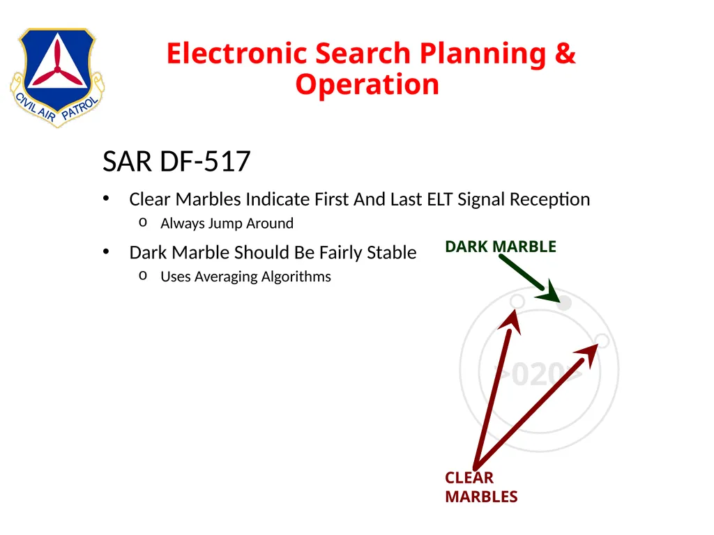
Clear Marbles Indicate First And Last ELT Signal Reception
Always Jump Around
Dark Marble Should Be Fairly Stable
Uses Averaging Algorithms<br>
slide114. Electronic Search Planning & Operation SAR DF-517
Locate Target
Station Passage When Overflying
Turn Around And Re-DF
Fly Turns Around A Point
RB = 90 or 270
Helps Scanner/Observer Locate Target<br>
slide115. Electronic Search Planning & Operation Thoughts About The Becker Units
Not As Sensitive As L-Tronics Initially
Arrows Show Direction Of ELT Left/Right
Number Is Relative Bearing
Dark Marble “Points” to ELT
Use AWOS, ASOS, etc, Signal To Train
ELT Coord Transmitted When Coupled To GPS<br>
slide116. Electronic Search Planning & Operation DFing With Ground Team
Coord With Ground Team If Available
Meet At Pre-determined Location
Provide Lat/Long To Ground Team
See Inflight Guide For Air-to-ground Signals<br>
slide117. Electronic Search Planning & Operation DFing Without Ground Team
ELT Often At Airport
Coordinate With IC
Land
Use Hand Held Radio As A DF Unit
Use Body Blocking Method
Tune Off Frequency As Signal Gets Stronger
Remove Antenna<br>
slide118. Electronic Search Planning & Operation DFing Without Ground Team
You Found It! Now What?
Turn It Off
You Are Not Authorized to Enter Private Property Except For The Purpose Of Saving Life
Hangar
Aircraft
Coordinate With Airfield Manager
Call Aircraft Owner
Local Law Enforcement
Be Aware Of Ballistic Parachutes
Normally Will Have Warning Placards
Avoid This Area<br>
slide119. Other Mission Types Other Types Of Missions
Disaster Assessment
Aerial Photography
Transportation
Military Support<br>
slide120. Other Mission Types Disaster Assessment
Similar To Visual Search
Usually Work For State Or Federal EMA
Note Infrastructure Status
River Dikes
Highways & Bridges
Flood Boundaries
Often Combined With Aerial Photography<br>
slide121. Other Mission Types Aerial Photography
Normal Crew
MP
Normal Duties
Takes Photo Run Directions From AP
MO
Normal Duties
Provides Outside Vigilance
AP
Provide Photo Run Guidance
Altitude
Direction
Aircraft Attitude
Provides Before & After Event Conditions
Uploads Photos To User Identified Location<br>
slide122. Other Mission Types Transportation
CAP Personnel & Equipment
Other Agencies
Red Cross
Emergency Management
Law Enforcement
Usually Requires Commercial Certificate & Class 2 Medical
Non-CAP Personnel
Must Be Pre-Approved By NOC
Must Sign CAPF 70-9
Advise IC Of Location of Form 9<br>
slide123. Other Mission Types Military Support
Homeland Defense
Fighter Intercept
Simulated Border Incursion
Training Route Surveys
RPA Escort<br>
slide124. Stepping Through A Mission Departure Preparations
Personal And Aircraft Items
Crew Duty Day
IMSAFE
Preflight
Arrival Items
Aircraft Security
Fuel
Mission Check-in
WMIRS<br>
slide125. Stepping Through A Mission Web Management Information Reporting System
Mission Page
Air Sortie Page
e104
ORM
Fly The Mission
Return Home
Secure The Aircraft
Post Traumatic Stress
When Is Mission Over<br>
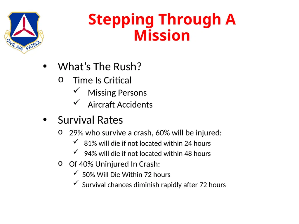
slide126. Stepping Through A Mission What’s The Rush?
Time Is Critical
Missing Persons
Aircraft Accidents
Survival Rates
29% who survive a crash, 60% will be injured:
81% will die if not located within 24 hours
94% will die if not located within 48 hours
Of 40% Uninjured In Crash:
50% Will Die Within 72 hours
Survival chances diminish rapidly after 72 hours<br>
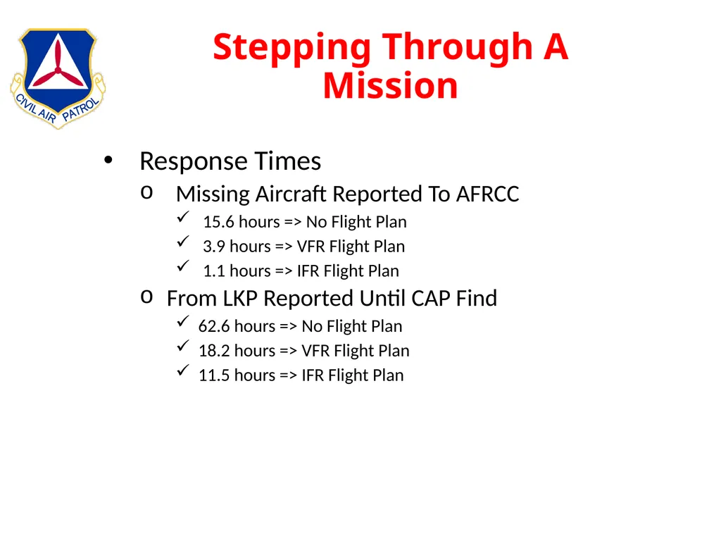
slide127. Stepping Through A Mission Response Times
Missing Aircraft Reported To AFRCC
15.6 hours => No Flight Plan
3.9 hours => VFR Flight Plan
1.1 hours => IFR Flight Plan
From LKP Reported Until CAP Find
62.6 hours => No Flight Plan
18.2 hours => VFR Flight Plan
11.5 hours => IFR Flight Plan<br>
slide128. Stepping Through A Mission Departing Home Station
Uniforms Per CAPR 39-1
Required Credentials
CAP ID
CAPF 101
CAPF 160
Current Charts / EFB
Personal Supplies And Money
Cell Phone
Flashlight With Spare Batteries
Other Charts / Maps (topo, county)<br>
slide129. Stepping Through A Mission Departing Home Station (cont)
Crew Duty Period Per CAPR 70-1
14 hr CAP Duty
Starts At First Official CAP Duty
Ends After All Official Duties Are Complete
10 hr Crew Rest
9 hr Planned Flight Time<br>
slide130. Stepping Through A Mission IMSAFE
Illness
Medication
Stress
Alcohol
Fatigue
Emotion<br>
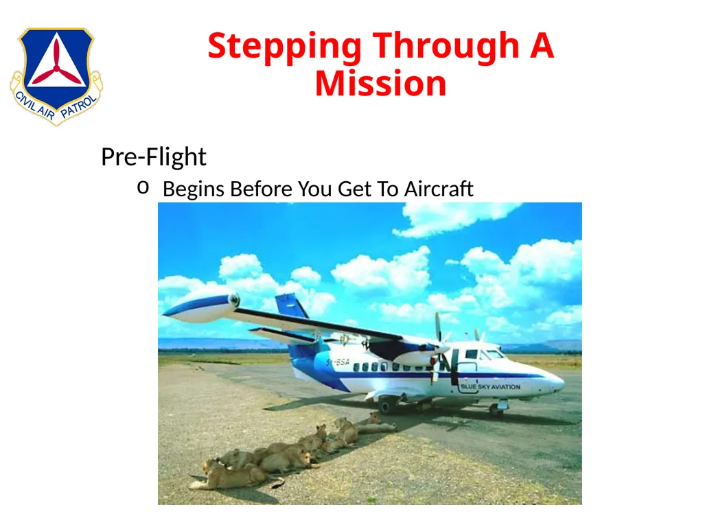
slide131. Stepping Through A Mission Pre-Flight
Begins Before You Get To Aircraft<br>
slide132. Stepping Through A Mission Arrival At Mission Base
Secure Aircraft
Chocks
Tiedown
Locks
Fuel If Needed
Sign Into The Mission
Debrief
Complete WMIRS<br>
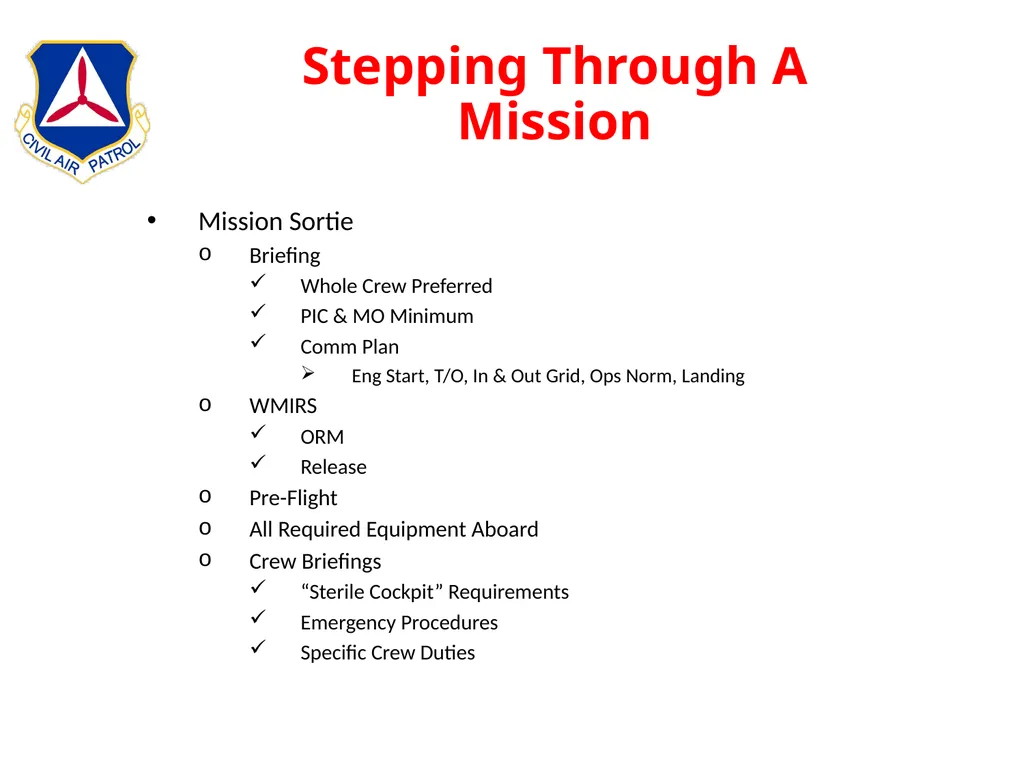
slide133. Stepping Through A Mission Mission Sortie
Briefing
Whole Crew Preferred
PIC & MO Minimum
Comm Plan
Eng Start, T/O, In & Out Grid, Ops Norm, Landing
WMIRS
ORM
Release
Pre-Flight
All Required Equipment Aboard
Crew Briefings
“Sterile Cockpit” Requirements
Emergency Procedures
Specific Crew Duties<br>
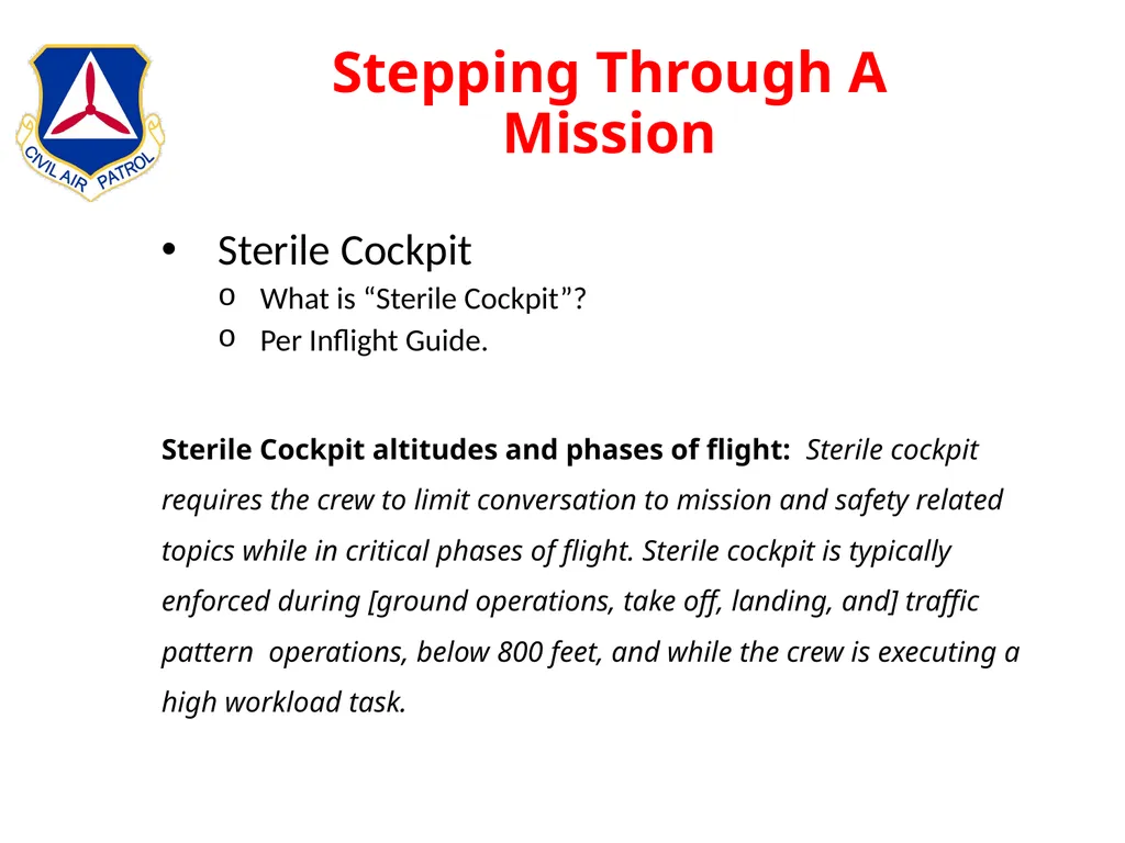
slide134. Stepping Through A Mission Sterile Cockpit
What is “Sterile Cockpit”?
Per Inflight Guide.
Sterile Cockpit altitudes and phases of flight: Sterile cockpit requires the crew to limit conversation to mission and safety related topics while in critical phases of flight. Sterile cockpit is typically enforced during [ground operations, take off, landing, and] traffic pattern operations, below 800 feet, and while the crew is executing a high workload task.<br>
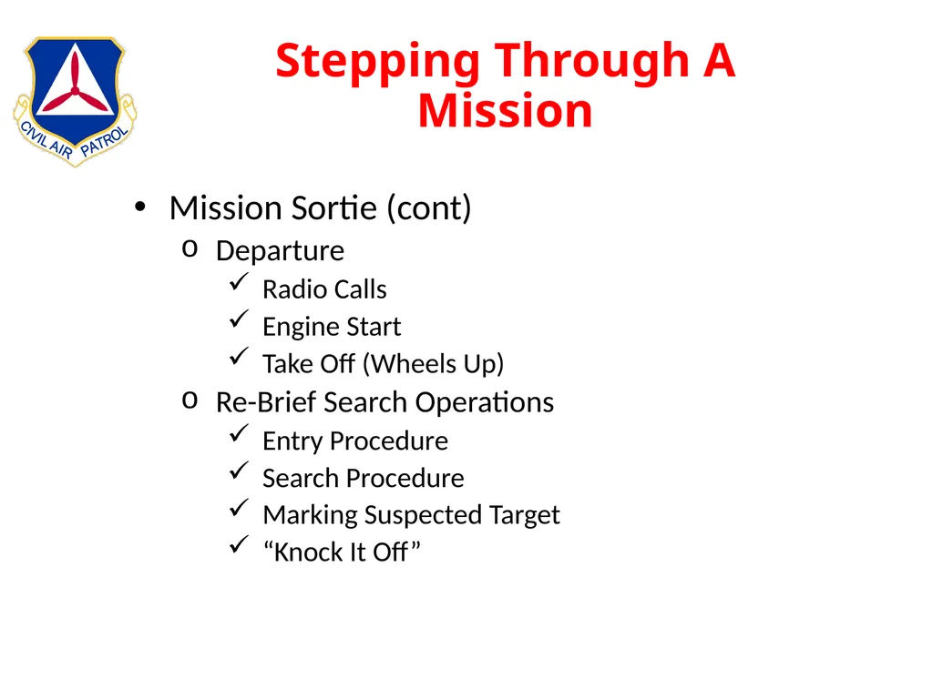
slide135. Stepping Through A Mission Mission Sortie (cont)
Departure
Radio Calls
Engine Start
Take Off (Wheels Up)
Re-Brief Search Operations
Entry Procedure
Search Procedure
Marking Suspected Target
“Knock It Off”<br>
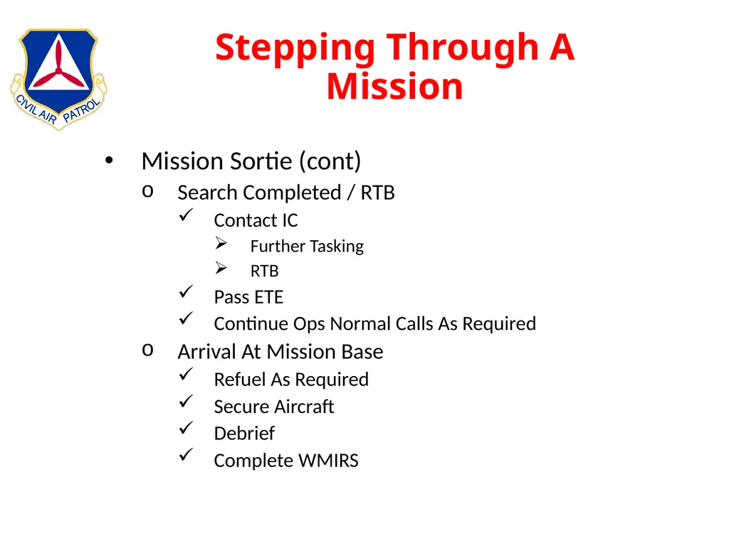
slide136. Stepping Through A Mission Mission Sortie (cont)
Search Completed / RTB
Contact IC
Further Tasking
RTB
Pass ETE
Continue Ops Normal Calls As Required
Arrival At Mission Base
Refuel As Required
Secure Aircraft
Debrief
Complete WMIRS<br>
slide137. Stepping Through A Mission Debrief
Note Both Positive And Negative Results
Be Honest Of Results
Used To Determine Effectiveness Of Search
Weather — shadows, visibility, snow cover
Terrain — open, flat, mountainous, rough
Ground Cover — barren, forest, scrub, sparse, dense
Other information — hazards, changes from plan
Used To Calculate “Probability of Detection”
Upload Photos And Attachments<br>
slide138. Stepping Through A Mission WMIRS (Web Management Information Reporting Sys)
Mission Information
Sortie Information
ORM
eE104
Briefing
Debriefing
Example: 23-T-4983 / A0002<br>
slide139. Stepping Through A Mission Operational Risk Management (ORM)
Complete Prior To Every Sortie
Systematic Decision Making Process
Analyze Hazards
Assess Risks
Evaluate Courses Of Action
Four Guiding Principles
Accept No Unnecessary Risk
Make Risk Decisions At Appropriate Level
Integrate Into Operations
Apply Process Cyclically And Continuously<br>
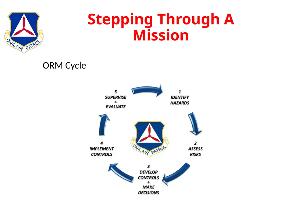
slide140. Stepping Through A Mission ORM Cycle<br>
slide141. Stepping Through A Mission ORM And The Aircrew
Acknowledge Risks
Each Crewmember Responsible To Look For Risks
Don’t Ignore Risks
PIC Is Ultimate Authority To Deal With Risks<br>
slide142. Crew Resource Management History
Prior To 1980’s
Captain Was “God”
FO’s Reluctant To Challenge Captain’s Decisions
Some Accidents Caused By Lack Of SA
Eastern Airliner Crashes Into Everglades
Gear Light
No One Flying Plane
Autopilot Disengaged
FAA / NTSB Recommendation for CRM Training
Captain Still PIC
Takes Inputs From Flight Crew
One Pilot Flies While Other Pilot Works Problem
Bottom Line:
One Person In Charge But Takes Advise
Use All Available Resources To Solve Problem
In or Out Of Airplane
Above All Else FLY THE PLANE First!<br>
slide143. Forms WMIRS
CAPF 104 (WMIRS)
CAPF 108 (WMIRS)
ORM Aviation Worksheet (WMIRS)
Others
CAPF 101 => ES Qualifications
CAPF 70-9 => Release
CAP SQTRs => Training Records
Wt & Bal => Upload To Sortie
FAA Flight Plan
CAPF ICS forms
Corrections
Strike Through
Make Correction
Initial<br>
Curriculum Director
618-604-5720
422502@tncap.us<br>
slide2. Administration Daily Sign In
Rest Rooms
Fire Exits
Breaks
Instructors / Crew Assignments<br>
slide3. Week’s Agenda Sunday
MAS Intro – Col Robert Freese/Commandant
Publications Handouts
Uniform Requirements
Black Shorts / Tan NESA T-Shirt with NESA Hat
Any CAP Uniform
Training Materials
Aircraft Handling Video<br>
slide4. Week’s Agenda cont. Monday
Classroom
Crew Assignments
Flying
Safety Sortie
Route Search
Tuesday
Classroom
Flying –Parallel
Wednesday
Classroom
Flying – Creeping Line<br>
slide5. Week’s Agenda cont. Thursday
Classroom - Test
Flying – Point Based
Expanding Square
Sector
Friday
Classroom
Flying - Electronic
Saturday
Graduation<br>
slide6. Overview Responsibilities
MO Responsibilities
MP Responsibilities
Basic Information
Weather
Aircraft Description
Navigation
In-flight services
Search Planning & Operation
Search Area
POD
Visual
Electronic
Other
Other Information
CRM
Documents<br>
slide7. MO Responsibilities Mission Expert
Visual Search
Navigation
Operate Aircraft & CAP Radio
Monitor Crew
CRM
Maintain Sortie Log
Assist With WMIRS<br>
slide8. MO Responsibilities Primary Duty in Search Area is Visual
Eyes Out – 80%
Eyes In – 20%
Attend Sortie Briefing w/MP
Record Pertinent Info in MO Log
Assist With e104 Briefing Entries
Assist MP With Planning Sortie
Identify Entry Point
Plot Course
Operate GPS
Flight Plan
User Waypoints
System Changes<br>
slide9. MO Responsibilities Operate Aircraft Radios
Provide ICP With Sortie Status IAW Comm Plan
Engine Start
Wheels Up
In/Out of Target Area
Wheels Down
Ops Norm
Assist MP With Aircraft Voice and Nav Radios
Monitor Crew
Fatigue
Hydration<br>
slide10. MO Responsibilities Assist MP With Flight Parameters
Fuel
Must Land With Minimum of One Hour of Fuel
Altitude, Airspeed, and Track
1000’ AGL
90 KIAS
+/- 0.2nm
Maintain Log
Assist With Debriefing
Assist With WMIRS<br>
slide11. MP Responsibilities Safety of the Crew and the Aircraft
Monitor Crew
Mission Expert
Accurate Execution of Search Pattern
Complete Mission Documents<br>
slide12. MP Responsibilities Primary Responsibility is Safety of Crew and Aircraft
Monitor Crew
Hydrate
Performance
Well Being
Assess Risks and Mitigate
Receive Mission Briefing
Understand Overall Requirements
SAR
Missing Person
Damage Assessment<br>
slide13. MP Responsibilities Understand How Specific Sortie Fits Into Mission
Know Sortie Specifics
Entry Point
Pattern To Fly
Comm Plan
Develop Plan
Assign Crew Duties
How to Enter Area
Aircraft Configuration<br>
slide14. MP Responsibilities Fly Mission As Briefed
Stable Pattern
90 KIAS
10 Degrees of Flaps
1000 ft AGL
On Track
Accurate
Goals
Airspeed: +/- 5 kts
Altitude: + 100 ft
XTK: +/- 0.03 nm<br>
slide15. MP Responsibilities After Landing
Refuel
Complete AIF
Return Equipment
Secure Aircraft
Debrief Sortie
Be Honest
Provide Crew Assessment of Sortie Accomplishment
Complete WMIRS<br>
slide16. MP Responsibilities Airport Operations
Use Airport Diagram
Runways
Taxiways
Obstacles
Services
Local NOTAMS
Know Airfield Signs And Markings
Taxiways
Runways
Light Gun Signals
Be Familiar With Airspace And Obstacles
Chart Supplement
Sectional Chart
ForeFlight
NOTAMS<br>
slide17. MP Responsibilities Airport Signs and Light Gun Signals<br>
slide18. MP Responsibilities Airport Markings<br>
slide19. Weather What Causes Weather?
Circulation Patterns
Air Masses
Fronts
Clouds & Precipitation
Icing
Turbulance<br>
slide20. Weather Uneven Heating of the Earth’s Surface<br>
slide21. Circulation As Earth Rotates Rising Air is Pulled East
Creates High Pressure Belt - 30 deg latitude
Air Flow Cools – Moves Southward
These Large Air Movements Mix Atmosphere<br>
slide22. Air Masses Circulations Create Homogenous Air Masses
Similar Physical Properties
Temperature
Humidity
Winds
Named For General Location
Polar
Cold
Dry
Sub-tropical
Temperate
Tropical
Hot
Humid<br>
slide23. Hi / Low Pressure Areas High Pressure
Clockwise Circulation
Downward Air Flow
Outward Air Flow
Generally Fair Weather
Low Pressure
Counter-Clockwise Circulation
Upward Air Flow
Inward Air Flow
Rainy / Stormy Weather
Circulation Generates Frontal Areas<br>
slide24. Fronts Boundaries Between Air Masses
Fronts
Generally Defined By Temperature
Always Generate a Shift In Wind Direction
Types
Cold
Warm
Stationary
Occluded<br>
slide25. Cold Front Characteristics
Often Fast Moving
Create Vertical Storms
Can Be Violent
Not Very Wide
Abruptly Forces Air Upward
Creates Unstable Air Mass
Thunderstorms
Tornados
Often Less Than 50nm – 100nm Wide
Depicted On Charts As A BLUE Line With Points Cold Warm<br>
slide26. Warm Front Characteristics
Slower Moving
Wide Spread Showers
Affects Wide Area
Warm Air Mass Slides Over Colder Air
Creates Stratus Clouds
Can Be Hundreds of Miles Wide
Limited Vertical Development
Depicted On Charts As A RED Line With Bumps Warm Cold<br>
slide27. Other Fronts Stationary Fronts
Boundary Between Two Air Masses
Doesn’t Move Very Much
Unstable Weather For Long Periods of Time
Depicted As A Line With Alternating RED Bumps and BLUE Points On Opposite Sides of Line
Occluded Front
Cold Front Overtakes Warm Front
Can Create Very Violent Weather Large Vertical Growth
Depicted As A PURPLE Line With Alternating Bumps and Points On Same Side of Line<br>
slide28. Clouds Types
Stratus - Layered
Cumulous - Billowing
Nimbus – Rain
Cirrus – High Icey
Heights
Low - at or below 6,500 feet AGL*
Mid-Level - between 6,500 feet and 15,000 feet AGL*
High Level - more than 15,000 feet AGL*
*National Weather Service https://www.weather.gov/key/cloudchart<br>
slide29. Clouds Stratus Cumulous Nimbus Cirrus<br>
slide30. Precipitation Rain
Showers
Moderate Rate
Low to Moderate Wind Speed
Thunder Storms
Moderate to Heavy Rate
Moderate to Strong Winds
Micro Bursts
Strong Downward Wind
Generated By Large Rain Shafts
Often During Dissipating Stage
Wind Shears
Tornados
Hail
Created By Re-freezing Rain in Up/Down Drafts
Can Be Thrown As Far As 20 Miles From Storm
Snow<br>
slide31. Thunderstorms<br>
slide32. Icing Most Insidious of Weather
Airframe
Carburator
Icing Hazards
Increased Weight & Drag
Reduced Performance
Four Primary Types
Rime
Rough
Opaque
Clear
Smoothe
Freezing Rain
Mixed
Frost Increased
Weight Increased
Drag Decreased
Lift Decreased
Thrust<br>
slide33. Icing<br>
slide34. Icing No Such Thing As A Little Ice
The only way to ensure that a wing is free from frost or ice is to touch it!<br>
slide35. Turbulence Mechanical
Obstacles
Mountains
Buildings
Weather Generated
Thunderstorms
Strong Up / Down Drafts
Micro Bursts
Wind Shear
Sudden Change in Direction
Sudden Change in Velocity<br>
slide36. Aircraft Components Fuselage
Wings
Empenage
Nose
Gear<br>
slide37. Aircraft Components<br>
slide38. Instruments Flight
Communications
Engine
Electrical<br>
slide39. Flight Instruments Airspeed
Usually in Knots Indicated Airspeed (KIAS)
Color Coded
Stall Speed
Flap Range
Max
Altimeter
Feet Above Mean Sea Level
Colesman Window<br>
slide40. Flight Instruments Artificial Horizon
Depicts
Sky
Ground
Bank Angle
Gyro Stabilized
Electric
Vacuum
Compass
Gyro Stabilized
Electric
Vacuum
NOT Magnetic!<br>
slide41. Flight Instruments Vertical Speed
Rate of Climb
Rate of Descent
Turn Coordinator
Rate of Turn
Quality of Turn<br>
slide42. Garmin Flight Instruments<br>
slide43. Navigation Global Coordinates
Latitude
Longitude<br>
slide44. Navigation Latitude
Equator
N/S 0⁰ - 90⁰
Parallel Circles
Longitude
Prime Meridian
E/W 0⁰ – 180⁰
Great Circles<br>
slide45. Navigation Standard Convention => N/S Lat – E/W Long
Lat / Long (hh dd⁰ mm.mmm’)
Lat
Expressed in Degrees N/S (N 32⁰ 45.594’)
0⁰ – 90⁰
Equator to Pole
Long
Expressed in Degrees E/W (W 86⁰ 32.154’)
0⁰ – 180⁰
Prime Meridian to Date Line<br>
slide46. Navigation<br>
slide47. Electronic Aids To Navigation Very High Frequency Omnidirectional Range - VOR
Distance Measuring Equipment - DME
Global Positioning System - GPS<br>
slide48. Electronic Aids To Navigation Very High Frequency Omnidirectional Ranging - VOR
Very common
Most air routes (airways) defined by VORs
Good Accuracy<br>
slide49. Electronic Aids To Navigation<br>
slide50. Electronic Aids To Navigation<br>
slide51. G1000 Integrated Flight Deck PFD<br>
slide52. G1000 Integrated Flight Deck MFD<br>
slide53. G1000 Integrated Flight Deck Garmin G1000 Simulator
Buttons & Knobs
Folders & Pages
Nav / Comm Radios
Navigation Information / Autopilot
***Use The Flight Sims In Between Flights***<br>
slide54. High Altitude & Terrain Atmospheric Pressure
Measured With Barometer
Standard Pressure At Sea Level => 29.92”
Standard Temperature At Sea Level => 15⁰ C
Altimeter Adjusted With Local Barometric Pressure
Density Altitude
Factors Affecting Density Altitude
Temperature
Altitude
Humidity
Determined By Adjusting Pressure Altitude With Non-standard Temperature<br>
slide55. High Altitude & Terrain Affects of Density Altitude
Less Pressure The Higher You Climb
Wings, Props, and Horsepower Lose Efficiency
Take Off and Landing Distances Increase
Climb Rate Decreases<br>
slide56. High Altitude & Terrain Strategies to Cope With High Density Altitudes
Don’t Fly During Hot Part of Day
Accurately Calculate Density Altitude and Weight
Reduce Weight
Less Fuel
Less Baggage
Fewer People
Flight In Mountainous Terrain
Don’t Fly Searches Unless You Have Completed the Mountain Flying Course.
Maintain At Least a 2000’ Clearance
Be Prepared For Down Drafts On Leeward Side of Ridges
Expect High Winds In Passes<br>
slide57. In-Flight Services Flight Service Stations
ATIS
Approach Control
Air Route Traffic Control Center<br>
slide58. In-Flight Services Automatic Terminal Information Service (ATIS)
Pre-Compiled Messages
Weather
Runway In Use
Approach Type
Local NOTAMS
Broadcast Hourly On Dedicated Frequency
More Often If Weather Conditions Are Rapidly Changing<br>
slide59. In-Flight Services Flight Service Station (FSS)
Now Serving Several Regions
Weather Briefings
NOTAMs
Flight Plan Filing
Directional Finder<br>
slide60. In-Flight Services Approach Control
Primary Responsibility => IFR Traffic Control / Separation
Secondary Responsibility => VFR Flight Following
Frequency In Comm Box Near Large Airports<br>
slide61. In-Flight Services Air Route Traffic Control Center (ARTCC)
Primary Responsibility => IFR Traffic Control / Separation
Secondary Responsibility => VFR Flight Following
Frequency Found In Comm Box
IFR Chart
Sectional Chart Margin<br>
slide62. Search Planning & Operation Search Area Possibility vs Probability
Area Possibility
Last Known Position (LKP)
Average Winds
Fuel On Board
Too Large!<br>
slide63. Search Planning & Operation Factors to Help Narrow Area of Probability
Statistics
W/in 5nm of Dep & Arr Airports
W/in 5nm of Direct Route<br>
slide64. Search Planning & Operation Other Factors
Flight plan
Weather information
National Track Analysis Program data
Airports along the intended flight track
Aircraft performance
Pilots flying habits
Radar coverage as a limiting factor
Nature of terrain along the flight track
Position reports — fuel stops, etc.<br>
slide65. Search Planning & Operation Search Area Priority
Areas of bad weather
Low clouds and poor visibility
Areas where weather was not as forecast
High terrain
Areas not covered by radar
Reports of low flying aircraft
Radio contacts or MAYDAY calls<br>
slide66. Search Planning & Operation General Items To Consider
Measurement
One minute latitude = 1 nm
One minute longitude = 0.6572nm to 0.9152nm
For Training Use One Minute Longitude = 1nm
Periodically Do A “Stupid Check”
Stabilized Pattern Entry
On Airspeed (90kts)
On Heading
On Altitude
Flaps 10 Degrees<br>
slide67. Search Planning & Operation Probability of Detection (POD)
“percent” search object was detected
Four interrelated factors used to calculate:
Track Spacing
Distance Between Tracks
Usually 1nm
Search Visibility
Distance An Object Can Be Identified
Can Tell the Difference Between A Horse and A Cow
Search Altitude
Normal is 1000’ AGL
Maybe 500’ AGL to Identify An Object
Type of Terrain<br>
slide68. Search Planning & Operation POD Chart<br>
slide69. Search Planning & Operation Cumulative POD 5-10% 15
11-20% 20 25
21-30% 30 35 45
31-40% 40 45 50 60
41-50% 50 55 60 65 70
51-60% 60 65 65 70 75 80
61-70% 70 70 75 80 80 85 90
71-80% 80 80 80 85 85 90 90 95
80+% 85 85 90 90 90 95 95 95 95+
5-10% 11-20% 21-30% 31-40% 41-50% 51-60% 61-70% 71-80% 80+% POD For This Search Previous
POD<br>
slide70. Search Planning & Operation Search Types & Priorities
Visual
Route (Hasty)
Parallel
Creeping Line
Point Based (Expanding Square / Sector)
Electronic
Direction Finding Equipment
L-tronics
Becker<br>
slide71. Visual Search Planning & Operation Visual Search Patterns
Route (Hasty)
Quickest
Searches Either Side of Suspected Route of Flight
First Leg is Offset From Route By 0.5 nm
Then Use 1 nm Track Spacing<br>
slide72. Visual Search Planning & Operation Route Search<br>
slide73. Visual Search Planning & Operation Visual Search Patterns
Parallel (Grid)
Defined By Several Methods
CAP Grid
Standard Grid
Any Defined Entry Point & Parameters
CAP Grid
Sectional Name
Sequence Number of 15’ x 15’ Quadrants
Begin In Upper Left Corner of Sectional Chart
Overlap Defaults to Western Sectional (MKC vs STL)<br>
slide74. Visual Search Planning & Operation Klamath Falls (LMT204) A B C D<br>
slide75. Visual Search Planning & Operation Visual Search Patterns
Parallel (Grid)
Standard Grid
1⁰ x 1⁰ Rectangle
Lat/Long of Lower Right Corner Defines the Grid
Letters Define Sub-Groups
CAP Grid Is 1/16th of Standard Grid<br>
slide76. Visual Search Planning & Operation Standard Grid<br>
slide77. Visual Search Planning & Operation Single User waypoint XTK, TRK, BRG, DIST and OBS
Input user waypoint
Fly “direct to” user waypoint
Set the course line (OBS) to the Base Line
At the end of the first track and at least 0.5NM outside the grid turn to establish a new track in the opposite direction at a distance XTK= track spacing (e.g. 1 nm for the second track and 2 nm for the third track etc.)
For NS tracks end of grid can be established by DIS from User Waypoint (see next slide)
Fly each track adjusting heading to achieve the desired TRK while maintaining desired XTK from the base line
The entry edge of the grid can be established by BRG to WPT, in the example given on next slide BRG=090 on entry edge of grid
Repeat until the grid is complete Parallel Search<br>
slide78. Visual Search Planning & Operation 78 0 7.6 8.1 7.8 8.5 9.0 9.6 10.3 7.5 1 3 2 4 5 6 7 0 XTK for each leg DIS to User Waypoint User Waypoint<br>
slide79. Visual Search Planning & Operation Two User waypoints XTK, DIS, and TRK
Determine true course between beginning point and end point of search from sectional
Insert a waypoint 99 miles beyond the start point of the creeping line, enter a flight plan from start to waypoint 99 miles beyond start point (this must not be >99 miles since G1000 will not display 1/10th miles at 99 NM or more)
Desired track for left offset of creeping line is DTK – 90°, Right offset of creeping line is DTK + 90°.
Approach the beginning point from the right side of the search course so that aircraft is established on creeping line track (DTK – 90° ) prior to crossing search course.
When the Cross Track Error (XTK) readout indicates that the aircraft is at the Offset plus at least + 0.5 NM from the course line, perform a turn to intercept the reciprocal track (DTK + 90°)
Adjust the turn as necessary so that the aircraft is closer to the course end point by distance equal to track spacing and on a ground track perpendicular to the course line
Continue this process until the search pattern is completed. Creeping Line<br>
slide80. Visual Search Planning & Operation 0 Starting User Waypoint 99 L/2 = XTK L/2 = XTK 93 95 94 96 97 98 99 DIS to 99NM User Waypoint 99NM User Waypoint Creeping Line Course Creeping Line<br>
slide81. Visual Search Planning & Operation<br>
slide82. Visual Search Planning & Operation Expanding Square Search
1. Input user waypoint for center of square search by Lat/Long.
2. Load a “direct to” user waypoint flight plan.
3. Set OBS to 360, intercept course line and cross waypoint at designated ground speed and altitude.
4. At DIS=0.5, turn right using a std rate bank angle to a TRK of 090.
when XTK=0.5 turn right to 180 using a std rate bank angle, roll out XTK=1.
5. Establish heading to stay on XTK = 1.0 and TRK=180, use ground track bug if able.
6. When ground track stable, set OBS=270; at XTK=0.5 turn right using std rate bank angle, roll out to achieve TRK=270 and XTK=1.0.
7. Establish heading to stay on XTK = 1.0, TRK=270.
8. When ground track stable, set OBS=360; at XTK=0.5 turn right using std rate bank angle, roll out to achieve TRK= 360 and XTK=1.0.
9. Establish heading to stay on XTK = 1.0, TRK=360.
10. When ground track stable, set OBS=090; at XTK=1.5 turn right using std rate bank angle, roll out to achieve TRK= 090 and XTK=2.0.<br>
slide83. Visual Search Planning & Operation Expanding Square<br>
slide84. Visual Search Planning & Operation Sector Search
Create Entry Waypoint
Fly Direct To Waypoint With OBS Set To First Outbound Crs
Fly Outbound Until Dis = Leg Length
Turn Right
Reset OBS To Next Inbound Course
Intercept New Course Outside Of The Leg Length
Fly Inbound To Waypoint
Continue Flying OBS Crs Outbound Until Dis = Leg Length
Reset OBS To Next Inbound Course
Repeat Until Search Is Completee<br>
slide85. Visual Search Planning & Operation Sector Search<br>
slide86. Electronic Search Planning & Operation Types of Beacons
Aircraft
Marine
Personal
Detection Process
Monitoring 121.5 mHz
Satellite 406 mHz
Direction Finding (DF) Equipment
L-Tronics
Becker<br>
slide87. Electronic Search Planning & Operation Multitude of Models ©2000 Scott E. Lanis<br>
slide88. Electronic Search Planning & Operation Types of ELT’s
Aviation
Automatic Activation
Frequencies
121.5 mHz
406 mHz
243.0 mHz
Marine
Automatic or Manual Activation
Frequency
156.8 mHz
Personal
Manual Activation
Frequency
406 mHz<br>
slide89. Electronic Search Planning & Operation Aircraft ELT Antennas 121.5 mHz 406 mHz<br>
slide90. Electronic Search Planning & Operation Marine
Emergency Position Indicating Radio Beacon
Similar to an ELT, an EPIRB is used on ships and boats
Most have installed the new 406 MHz EPIRBs (older units on 156.8 MHz)
Some activate automatically and others are manually activated<br>
slide91. Electronic Search Planning & Operation Personal
Personal Locator Beacon (PLB)
Hikers
Hunters
Boaters
Other remote wilderness travelers
Frequencies
406 mHz
121.5 mHz homing signal (generally, at only 25 milliwatts)
Some with a built-in GPS
Each PLB must be registered with NOAA<br>
slide92. Electronic Search Planning & Operation 406 mHz ELT Transmitters
General Information
406.025 + Low Power (100mw) 121.5mHz
50 Second Interval Data Burst
Owner’s Name
Address
Phone Numbers
Type of Aircraft
Coordinates If Connected to A GPS
Operates With SARSAT/COSPAS<br>
slide93. Electronic Search Planning & Operation Practice Beacons
Used For Training
121.775 mHz
Referred To As “PRACTICE BEACON” Not ELT<br>
slide94. Electronic Search Planning & Operation Inadvertent Activation
Hard Landings
Hard Ground Handling
Change of Switch Position
Removal/Installation
Malfunction<br>
slide95. Electronic Search Planning & Operation Activation Detection
SARSAT-COSPAS System
Monitors 406 mHz Only
No Longer Monitors 121.5 mHz or 246.0 mHz
Detection Only From Aircraft/ATC or Vessels
Requires Intersecting Coverage To “Pinpoint”<br>
slide96. Electronic Search Planning & Operation On Activation
406 MHz ELT is activated
406.025 MHz At 5 Watts
19 Separate Channels
50-second intervals
Encoded Digital Message To NOAA-SARSAT
Serial Number of the Transmitter or Aircraft ID
Country Code
I.D. Code
Lat/Long If Coupled to Aircraft’s GPS
100 Yard Accuracy
Swept Tone at ~100 Milliwatts
121.5 mHz
243.0 mHz<br>
slide97. Electronic Search Planning & Operation ID Code
Allows AFRCC To Access Registration Database
Owner's Name
Owner's Address
Owner's Telephone Number
Aircraft Type
Aircraft Registration Number
Alternate Contact
Allows Contact With Owner
Is This A False Alarm?<br>
slide98. Electronic Search Planning & Operation No Position Information
Satellite Makes Several Passes
3 – 4 Hours May Be Needed For Satellite To Be Overhead
Uses Doppler To Determine Location
1 – 3 nm Accuracy<br>
slide99. Electronic Search Planning & Operation Every ELT Mission Should Be Treated As An Emergency<br>
slide100. Electronic Search Planning & Operation Directional Finder Equipment
L-Tronics
Older Technology
Unable to Track 406 mHz Beacon
Becker
Newer Technology
Based On Pseudo Doppler Shift
Becker SAR-DF 517
RhoTheta RT-600<br>
slide101. Electronic Search Planning & Operation L-Tronics Directional Finder
Compares Signal Strength
Antennas Normally On Bottom Of Aircraft
Centered TO or FROM
Points In Direction Of Signal
Similar To ADF Needle
Points Left or Right
Hence Left-Right Homing<br>
slide102. Electronic Search Planning & Operation Normal: Alarm Toggle In “UP” Position
DF: Toggle In DF “Down” Position Left-Right Meter Strength Metter Freq Selector Volume Sensitivity<br>
slide103. Electronic Search Planning & Operation L-Tronics Antennas
Becker Antenna<br>
slide104. Electronic Search Planning & Operation Becker DF Units
SAR DF-517
121.5 mHz
156.8 mHz
243.0 mHz
406 mHz
Only 3 Of 19 Channels
1 Reference Channel
2 Operational Channels
Rho-Theta RT-600
Same Frequencies
All 19 406 Channels<br>
slide105. Electronic Search Planning & Operation SAR DF-517
Must Search Using 121.5 mHz If ELT Transmit on Other Than Channels 2 or 3.
Left-Right DF Homing
Wing Shadow Method
Aural Search
Metered Search
Combinations of the above techniques
Best Technique
Select 121.5 mHz
Home to Signal
Signal Strength Usually Too Weak to Successfully Use Wing-Null<br>
slide106. Electronic Search Planning & Operation SAR DF-517
Power
Mode
Page
Tune
Squelch
DF
Locate<br>
slide107. Electronic Search Planning & Operation SAR DF-517
Power
Push ON/OFF Button
Be Prepared to Change Mode
Mode
Select
Training
Emergency
Can Only Be Changed During Power On<br>
slide108. Electronic Search Planning & Operation SAR DF-517
Page
Use the PAGE knob to cycle to desired page
Page 1 => ADF
Page 2 => Front Quarter Only
Page 3 => Relative Bearing Only<br>
slide109. Electronic Search Planning & Operation SAR DF-517
Tune Frequency
Lower Right +/- Knob
121,500 => Actual SAR
121,775 => Training
243,000 => Actual SAR (Military)
243,550 => Training (Military)
406,025 => Actual SAR
156,800 => Marine Band Channel 16
Training Frequencies in Training Mode
SAR Frequencies in Emergency Mode<br>
slide110. Electronic Search Planning & Operation SAR Df-517
Squelch
Upper Left Knob
Adjust Until Below Top Of Ambient Noise Bar
Volume
Lower Left Knob
Adjust As Required<br>
slide111. Electronic Search Planning & Operation SAR DF-517 Squelch Knob Squelch Setting Triangle Ambient Noise Level<br>
slide112. Electronic Search Planning & Operation SAR DF-517
DF
Fly Relative Bearing To ELT
Use Homing Procedures
Correct For Strong Winds
Relative Bearing + True Heading = True Bearing
Ex: 27 deg (RB) + 280 deg (TH) = 307 deg (TB)<br>
slide113. Electronic Search Planning & Operation SAR DF-517
Clear Marbles Indicate First And Last ELT Signal Reception
Always Jump Around
Dark Marble Should Be Fairly Stable
Uses Averaging Algorithms<br>
slide114. Electronic Search Planning & Operation SAR DF-517
Locate Target
Station Passage When Overflying
Turn Around And Re-DF
Fly Turns Around A Point
RB = 90 or 270
Helps Scanner/Observer Locate Target<br>
slide115. Electronic Search Planning & Operation Thoughts About The Becker Units
Not As Sensitive As L-Tronics Initially
Arrows Show Direction Of ELT Left/Right
Number Is Relative Bearing
Dark Marble “Points” to ELT
Use AWOS, ASOS, etc, Signal To Train
ELT Coord Transmitted When Coupled To GPS<br>
slide116. Electronic Search Planning & Operation DFing With Ground Team
Coord With Ground Team If Available
Meet At Pre-determined Location
Provide Lat/Long To Ground Team
See Inflight Guide For Air-to-ground Signals<br>
slide117. Electronic Search Planning & Operation DFing Without Ground Team
ELT Often At Airport
Coordinate With IC
Land
Use Hand Held Radio As A DF Unit
Use Body Blocking Method
Tune Off Frequency As Signal Gets Stronger
Remove Antenna<br>
slide118. Electronic Search Planning & Operation DFing Without Ground Team
You Found It! Now What?
Turn It Off
You Are Not Authorized to Enter Private Property Except For The Purpose Of Saving Life
Hangar
Aircraft
Coordinate With Airfield Manager
Call Aircraft Owner
Local Law Enforcement
Be Aware Of Ballistic Parachutes
Normally Will Have Warning Placards
Avoid This Area<br>
slide119. Other Mission Types Other Types Of Missions
Disaster Assessment
Aerial Photography
Transportation
Military Support<br>
slide120. Other Mission Types Disaster Assessment
Similar To Visual Search
Usually Work For State Or Federal EMA
Note Infrastructure Status
River Dikes
Highways & Bridges
Flood Boundaries
Often Combined With Aerial Photography<br>
slide121. Other Mission Types Aerial Photography
Normal Crew
MP
Normal Duties
Takes Photo Run Directions From AP
MO
Normal Duties
Provides Outside Vigilance
AP
Provide Photo Run Guidance
Altitude
Direction
Aircraft Attitude
Provides Before & After Event Conditions
Uploads Photos To User Identified Location<br>
slide122. Other Mission Types Transportation
CAP Personnel & Equipment
Other Agencies
Red Cross
Emergency Management
Law Enforcement
Usually Requires Commercial Certificate & Class 2 Medical
Non-CAP Personnel
Must Be Pre-Approved By NOC
Must Sign CAPF 70-9
Advise IC Of Location of Form 9<br>
slide123. Other Mission Types Military Support
Homeland Defense
Fighter Intercept
Simulated Border Incursion
Training Route Surveys
RPA Escort<br>
slide124. Stepping Through A Mission Departure Preparations
Personal And Aircraft Items
Crew Duty Day
IMSAFE
Preflight
Arrival Items
Aircraft Security
Fuel
Mission Check-in
WMIRS<br>
slide125. Stepping Through A Mission Web Management Information Reporting System
Mission Page
Air Sortie Page
e104
ORM
Fly The Mission
Return Home
Secure The Aircraft
Post Traumatic Stress
When Is Mission Over<br>
slide126. Stepping Through A Mission What’s The Rush?
Time Is Critical
Missing Persons
Aircraft Accidents
Survival Rates
29% who survive a crash, 60% will be injured:
81% will die if not located within 24 hours
94% will die if not located within 48 hours
Of 40% Uninjured In Crash:
50% Will Die Within 72 hours
Survival chances diminish rapidly after 72 hours<br>
slide127. Stepping Through A Mission Response Times
Missing Aircraft Reported To AFRCC
15.6 hours => No Flight Plan
3.9 hours => VFR Flight Plan
1.1 hours => IFR Flight Plan
From LKP Reported Until CAP Find
62.6 hours => No Flight Plan
18.2 hours => VFR Flight Plan
11.5 hours => IFR Flight Plan<br>
slide128. Stepping Through A Mission Departing Home Station
Uniforms Per CAPR 39-1
Required Credentials
CAP ID
CAPF 101
CAPF 160
Current Charts / EFB
Personal Supplies And Money
Cell Phone
Flashlight With Spare Batteries
Other Charts / Maps (topo, county)<br>
slide129. Stepping Through A Mission Departing Home Station (cont)
Crew Duty Period Per CAPR 70-1
14 hr CAP Duty
Starts At First Official CAP Duty
Ends After All Official Duties Are Complete
10 hr Crew Rest
9 hr Planned Flight Time<br>
slide130. Stepping Through A Mission IMSAFE
Illness
Medication
Stress
Alcohol
Fatigue
Emotion<br>
slide131. Stepping Through A Mission Pre-Flight
Begins Before You Get To Aircraft<br>
slide132. Stepping Through A Mission Arrival At Mission Base
Secure Aircraft
Chocks
Tiedown
Locks
Fuel If Needed
Sign Into The Mission
Debrief
Complete WMIRS<br>
slide133. Stepping Through A Mission Mission Sortie
Briefing
Whole Crew Preferred
PIC & MO Minimum
Comm Plan
Eng Start, T/O, In & Out Grid, Ops Norm, Landing
WMIRS
ORM
Release
Pre-Flight
All Required Equipment Aboard
Crew Briefings
“Sterile Cockpit” Requirements
Emergency Procedures
Specific Crew Duties<br>
slide134. Stepping Through A Mission Sterile Cockpit
What is “Sterile Cockpit”?
Per Inflight Guide.
Sterile Cockpit altitudes and phases of flight: Sterile cockpit requires the crew to limit conversation to mission and safety related topics while in critical phases of flight. Sterile cockpit is typically enforced during [ground operations, take off, landing, and] traffic pattern operations, below 800 feet, and while the crew is executing a high workload task.<br>
slide135. Stepping Through A Mission Mission Sortie (cont)
Departure
Radio Calls
Engine Start
Take Off (Wheels Up)
Re-Brief Search Operations
Entry Procedure
Search Procedure
Marking Suspected Target
“Knock It Off”<br>
slide136. Stepping Through A Mission Mission Sortie (cont)
Search Completed / RTB
Contact IC
Further Tasking
RTB
Pass ETE
Continue Ops Normal Calls As Required
Arrival At Mission Base
Refuel As Required
Secure Aircraft
Debrief
Complete WMIRS<br>
slide137. Stepping Through A Mission Debrief
Note Both Positive And Negative Results
Be Honest Of Results
Used To Determine Effectiveness Of Search
Weather — shadows, visibility, snow cover
Terrain — open, flat, mountainous, rough
Ground Cover — barren, forest, scrub, sparse, dense
Other information — hazards, changes from plan
Used To Calculate “Probability of Detection”
Upload Photos And Attachments<br>
slide138. Stepping Through A Mission WMIRS (Web Management Information Reporting Sys)
Mission Information
Sortie Information
ORM
eE104
Briefing
Debriefing
Example: 23-T-4983 / A0002<br>
slide139. Stepping Through A Mission Operational Risk Management (ORM)
Complete Prior To Every Sortie
Systematic Decision Making Process
Analyze Hazards
Assess Risks
Evaluate Courses Of Action
Four Guiding Principles
Accept No Unnecessary Risk
Make Risk Decisions At Appropriate Level
Integrate Into Operations
Apply Process Cyclically And Continuously<br>
slide140. Stepping Through A Mission ORM Cycle<br>
slide141. Stepping Through A Mission ORM And The Aircrew
Acknowledge Risks
Each Crewmember Responsible To Look For Risks
Don’t Ignore Risks
PIC Is Ultimate Authority To Deal With Risks<br>
slide142. Crew Resource Management History
Prior To 1980’s
Captain Was “God”
FO’s Reluctant To Challenge Captain’s Decisions
Some Accidents Caused By Lack Of SA
Eastern Airliner Crashes Into Everglades
Gear Light
No One Flying Plane
Autopilot Disengaged
FAA / NTSB Recommendation for CRM Training
Captain Still PIC
Takes Inputs From Flight Crew
One Pilot Flies While Other Pilot Works Problem
Bottom Line:
One Person In Charge But Takes Advise
Use All Available Resources To Solve Problem
In or Out Of Airplane
Above All Else FLY THE PLANE First!<br>
slide143. Forms WMIRS
CAPF 104 (WMIRS)
CAPF 108 (WMIRS)
ORM Aviation Worksheet (WMIRS)
Others
CAPF 101 => ES Qualifications
CAPF 70-9 => Release
CAP SQTRs => Training Records
Wt & Bal => Upload To Sortie
FAA Flight Plan
CAPF ICS forms
Corrections
Strike Through
Make Correction
Initial<br>